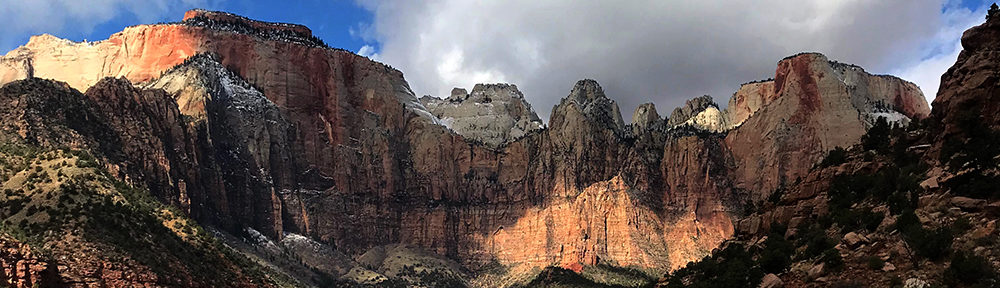
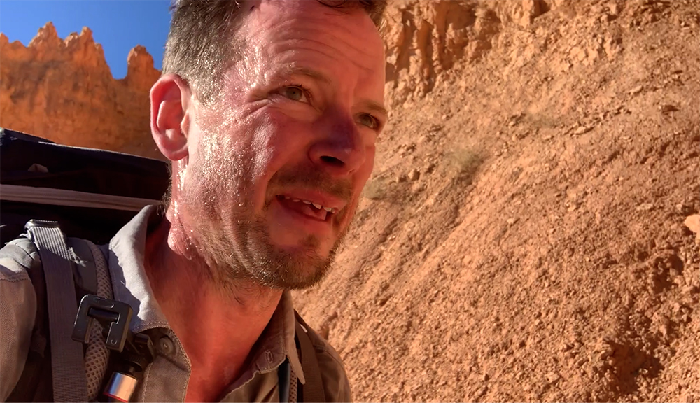
Following an adventurous 150th anniversary season in Yellowstone, Park Junkie finds his way to the red rock canyons of southern Utah, and Zion National Park. Upon arrival however, our wandering explorer finds that fall has not yet made it to this area, and triple digit temperatures send him on a Top Down Hike through the Zion Narrows in search of cool water seldom found shade!
I woke slowly that Monday, which would prove to be my last such day in Yellowstone for this season…
For some strange reason I found it easy to just roll over and close my eyes again, hugging my pillow and contemplating how I might one day design a system by which I could telepathically tell my french press to just make the coffee itself. It’s hard to get up without the smell of coffee… & it turns out my french press is worthless with my physical direction.
After a few minutes of self-directed deprecating humor about what a lazy loser I was, I found my way to my feet, stood tall and stretched my back toward the sky before slowly lumbering toward the heavenly destination that is my coffee station. I grabbed the water kettle, filled it with water from my gravity filter and placed it on its stand before pushing the button that would magically ignite the electric element and heat the water for my morning fix…
I emptied a precise amount of beans into the grinder, pushed down and listened as the blades of the electronic device effortlessly shredded the beans into a coarsely ground mixture that quickly made its way into the dark depths of my french press… Ten minutes later, I poured a cup of coffee and sat back to observe the morning light from the Park Junkie Maproom’s back patio… content to enjoy a few moments of serenity before deciding upon the day’s adventure.
One day prior, adventure had rewarded with me, as it had all summer long in Yellowstone. My old friend Eva & I had attempted a hike to the Pelican Cone, at the northern end of Pelican Valley. The journey to the cone proved a bit too much for the time restraints that day, as the Park Service regulates the time during which one can hike in Pelican Valley, due to the fact it is a bear management area. Hikers can only access the area between the hours of 9am and 7pm.
Yellowstone’s Pelican Valley provides an easy entrance into the one of the park’s wildest areas. Entry is restricted due to the number of grizzly bear encounters in this area.
The hike to the Pelican Cone is a minimum of 22 miles, and with only a few hours during which my hiking partner & I had to cover those miles, we just cruised at a comfortable pace, content with whatever route the day presented. If the summit of the Cone proved unattainable, there was always a stellar consolation prize: The Pelican Spring Cabin, which required a mere additional mile or two, rather than the added 8 miles needed to summit the Cone.
As we strolled along with this comforting fact in the back of our heads, we gazed about the vast green valley and chatted about the stunning scenery. We wondered to one another if the numerous bison grazing on the never-ending grasses in the valley were “out to pasture”, content to just graze in peace in the final years of their lives.
It was rutting season, after all. During this time, most of the young virulent bulls were out in Hayden and Lamar Valleys, testing their testosterone in heated battles with others of prime physical condition. Such battles reward the strongest with the ability to mate with fertile females, ensuring the stability of the herd through the ancient process of natural selection.
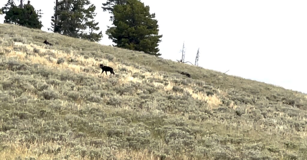
I hiked in the lead as we made our way along the western edge of the vast valley. As we crested a small knoll, I stopped suddenly, staring out into the sage brush before me, startled by an out-of-place character whom I had no expectation of encountering in this setting. A doglike beast stood about thirty yards out, staring intently at me, as I stared intently at it.
Upon first notice, I thought it a dog… a German Shepard or some mix thereof, as it stood with head raised, noble in stature, solid black, with a collar… I literally thought to myself in an instant “whose dog is lost out here”… Then, I honed in on its piercing blue eyes, which locked in unison with my own for a few seconds. I instantly revised my original interpretation of this creature’s identity, and quietly spoke the word “wolf”…
A lucky encounter in Pelican Valley. Rather than running across an angry grizzly bear, we came across a pack of wolves, which we believe to be the Mollie’s Pack.
Both the wolf and I visually recorded and mentally processed the necessary information about the being before us. After a few long seconds, we each seemed satisfied that we were probably safe from attack, and we slowly backed away from one another. At this point, we noticed that there were others, in fact, there were six wolves in the pack, that we later found was known as Mollie’s Pack. This pack is known to inhabit the wooded areas in the northern region of Pelican Valley.
The wolves followed the lead of the wolf closest to us, and as it trotted up the hill, toward the wooded area above, it turned to look back at us several times, curious, but content to continue its retreat into the safety of the trees. We stood silent, aside from a few utterances about how “cool” this was or how “unreal” the whole episode seemed.
Once the wolves were gone, we gloated about for a few minutes, unable to contain the emotion of the experience. It was both Eva & I’s first time seeing a wolf. I had always assumed that my first sighting would come through binoculars, or a spotting scope, as close wolf sightings in the wild are not commonly reported.
After some time spent in such fashion, we continued our mission, not quite ready to exclude Pelican Cone from the possibilities for the day. Another hour of hiking brought us to the Pelican Cone Trail, at which point we reluctantly decided that we’d rather enjoy the remainder of the day than relentlessly pound out miles in order to record a successful summit.
So we made our way across the Raven Creek Trail to the Pelican Spring Cabin, where we just chilled in the shade for an hour or so, before making our way back to the trailhead. An early exit to the trail led us to the Lake Hotel Sunroom for a cocktail, before we parted ways. Eva was staying at the Hotel, while I was making my way back to Wapiti, on the eastern side of the park, just a short drive from the cowboy town of Cody, Wyoming.
I drove back to my humble abode, had a nice lil dinner and called it a great day!
That Monday, as I enjoyed my first cup of coffee, I thought back on the summer’s adventures in our first national park. The sighting of the wolves seemed to complete something for me and I couldn’t help but feel that somehow they signaled a completion to my Yellowstone adventure for this year. I also felt the cool breeze that had recently became common in the Yellowstone area, reminding me that summer was over. Fall was on the way…
It took little time to decide upon a mission for the day, as I had already been considering a departure from Yellowstone. However, this mission was not quite what I had considered just a few days before, when I debated my next destination. My birthday was coming, and what hike should I do for that increasingly remorseful event…? I had been kicking a few ideas around my head. Climb the Grand Teton, hike to Delta Lake, head to Glacier & try a jaunt to Goat Haunt… or just stay in the area and retry a summit hike of Yellowstone’s Electric Peak…?
Or, should I just break south & get back to Zion?…
Just like that, I sipped the final lukewarm dregs of my first cup of coffee, and decided upon the Zion option… I packed up in a jiffy, poured the remains of the french press into two Yeti travel mugs, tossed them in the console and hooked the MapRoom onto my truck, and headed out!
The drive took all day and went into the night. I arrived at my little Zion retreat about 2am on August 30. Upon waking the next day, I took care of some overdue chores at my camp and enjoyed the morning from my little piece of paradise. As the day wore on however, the heat index surpassed any numbers that I had experienced during that summer. My body began to feel the exhausting effects of the triple digit heat, and I began to wonder if I had perhaps made my southern trip a few weeks too soon.
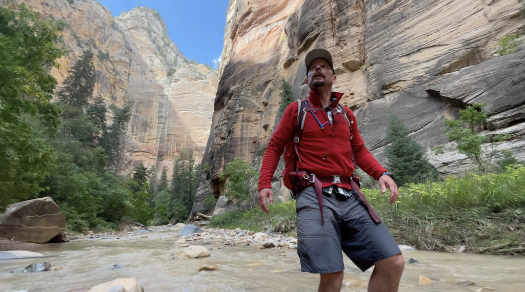
No big deal, I’ve spent a few hot seasons in this Land of Zion… So it wasn’t that hard to come up with a relief from the maddening heat. Without delay, I headed to the Zion Visitor Center, where the backcountry desk provided me with a permit for a Top Down Hike through the Zion Narrows.
A quick visit with my boy @jonnyzion secured a shuttle ride to a trailhead at Chamberlain’s Ranch, where I would begin a 16-mile hike through on of my favorite slices of the Earth… The Zion Narrows!
All content found on Park Junkie is meant solely for entertainment purposes and is the copyrighted property of Park Junkie Productions. Unauthorized reproduction is prohibited without the express written consent of Park Junkie Productions.
YOU CAN DIE. Activities pursued within National Park boundaries hold inherent dangers. You are solely responsible for your safety in the outdoors. Park Junkie accepts no responsibility for actions that result in inconveniences, injury or death.
This site is not affiliated with the National Park Service, or any particular park.
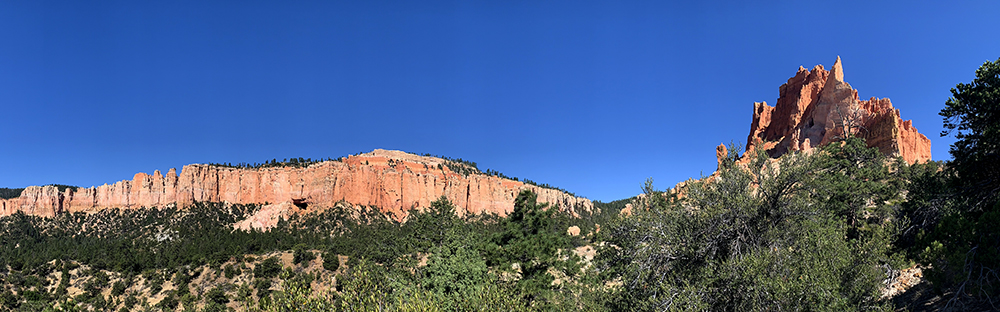
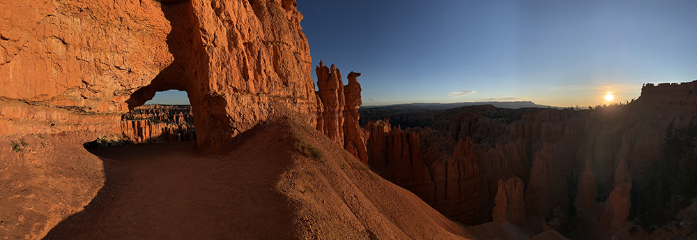
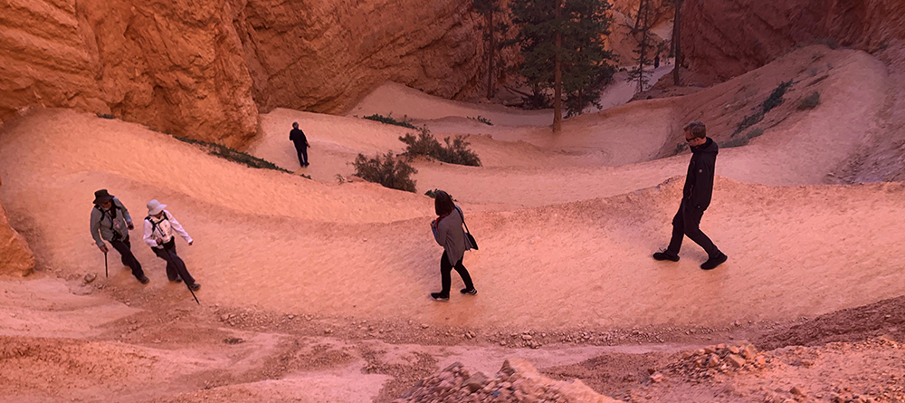
A few quick steps for those hiking Bryce Canyon’s Under the Rim Trail, and poof…..
The backcountry hiker is ushered into a sacred world of magical silence, immediately removed from the maddening crowds gathered at trailheads and overlooks far above…
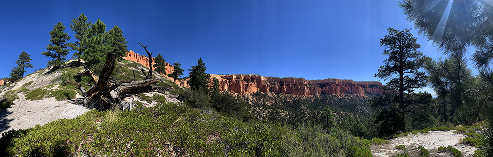
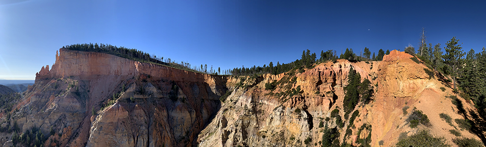
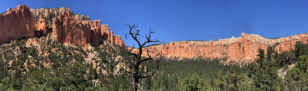
Views from the Under the Rim Trail look up at Bryce Canyon National Park’s majestic pink cliffs.
The Under the Rim Trail is a 22.9-mile trail that drops down below the park’s famed hoodoos. Hiking Bryce Canyon’s Under the Rim Trail does not lead one through the hoodoos, rather it provides a different perspective. Hikers are forced to look up toward these majestic structures.
The trail runs parallel to Bryce’s tall, pinkish cliffs through a series of horseshoe-shaped amphitheaters as it makes its way northward, or southward, depending upon your chosen direction of travel.
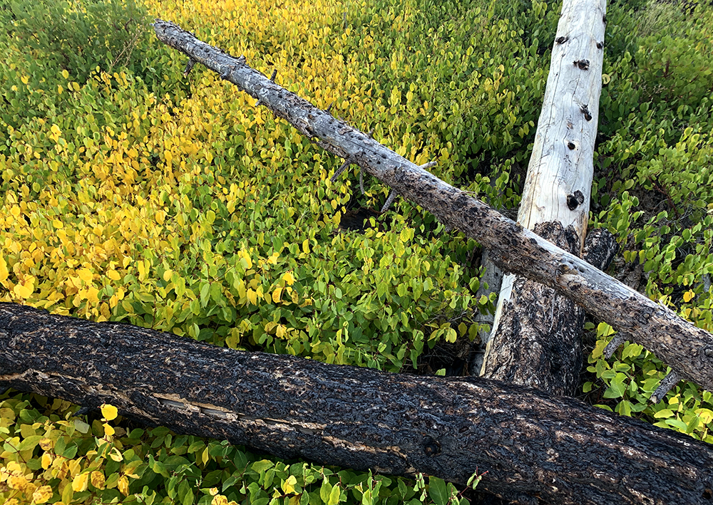
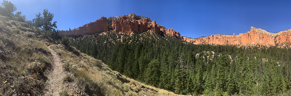
This trail is rugged. There are no services, no bathrooms, no ice cream stands. Sparse amounts of water to be found along the route. There is little maintenance at all on the trail’s southern section. Hundreds of downed trees complicate travel for those with a heavy pack.
At one point in this area, hikers will encounter a landslide, which has completely covered the trail. This spot will likely require many to negotiate the terrain with care. This is not a good first backpacking trip… Or maybe it is…
That said, those seeking solitude and a true backcountry experience will find exactly what they are looking for while hiking the Under the Rim Trail.
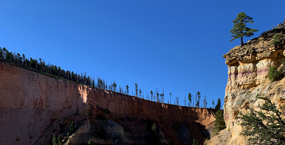
Bryce sits on the eastern edge of the Paunsaugunt Plateau, which is under the constant force of westward erosion. Soon, these trees will be cast into the canyon below.
Getting a Permit
A quick stop at the visitor center and a $5 fee provided me with a permit to hike northbound from Rainbow Point to Bryce Point with two nights on the trail. There are eight campsites along this route, and you can choose any that you prefer.
I chose to hike from south to north because there is less elevation gain here as the hiker drops in from Rainbow Point, which sits at 9,115′ and exits at Bryce Point, which is 8,296′. The savvy adventurer avoids a substantial amount of uphill travel by hiking the Under the Rim Trail from the south to the north.
My itinerary was to camp the first night at Swamp Canyon, about half way through the trail. The second night was to be spent at the Right Fork of Yellow Creek, the closest camp to the exit at Bryce Point. I figured this camp was close enough to the exit that an early rousing would allow me to add the Peek-A-Boo Loop and the Navajo Loop to my effort and see some stellar hoodoos too. Also, I suspected that if I arose early and dropped into these trails right at sunrise, it was highly likely I’d have them all to myself.
The ranger at the backcountry desk warned me of e coli in water sources and insured I had a filter. He warned me of bears and asked if I had a bear-proof canister for food. (the park will provide one if you don’t have one) He also told me that there were likely some 120-150 trees down along the trail between Rainbow Point and the Right Fork of Swamp Canyon.
This would prove to be true…
Shuttle Options
The park offers a free shuttle service that runs from Ruby’s Inn (outside the park) as far into the park as Bryce Point. This shuttle runs continuously from 08:00 till 20:00 during the summer, and from 08:00 to 18:00 during the spring and fall. I was headed to Rainbow Point, about 20 miles further south of Bryce Point, so this would not work for me. Luckily, there was another option.
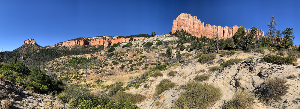
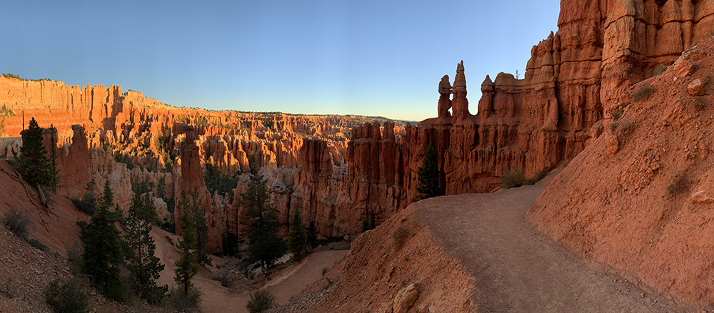
Views such as this are constant along the 23-mile Under the Rim Trail. Oh, and solitude is pretty common. You can carry on a 23-mile conversation with yourself without worry of looking like a freak.
Bryce Canyon Shuttle Tours operates a tour that offers free shuttles to hikers to points south of Bryce Point. Reservations are required. The shuttle will pick up those without reservations on a space-available basis, but is often full.
Upon securing my permit, I headed out to the truck, and having cellular service, called Bryce Canyon Shuttle Tours to arrange a free shuttle for my trip. This is more of a tour than a shuttle, but it would work, so I was stoked. A bonus was that they offer a pickup at Bryce Canyon Lodge, which because I was adding the Peek-A-Boo and Navajo Loop to my itinerary, was right by my exit. Fabulous!
The tour operates twice daily during the summer season, departing at 09:00 and 13:30 from the Bryce Canyon Visitor Center. It is a great option for those hiking the Under the Rim Trail.
Park Creation
Bryce Canyon National Park was largely unknown to the outside world only a century ago. Local people in southern Utah had often heard of the peculiar landscape, but hardly anyone had actually seen it.
In 1915, a Forest Service supervisor named J.W. Humphrey was stationed in nearby Panguitch, Utah. One of his employees was familiar with the area and suggested that Humphrey go see “the eastern edge of the Paunsaugunt Plateau.”
Humphrey made the trip and upon his arrival at the rim, he was immediately impressed:
“You can perhaps imagine my surprise at the indescribably beauty that greeted us, and it was sundown before I could be dragged from the canyon view. You may be sure that I went back the next morning to see the canyon once more, and to plan in my mind how this attraction could be made accessible to the public.”
J.W. Humphrey – 1915
Looking down on the hoodoos at sunrise is a surreal experience.
Humphrey sent photographs to Forest Service officials in Washington D.C. while also alerting leaders of the Union Pacific Railroad to the presence of another scenic wonder in southern Utah. The following year, Humphrey acquired a $50 appropriation to improve the road and make the park’s upper area to auto traffic.
Knowledge of the otherworldly scenery spread quickly back in the nation’s capital. In June of 1923, President Warren G. Harding named Bryce Canyon a national monument. The following year, Congress one-upped this and created Utah National Park. In 1928, the name of the park was changed and Bryce Canyon National Park was created.
Let’s Go!
After acquiring a permit and arranging my free shuttle, I headed southbound to park my rig, Frankie, at Rainbow Point. Driving through the meadows that hold the Paria Ski Loop, to the east of the road, I witnessed a lone Pronghorn strolling slowly across the meadow. I slowed and gazed out curiously toward this creature, the second fastest land mammal in the world.
Traveling southward, initially traffic did not seem daunting. However, at the parking area for Rainbow and Yovimpa Point, a line of more than 30 cars stood at dead-standstill. I resigned myself to just kick back and wait for the masses to filter through the lot ahead. Lest I forget, Bryce was the 12th most visited national park in 2018, with 2,679,478 visitors.
Essentially, none of these people ever venture into the backcountry. I just had to hold on to my sanity for another 30 minutes or so…
At last, I arrived, at the lot… a space with my truck, Frankie’s, name on it!
“This will be your home for the next two days.” I told my trusty metal chariot. (yes, I talk to my truck, who doesn’t?)
I grabbed my pack, tossed in a couple of last-minute additions, just to add some extra weight… Then I headed out to wade through the masses and beyond… into the wild.
On the Trail
A few camera toting tourists gawked at my pack as if it were a goiter and stood in awe. I quickly bolted past, desperate to evade that inevitable question of “where are you going?“…
Despite a significant wind, a perfect temperature of 76 degrees F made the day seem perfect as I skated onto the trail. An elevation of 9,115 feet provides a perfect hiking climate during the summer months. This makes Bryce a welcome destination for those looking to cool off after visits to nearby desert attractions.
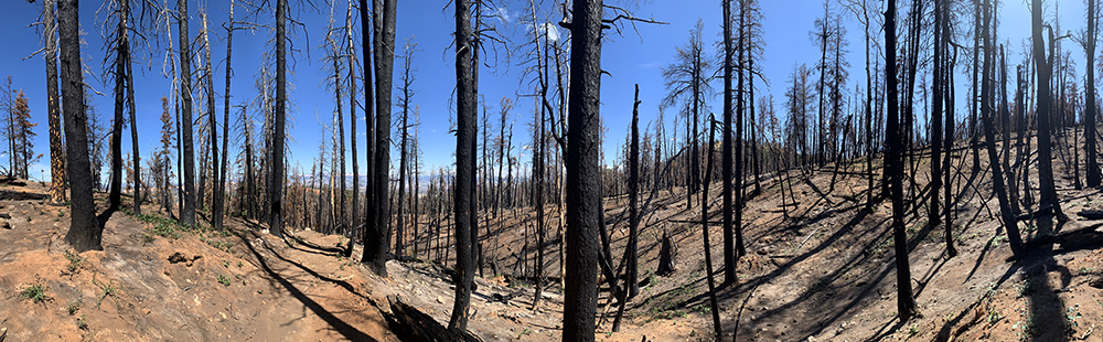
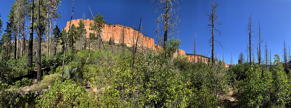
The northbound hiker first navigates the trail through a recently burnt forest near Rainbow Point.
Rainbow Point Departure
In quick fashion, I was on the move, headed down through a stand of burnt Ponderosa and Douglas fir. Switchbacks took me lower, through blackened remains of a once green forest. A beautiful pinkish ridge that lay in the distance. The obvious line of a trail that divided the ridge became apparent. Its allure invited my gaze to imagine the view from that point. I soon arrived and found a number of photographic pursuits.
I moved steadily downward, stopping often to take still more photos and numerous videos of the magical scenery unfolding around me. The burnt-out forest soon gave way to a healthy high desert environment. Green patches of manzanita dotted the red soil, which gave way to steep red cliffs just off the trail.
A world of sand and mixed greens exists below the rim…
Ancient Great Basin Bristlecone Pines stand gnarled against the sky on high limestone knolls. These trees are among the oldest living creatures on Earth, with some more than 4,000 years old. They are testament to the rugged environment of the Paunsaugunt Plateau, upon whose eastern edge stand the cliffs of Bryce.
Numerous other trees find homes here. The Limber Pine, Ponderosa Pine, Douglas-fir and Blue Spruce are just a few of the residents in Bryce’s high-altitude forest. Such trees help form a unique habitat here that differs greatly from the surrounding Utah landscape.
As my trail descended into the park’s lower regions, the winds subsided and temperatures increased, although only slightly. I quickly found myself in a world quite different from that above. Familiar desert plants appeared such as Pinyon Pine, juniper and gamble oak, and of course, the desert classics: yucca and cactus.
Now below the rim, I began to look up into the cliffs, hundreds of feet above. The midday sun backlit the hoodoos, which mostly blended into the cliffs behind. Recessed areas of the cliffs where small canyons and drainages exit, offered views into the depth of the cliffs. These areas glowed orange as the sun illuminated them, while then cliff faces to the east stood drab, in a washout of light. The glowing openings were most intriguing, and recaptured my gaze from moment to moment.
The trail became a mix of red soil and rock, and provided relatively easy walking. The sand sections seemed short and not overbearing. A green carpet of manzanita lay divided by the red bark of Ponderosa Pines. The green of the forest stood backed by the pinkish red hue of the cliffs rising behind. A magic glow enveloped the park junkie.
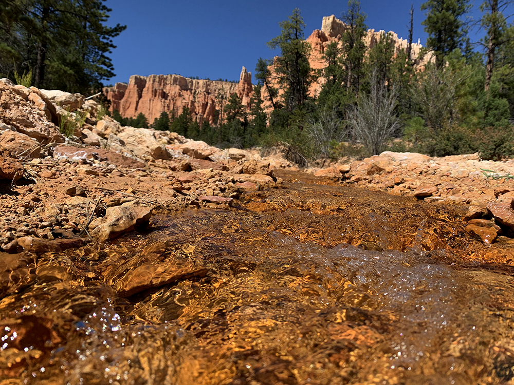
Several streams exit the cliffs and descend to the east. Most are bone dry. Some have water flows that are several inches wide, and probably an inch or so deep. Not much water… but just enough… sometimes… Ranch land to the east of the park relies in part on water that flows through this area, but more than a century ago, a gentleman whose name you’ll recognized figured out a way to get more.
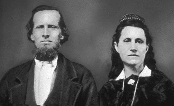
Ebenezer Bryce
In 1875, a Scottish-born Latter Day Saint named Ebenezer Bryce came here at the behest of the church to farm the Paria Valley just east of the park. He and his wife Mary originally settled in Clifton, which does not exist anymore. Soon they moved up into the Henderson Valley, and they worked much of the land in view from the upper parts of the Under the Rim Trail.
Ebenezer Bryce and his wife Mary were Mormon pioneers who moved into the area in 1875. Mr. Bryce, a skilled woodworker, built the first road onto the rim of the Puansaugunt Plateau in order to gain access to the trees that abundant there.
Mr. Bryce helped construct a 7-mile irrigation canal that provided water to barren fields. He also built a road high into the pink cliffs, in order to have better access to the rich timber that stood in the higher elevations. Bryce was a ship builder by trade, and was quite skilled with wood work. In fact, he constructed a church in the shape of a ship in Pine Valley, near St. George, Utah, just west of Zion. This church is recognized as the oldest continuously-used chapel in the Mormon faith.
Ebenezer Bryce was instrumental in creating the infrastructure crucial to the ranching enterprises that sprung up on what would one day become the park’s eastern edge. Folks soon began calling the land of the pinkish hued cliffs, Bryce’s Canyon. Although he and his wife left the area in 1880, the name stuck. His feelings toward the land are not widely known. He likely felt something when he gazed at the bizarre landscape, as he often must have done.
Today, the only widely known statement made by Mr. Bryce about his namesake national park is that it was “a helluva place to lose a cow”…
Back on the Trail…
The leaves on the Quaking Aspen trees quaked and fluttered furiously, although the breeze was now quite tranquil compared to above. Aspen trees are always so hyperactive… These trees are unique in that they share a common rootstock, meaning all of the trees in a grove are connected to the same root. If the age and size of their roots are measured, they can be among the oldest and largest living things on Earth. Stunning… Nature is cool.
I soon arrived at the Iron Springs Campsite. For those moving northbound, this is the first of the eight campsites along the Under the Rim Trail. The waters of Iron Springs can be filtered for drinking, but the water’s iron hue sure looks intimidating. I passed…
Continuing toward my chosen camp, I began to encounter a number of small obstacles.
This section of trail is rough. Well, not really rough… but it is kind of raw. Washes are spanned not by bridges, but by haphazardly placed logs. None of these sticks instill confidence in a safe crossing due to cracked and rotted sections. The fact that a simple step evoked a creaking sound familiar to horror film buffs reassured me that I’d be better suited to just take another route.
The next 6-8 miles contained hundreds of downed trees, many of whom fell victim to past wildfires. At one point, I came upon a nice landslide, which covered an estimated 40 feet of trail. This required a bit of scrambling, but nothing outrageous.
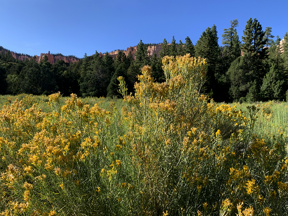
Rabbit Brush is right at home in a meadow along the Under the Rim Trail.
As the sun slowly descended behind the rising hoodoos and pink cliffs to the west, the ampitheater of Bryce began to glow. I soon came upon a meadow filled with yellow Rabbit Brush that waved placidly in a light breeze. I stopped and filmed the scene for a brief spell, contrasting the yellow against the red and pink behind, before continuing along the trail. So nice…
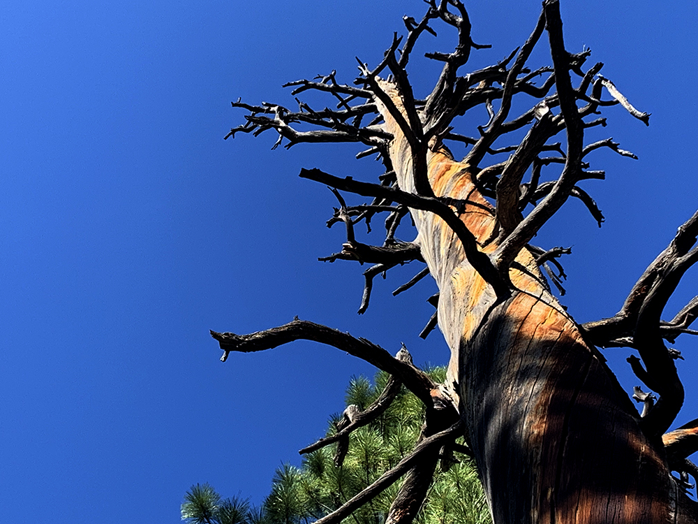
Tall dead skeletons of trees whose once thick bark was removed by fire stood proudly against the blue sky, their limbs outstretched toward the heavens. I stopped to admire the colorful grain in the trees body. Their naked core wore a most beautiful reddish hue at this time of day. I followed the lines of their grain upward to the as they wound around the trunk in a clockwise manner. This led me to wonder, do trees south of the equator’s grains grow in a counterclockwise manner…?
The reddish grains on this dead Ponderosa move up the tree in a clockwise manner.
I passed the Agua Canyon connecting trail, which led back to the top of the cliffs and the masses of people above. It was closed… I don’t know why. These trails don’t see much traffic.
Soon after, I passed the Natural Bridge campsite, which lies directly below the Natural Bridge, which is a popular stop along the road where car-bound visitors mug for shots against the stunning backdrop to the east. Folks at this campsite enjoy the view from a much different angle.
The forest was quiet as I strode through the tall trees, the only sound being that of my feet as the crunched pine needles and small pebbles beneath. I climbed some switchbacks toward a pass that rose above with a fabulous view of a south-facing cliff that was basked in a golden-red glow.
Cliffs to the to the southeast of Swamp Creek. The camp is located in the trees to the right.
I paused to glance at my map, knowing that my day was nearing its termination and that my campsite must be near. Sure enough, at the apex of this climb, I would descend slightly before entering what appeared to be slight incline toward my camp at Swamp Creek.
Continuing on, I passed through a section of trail that departs the park and re-enters perhaps a half mile later. The trail took on an ever-so-slight upward tilt as I crossed another 20 or 30 downed trees, fallen in a beautiful random pattern of natural organization. Greens glowed green and reds glowed red. To my east rose Noon Canyon Butte, bathing in the perfect light of a typical Bryce sunset.
While the hundreds of downed trees may complicate travel, they can present a beautiful scene as well. Look for the silver lining…
As I made my way onto a flattened section of a valley that seemed as if it tapered off to the east ahead, I knew my camp was afoot. Within ten minutes, a fantastic view opened to the east, with reddish pink cliffs falling sharply from a cliff whose treed meadow ended quite abruptly at its northern edge.
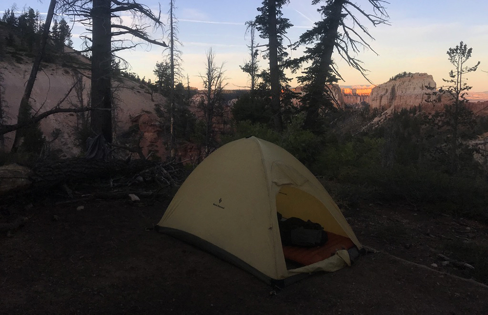
I came upon the Whiteman Connecting Trail, and the Swamp Canyon campsite, some 50 feet beyond. Home sweet home… I had just hiked somewhere in the neighborhood of 11 miles… and had not seen a single soul since the parking lot at Rainbow Point! Gotta love that!
Swamp Canyon Campsite
I removed my pack, to experience that floating feeling that only a backpacker knows upon discarding his burden. It is kind of like levitating, as the weight of one’s world is immediately gone and he feels so much lighter, almost as if he is so light he could fly.
I flew into the evening chores: erecting a tent, pumping up my sleeping pad, tossing the sleeping bag into the perfect position, and preparing a dinner fit for a king… Ah, Tasty Bites with summer sausage. Taking a perfectly good vegetarian meal… and making it more perfect…
While dinner was preparing, I took the opportunity to set a time-lapse of the sun setting on Mud Canyon Butte, and Swamp Canyon Butte, both of which were positioned just to my northeast. I enjoyed dinner, and did my dishes (none), then topped off my feast with a chocolate bar and a nice swallow of water to wash it down.
I had become somewhat concerned with my water supply. There were a couple of sources available earlier in my day, but I had continued on without adding to my reservoir because I just hadn’t used much at that point. As I continued I had drank more and more of course, but hadn’t crossed a good source for miles. So I was suspect and resolved to use a minimal amount with dinner. Luckily, my choice of meals requires no added water, and I could reuse the boiled water that heats my meal.
I was sure there was water ahead at some point, but the ranger had been reticent to tell me for certain that there was water in any of the given sites ahead. He had, however, warned me that Yellow Creek, which I would pass the next day, had tested positive for E Coli… so I had that in my pocket…
I went for a brief stroll before bed while the time-lapse continued. I crept along the rim of Swamp Creek, that drops off just to the north of the camp. Stopping to listen, a delightful sound was heard… running water!
I cocked my head to gain a more accurate recording of the sound, to make sure I wasn’t trippin… Yep water! The small Swamp Creek had a small flow to it, and this would be sufficient to supply my filter for the following day’s trek. Relieved, I returned to camp, laid down in my tent to examine the map. I waited patiently for darkness to envelope my world so I could grab my iPhone, which was capturing what I felt positive would be an epic sunset.
Home sweet home at the Swamp Canyon Camp.
Park junkie can stare at a map for hours, processing the finely detailed contour lines of a beautiful topographic map…. I stared and stared…. Read the park descriptions and geologic facts that such maps occasionally include… Finally, darkness…
I emerged from my tent, grabbed the iPhone and returned to my dwelling, eager to press play, and witness my filmmaking skill…
Play: sun sets, camera re-adjusts exposure… gets darker… camera re-adjusts exposure… gets darker…. camera readjusts… Well shit…
Back to the iPhone learning curve… I suppose you have to set the auto lock focus/exposure…. Okay… Damnit… Off to sleep now…
Relaxing….I quickly fell into a nice slumber…
Soon however, I was awakened by the soft murmur of voices… What? Yes, voices in the wilderness. A European accent, the language of which I was unsure.
They were cogniscent of my presence and were quite respectful, whispering and moving about with care. I was thankful… and rolled over to return to my dreams of flying cars and puppies with horns and glowing eyes on merry-go-rounds.
Day Two
Somehow, sleep was not to be an enjoyable affair that night. I awoke at some point around 01:00 to a flat sleeping pad… quite a bummer. I went outside to relieve myself, and returned to pump the pad up again. After this process, which only takes a couple of minutes thanks to a foot pump embedded in the pad, I returned to my position of rest. I tossed and turned until sometime around 04:00 before I returned to an unconscious state. At 07:00, I awoke, to find my sleeping pad had flattened again. Quite frustrating….
I laid around for a few, then sprung into action, not quite rested from my evening of first -world struggles. I went about breaking down camp quietly, as my neighbors had not yet risen. After camp was broken down, I fixed a delicious breakfast of Tasty Bites, although this time with smoked salmon, and packed up to hit the trail.
My neighbors had made their way out of their tents by this point. A nice European family who had hiked down the Whiteman Connecting Trail, which leads directly to the Swamp Canyon campsite, just to get an evening in the backcountry. They were headed right back up the same trail, back to their car. They hiked a total of 100 feet on the Under the Rim Trail… like I said, this trail doesn’t see much traffic.
Moving out of camp was a slow affair, as I was a bit sluggish, but the trail soon revived my senses and I stopped to filter some water at Swamp Creek. A small flow proved adequate to fill my Camelback and my Kleen Kanteen. After a quick hike up into the woods to relieve myself of a morning urge, I resumed my northernly course up Swamp Canyon toward the Right Fork. I would continue northward and camp tonight at the Right Fork of Yellow Creek, just below a feature known as the Hat Shop.
This stretch of trail was beautiful, passing through a large grove of dead trees, backed by the morning glow of the red cliffs to the west. I hiked past Mud Canyon Butte and Swamp Canyon Butte, which at this hour provided shade for my passage.
The trail through Swamp Canyon passes through a regenerating forest that has been scared by fires.
I arrived at the Right Fork shortly and continued north, up a small incline that allowed fabulous views of the cliffs to the north. Soon, I found myself hiking through a slightly thicker forest, on a trail that seemed much more well traveled.
The trail leads to the east at this point, moving around an area of the Puansaugunt Plateau that juts out into this region. Large reddish pink cliffs line the route to the north and the trail skirts their southern edge, giving a fine view of these rarely seen wonders. Occasionally, towering red monoliths poke above the cliffs, showcasing the great variance in the plateau’s topography.
Geology of Bryce Canyon
As I strolled along this section of the trail, with its up-close proximity to the cliffs above, I began to recollect my readings from the previous night’s map examination.
This area of southern Utah is encompassed by a larger area of the American Southwest known as the Colorado Plateau. This massive plateau stretches from its western termination near the Grand Canyon and Zion, all the way into south-central Colorado. It covers more than 130,000 square miles and was the result of a geologic uplift some 15-20 million years ago. It is comprised largely of sandstone. Much of this rock is comprised of grains of sand which washed and blew westward over tens of millions of years. These sands came from the Appalachian Mountains, which once rose to massive heights on the continent’s eastern side.
Within the bounds of the Colorado Plateau, endless amazing scenes are found. Many areas here enjoy national park status, or some related form of public protection. Practically the entire section of Utah south of I70 is protected by some state or federal agency, all the way to the state boundary with Arizona.
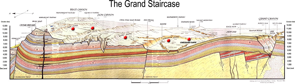
The western section of this area includes Bryce Canyon National Park, Zion National Park, and the Grand Canyon National Park. More than simply pretty places, these landmarks are known in the geologic world to comprise the western cornerstones of an area called the Grand Staircase.
The Grand Staircase comprises a large swath of southern Utah and a part of northwestern Arizona. It is an area in which a large sequence of sedimentary rock layers lead downward in elevation, from Bryce Canyon down into Zion, and further down, into the depths of the Grand Canyon. Scientifically speaking, this is the most well-preserved geologic storybook found anywhere on Earth!
Layers of the Grand Staircase. Image courtesy of : Public Domain, https://commons.wikimedia.org/w/index.php?curid=314356
Named in the 1870s by geologist Clarence Dutton, who divided the region into 5 layers, this area is now is known to hold more than 20 layers of individually named stone formations. These stratifications in the Earth’s outer region’s offer clues to some 550 million years of geologic history!
The Grand Staircase is unique in that most of these layers are easily observable here today. No place else on the planet provides a more complete listing of the chapters of the Earth’s history. In most places, the book of geologic history is damaged, much like an abused library book. It is missing chapters that were torn out by deviant glaciers, or erased by those pesky mountain building events. Some pages have been removed, only to be rolled with some illicit substance and smoked in the bathroom by a wayward volcano…
The course of geologic history is often incomplete due to the simple passage of millions of years. Yet the region of the Grand Staircase stands largely unaffected by the common destroyers of such history.
Each layer is significantly different, but water has played a part in each area’s erosion. It is easy to see the effects of water at the Grand Canyon and Zion. It is obvious to the common visitor that these great canyons were carved by water, although it may seem somewhat unbelievable given the massive scope of these areas.
But what the hell happened at Bryce…?
A delicate balance of time, temperature fluctuation, and soil composition provide the perfect elements for a process scientists call “frost wedging” to work magic on the land.
At the top of the Grand Staircase is our Bryce Canyon National Park, standing at the eastern edge of the Paunsaugunt Plateau. Here, at the height of 9,150 feet we find the top layer in Dutton’s Grand Staircase, the Claron Layer. The heightened elevation here means that this place is affected by a drastically different climate than the lower areas of the Grand Canyon, at a mere 2,600 feet.
Bryce Canyon receives plenty of winter snow. It also sees more than 200 frost/thaw cycles per year, which is instrumental to the erosion process that creates this wonderland.
Bryce sees a wide range of temperatures at this elevation, and winter nights are downright harsh. The park receives a great amount of snow, and more precipitation than surrounding areas. In the winter of 2018/19, the park was blanketed with more than 11 feet of the white stuff, effectively removing it from a drought that had lasted for nearly four years.
Let’s not forget the fact that this is still part of the desert southwest, a land of sunny days with nary a cloud. This means that Bryce has bone chilling frosty nights, and warm sunny days that provide great amounts of heat for creatures who wish to lie on the rocks, which absorb this heat. The park witnesses more than 200 freeze/thaw cycles per year.
The effect of this temperature fluctuation is severe. Water that seeps down into cracks along the edges of the Paunsaugunt Plateau is frozen at night. Frozen water expands by some 10% its size. This slowly creates and widens cracks that form in what eventually become cliffs.
Cliffs at Bryce are comprised of relatively weak sedimentary rock, mainly limestone. It falls away easily providing the erosive forces here an easily workable palate.
These cliffs are comprised of mudstone, siltstone and largely, sedimentary limestone. All of these rock formations are weak compared to other types of rock. The water freezes and expands, only to melt then following morning, then freeze and expand the following night… then melt… then freeze and expand the next night… and the next…
For tens of millions of years… Yes, you’re beginning to get it huh?
Rocks are broken… Openings enlarge… Walls are eroded… Stronger layers of rock remain… Weaker layers fall away… Windows form… Windows collapse… Debris falls hundreds of feet. It will be washed away by rains… The cliffs erode further into the plateau…
Scientists estimate that these cliffs will eat their way through to the west side of the Paunsaugunt Plateau within 300 million years… So you better go now.
Back on the Trail…
I found myself winding through Ponderosa pines and the red soil lay littered with cactus and manzanita bushes that glowed bright green in the mid-morning sun. A fantastic day was unfolding and I was eager to get some miles under my belt.
I moved eastward along the trail. Just prior to the Sheep Creek Connector Trail, I noticed people in the distance. These were the first people that I had encountered on the actual trail since I left the parking lot, some 13 miles back.
These folks were day hikers who had came down the Sheep Creek Trail and planned to head back up the Right Fork Swamp Canyon Trail. They were somewhat older, but still going for it. We talked for a spell, as you sometimes do when you’re actually out there. These fine folk, Sharon and Dennis, told me that they were from Virginia. They had hiked more than 1,700 miles of the Appalachian Trail. They were hoping to complete it before they got too old. I loved it. Nice work ya’ll.
As I just noted, I often find myself actually talking to people, and enjoying them, on the trail in the more remote backcountry. Conversely, I most often avoid them like zombies when in the more congested areas of the trail. Just overload I guess. And perhaps respect for those who get out there…
This stretch of trail held a few hogsbacks over which I had to climb. These involved an ascent of some 300-400 feet. A little uphill, but usually in short stretches. The trail is quite nice through here. It is well-traveled and there are no downed trees to climb over. This elevation provides a nice workout for the legs and lungs.
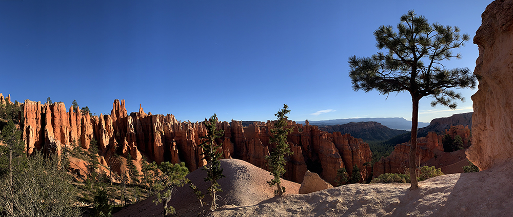
The Under the Rim Trail follows a series of horseshoe shaped amphitheaters as they wander the eastern edge of the Paunsaugunt Plateau. The trail leads up and down small ridges such as this along the way.Elevations here are between 6,000-9,000 feet.
I topped out on one of these ridges and took a break for lunch. I broke out an apple and ate it. Then I busted out a nice chocolate energy bar thingy. I stared at my surroundings. I stared at my map. Then stared at my surroundings again. Where the hell am I….? Ah, there, on that lil ridgeline right there…
Looking back to the south, I could still see Rainbow Point and the ridge that I descended to the east the day before. The landscape revealed my route, which led in a series of horseshoe shaped cirques as I followed the contour of the cliff. I looked to the north. Yellow Creek lay just over the next ridge. Let’s go…
More beautiful pink cliffs rose before me to the west. More trees and desert shrubs lay before me along the sandy section of trail that I found myself descending. I moved somewhat slowly. The previous night’s lack of sound sleep was catching up with me. I just kept rolling, planning to maybe take a nice break at the Yellow Creek Camp, which lay within striking distance.
Birds sang me songs as I made my way into the forest below. I paused just to listen to the wind in the limbs of the tall Ponderosas for a few minutes… It was perfect.
Yellow Creek Amphitheater from the trail above as I descend into the basin.
I moved around the eastern point of a small ridge and turned back to the west to descend into the next horseshoe shaped amphitheater…
Bam! Another stellar view! This one home to Yellow Creek and a stunning array of hoodoo-laden cliffs that seemed to hold an ancient secret. Perhaps they do…
Native People
The ancestors to the Paiute Indians, occupied this area beginning around 1200 A.D. They used the land for hunting and gathering activities. There is no evidence of native settlements in the immediate Bryce area.
The natives observed what we know today as Bryce with a great curiosity and respect. A Paiute elder, Indian Dick, explained the legend of this area to a park service naturalist in 1936.
“Before there were any Indians, the Legend People, To-when-an-ung-wa, lived in that place. There were many of them. They were of many kinds – birds, animals, lizards and such things, but they looked like people. They were not people. They had power to make themselves look that way. For some reason the Legend People in that place were bad; they did something that was not good, perhaps a fight, perhaps they stole something… the tale is not clear at this point. Because they were bad, Coyote turned them all into rocks. You can see them in that place now all turned into rocks; some standing in rows, some sitting down, some holding onto others. You can see their faces, with paint on them just as they were before they became rocks.The name of that place is Angka-ku-wass-a-wits (red painted faces). This is the story the people tell.”
Indian Dick – 1936
Back on the Trail…
As I dropped into the Yellow Creek basin, I saw a nice meadow below, which beckoned my presence. I moved downward, considering what the view might look like from such a tranquil place.
I noticed an approaching hiker rapidly approaching from below. A lone fellow with a couple of trekking poles and large friendly smile wasted no time in ascending the trail. He & I chatted for a few. He was hiking from Bryce Point to the Right Fork of Swamp Canyon, and back up to the main road. A nice day hike for sure! I bade him well and disappeared into the forest below in search of my meadow.
The Under the Rim Trail as it rises to the south from the Yellow Creek Campsite.
I made my way to the Yellow Creek Campsite, which I will report was my favorite of the eight sites along the trail. There is a flowing creek beside the camp, and it is yellow. The ranger at the VC, and a sign posted at the camp’s entrance warned of E Coli here. Being in need of water, I filtered a canteen’s worth anyway, but did not add it to my camelback. This water could be boiled later if needed. Filtering alone is not sufficient to remove all risk of E Coli contamination, but a 3 minute boil and a filter will do the trick.
I laid around the campsite on a log, relaxing… Staring at the cliffs… Staring at my map… Enjoying the breeze and the sound of running water in the wilderness…
I considered staying here for the night, it was so nice. But knew that I should move on to lessen the miles remaining the following morning. I laid around some more…
It’s really easy to just lay around and do nothing when scenes like this abound…
Finally, I arose and set out to find that meadow that I had noticed from above. What would cause such a feature to form in an otherwise wooded basin? I would find out…
I headed upstream from camp, walking beside the flowing yellow water. It was gorgeous against the pink hue of the creek-bed, which was about 30 times wider than the stream that currently flowed through it. During storms, this must be quite a scene.
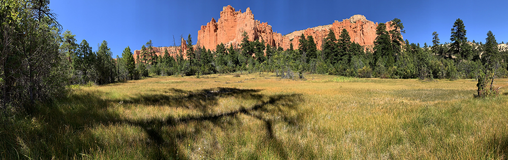
It did not take long at all to reach the source of the water, listed on the map as Yellow Spring. In fact, Yellow Spring, it turned out, was the meadow that I had witnessed from above. Strange… The water just flowed right out of the grass beside the creek. It was quite a small flow, but it was steady and constant. I climbed up to the bank of the stream and stole a few panoramic photos of this scene, which I found soothing.
This is Yellow Spring. Water is flowing through this meadow. If you walk into it, your feet will be soaked immediately. It provides the water for Yellow Creek.
I enjoyed the view for a time, then headed back down the stream to the camp and my pack. More miles to put in today. But only a few. Three miles between me and the Right Fork Camp. Let’s roll…
A Close Encounter
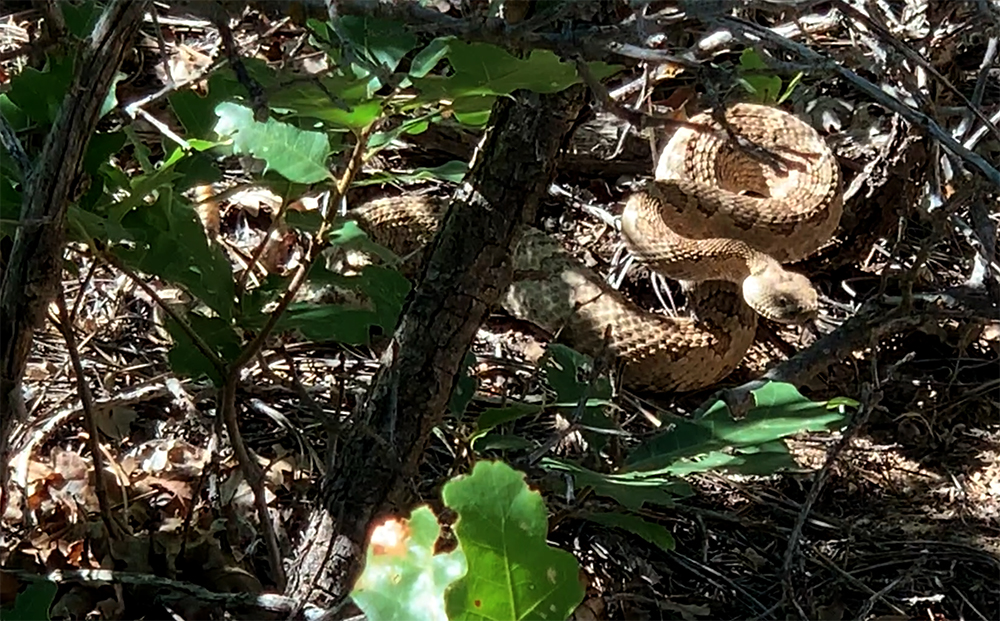
I made my way quickly along the trail, which cut through a thickly forested canyon as it continued east. I was clicking right along when out of nowhere came a sound that stops all hikers in their tracks, or sends them springing a few feet into the air… The sudden high frequency thrashing of a rattle… the demon of the desert! The rattlesnake!
I instantly located the direction of the source of this sound and immediately determined that I was indeed safely past his striking distance. Whew….!
I peered into the brush, and there he was… coiled up and in the fighting stance. His rattle was going mad and his tongue flicking up and down in the air. The serpent acutely assessed his situation while alerting me that I didn’t want none… He was right. I wanted no static from this guy. I examined him from my safe haven of several feet away for a minute and then bailed out… Let’s roll…
The demon of the desert… The classic Great Basin Rattlesnake. Despite their nasty reputation, they are kind enough to give you ample warning before a strike. I respect that… Thank you.
I made quick moves again, headed for my cozy lil camp. After passing the Yellow Creek Group Campsite, the trail opened up into a typical open desert scene for about a quarter of a mile before popping back into a canyon, the beginning of the Right Fork of Yellow Creek.
I made good progress here, knowing that camp was close at hand. The sun was still well above the cliffs to the west, but I wanted to get in early, as to set up camp, cook, filter some water and boil it, and head up to the Hat Shop for sunset. I wanted another shot at that damned time lapse.
Right Fork of Yellow Creek Campsite
Soon I arrived at my destination. After setting up camp, I examined my sleeping pad and cleaned the air ports of any potential debris which could cause a leak in hopes of getting a full night’s sleep without the discomfort of a deflated pad. I cooked a quick meal and boiled more water.
My campsite was wooded and shaded. There is a small flow of water at this site, although the warning of E Coli presence is posted here as well. There is space for perhaps 4 or maybe 5 tents here. It is a cozy camp and the sound of running water is always a bonus when considering a night’s sleep as far as park junkie is concerned.
After a brief chill session, I headed up the trail toward the Hat Shop to witness the setting sun.
The wind had picked up, and setting up the ol iPhone on the worthless little tripod that I use proved impossible. I found a nice little bush whose lower limb had been broken off by something. The limb was still sturdy, and made a perfect down presser for the top of the tripod. I tucked it right under there, set the camera in motion, applied the auto lock function, and found a nearby rock upon which to enjoy the show.
A hiker soon came into my view, quickly making his way down the trail, right across the top of the Hat Shop. He paused here and there for a photo, but seemed bent on making his way down to camp. Onward he marched, seemingly unaware of my distant presence.
I grew bored laying around, so i grabbed my other iPhone and headed to the top of the Hat Shop to and just lounged around enjoying the silence and solitude. After an hour or so, the sun disappeared. Time for bed. The morning would come early and I had a date with my alarm at 05:00 am.
I strolled into camp just before it really got dark to find that I had a new neighbor, whose name was Pete. He was set up for success and was getting ready to go on an evening stroll in the remaining moonlight. The full moon had passed some 4 days earlier, but the night glow was still sufficient for an evening exploration. We chatted briefly. I told him a bit about Zion, which was his next destination. Then I wished him well, and laid down my weary head and about 20:45.
Day Three
I awoke before my alarm at 4:51, my pad still fully inflated! I had enjoyed a full sleep and felt alive and ready to roll… Ah, the great outdoors!
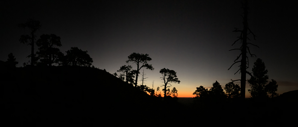
I quietly packed up my belongings and ate a morning snack. Then I woke Pete, who had asked for a wake-up-call. I made my way onto the trail, and turned off my headlamp. I prefer to hike in the moonlight, or even starlight, when possible. It was 05:35 in the am.
An early 05:30 camp departure brings scenes such as this just above the Hat Shop.
The morning was brisk and beautiful. The cliffs glowed grey in the moonlight as I ascended the few hundred feet to the top of the Hat Shop. Here I was greeted by a small number of lights from the nearby town of Tropic, which lies just to the northeast of the park. There must have been at least 20 or 30 lights down there. That’s town out in these parts.
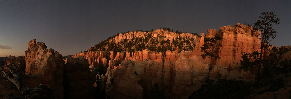
A faint glow arose in the east… I moved quicker. Staring at the map the day before, I had decided that I would hike up to Bryce Point. Then, instead of hiking the Rim Trail to the Bryce Canyon Lodge, I would descend back down to the Peek-A-Boo loop. From here, I would make my way onto the Navajo Loop before hiking back up through the Wall Street area, past the Silent City. If I was there early enough, I could complete this route and probably not see many people.
Light increased, so did my pace. Upward I moved with a purpose. The cliffs began to glow in an awesome reddish light, the type you just don’t see outside of canyon country. The southwest has its own red you know…. If you haven’t been here at sunrise or sunset, you just have no idea.
Yeah, early morning wake-ups are worth it in Bryce…
I began to pause here and there for photos and videos. The scene was just too amazing to ignore! There are colors at this time of day that simply don’t exist during other times.
Continuing upward, it was not long before I topped out at the intersection with the connecting trail that led down to the Peek-A-Boo loop. The sun was just rising above the ridglines in the east. Light was direct, and perfect! It was 07:14…
Peek-a-Boo Loop
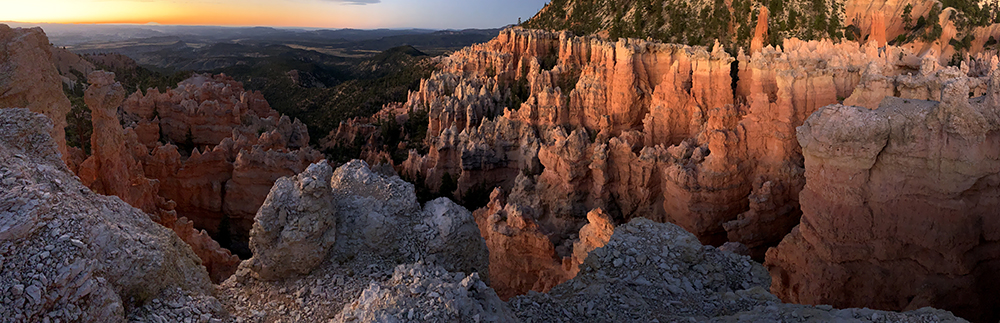
I moved downward as if a child descending into a massive sandbox with cliffs of chocolate cookies all around… It was the best sunrise I’ve seen in years. Not a soul in sight, not a one… Just the To-when-an-ung-wa… and myself.
Descending into the Peek-A-Boo Trail at 07:14…
My head spun in circles as I made my way through what I consider one of the most magical landscapes on Earth!
Hoodoos
Hoodoos are special features. They are found in many places in our wonderful world. There are hoodoos throughout the bizarre landscapes of southern Utah. Quite a number exist in the northern Great Plains of the Dakotas in places such as Badlands National Park and Theodore Roosevelt National Park. There are likely numerous areas in the middle east where such structures are not out-of-place.
However, nowhere else on Earth is there are larger, more grandiose collection of these astounding towers of dirt and rock than right here in the northern realm of Bryce Canyon National Park. For hoodoos, this is it…
Back on the Trail…
I roamed about in awe for some time, taking photos of this structure and that. After setting up a few videos I made my way further down the trail.
At sunrise, this is the only place on Earth, if you’re the only one there…
Soon, I reached a junction with another trail. But this seemed strange… It said Peek-A-Boo and had an arrow pointing in each direction. I was already on the Peek-A-Boo trail right? WTF? This sign should have an arrow to the east, and indicate that the Navajo Loop was perhaps a tenth-of-a-mile in that direction. I should be able to see it… Strange.
I headed down to the right, wondering why my map was not accurate. This should have been a warning sign right there… I hiked down the trail for what seemed a quarter-of-a-mile, then told myself this couldn’t be right, and headed back up the trail, to the junction from which I had just came.
Back at the junction, I scratched my head and looked at my folded map, whose contour lines didn’t match the surrounding area in any way whatsoever. I assured myself that the map was a piece of shit, and strolled off in the other direction, somewhat certain that I’d find a place where the trail intersected the Navajo Loop.
The time was 08:00. With one hour and 15 minutes to make my way to the lodge, I was not too worried, but was aware of my limitation.
I cruised up the other direction on what the sign told me was the Peek-A-Boo loop, uncertain as to why it was definitely not following the route indicated upon my map.
“This is bullshit”, I muttered to myself.
Not even park junkie’s map reading fumbles could ruin a trip into this place…
I continued on, sure that the Navajo Loop was somewhere below me, but found no sign of it. So effing weird… Time was ticking. I could now hear it.
I went on for some ways here, uncertain as to what was going on. Perhaps the To-when-an-ung-wa were responsible for this… I had still not seen another person this morning.
It was 08:20.
This would not be a problem, as it was only .2 + .4 + .5 to the Lodge, if I was at the junction of the Navajo Loop. But where the hell was I? This must be some sort of joke…
I continued on, before eventually determining that I must be headed back up the western side of the Peek-A-Boo trail, back toward where I came… So, I turned around and headed back to the junction where I had initially became unsure of my direction.
I arrived back at the strange junction and pulled out my map again. WTF!!!!? I stared at the map for a minute and then it hit me… I was at the beginning of the Peek-A-Boo loop! It was 1.3 miles on the east side and 1.7 on the west side, and there was a 1 mile connecting trail that I had hiked to descend to this point! I was at the end of that one mile connector, not at the end of the Peek-A-Boo loop! Doh!
I’m late for my shuttle, but just can’t stop taking these damn photos….
Damnit! Who was in charge of this circus!?! It all became immediately clear, and I looked at my iPhone to see the time… 08:43… I had 32 minutes to cover the 1.3 + .2 + .4 + .5 to the lodge. Quick math told me that I had 2.4 miles to travel in 32 minutes, uphill with a large pack… Not impossible I told myself! LET’S ROLL!
I took off at a run, jogging along like a man on a mission… Hell, I was on a mission!
Park Junkie Falters
I have not been having the best of luck with scheduled pickups as of late. A month ago, I missed my departing boat from Isle Royale National Park due to a time change error in my errant brain.
This turned out to be an epic problem, because storms were coming in the next day, and the Voyaguer II was full for the next week. The owner of the company, who I spoke with over the phone from the Rock Harbor Ranger Station, informed me that it may be up to two weeks before he could guarantee me passage on his boat to Grand Portage Minnesota due to possible weather… and the sea planes were full for the foreseeable future.
I luckily met some really cool fishermen at the dock at Rock Harbor. Their captain, a fine chap named Mike, accepted my stow-away status and his dad, an even finer chap named Mike, fed me beers the entire way back to Minnesota’s Grand Portage. Sometimes these sort of things just work themselves out…
Back on the Trail…
I moved along at a feverish pace, I could do it… This section of trail was meandering on contour through incredible terrain, but no time for that now! I jogged on. And then… it happened…
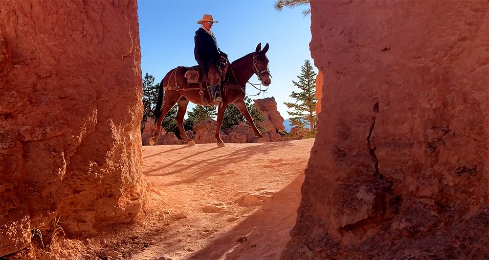
That’s right. I encountered the dreaded horseback tour…. NOOOOOOOO
Yep…
The Peek-A-Boo Loop is a horse friendly trail. You can dodge their droppings, and step aside when they come by. I’m gonna take on of these tours next time. If I can make it on time, that is…
Peek-A-Boo is a horse tour trail. Not only does this mean you must watch your step, it means that you must step aside when encountering the train of horses. Horses become spooked and hikers are good at spooking horses. So this is the rule…
I had not seen a soul all morning, and now I was forced to stop, and wait beside the trail as a train of 12 horses and their sometimes slightly overweight riders clippity clopped right by with cheery greetings of “hello”, “mornin”, and “howdy”….
Finally the last horse passed, now I really need to speed it up…
I ran up a section of rock and passed the first of a slew of hikers that would be encountered from here to the top. I approached what would normally be a super cool tunnel through a rock and began to pull my camera for a selfie video of me running through the tunnel when I heard another sound that evoked a cringe from my soul….
Hope vanished. It was 08:48… & I was still not to the end of the Peek-A-Boo trail…
As the last horse passed, it dropped a load of excrement on the trail right beside me, as if to punctuate my journey with a proper mark…
Hikers on the switchbacks of the Navajo Loop
Not one to give up, I began running again. I passed people who looked at me as if I was absolutely bonkers. I approached a couple of very attractive ladies who took note of my pace…
“Training day…” I winked as I sputtered by in near life support status…
“You’re doing great!” one of them exclaimed…
If you only knew…
Soon I arrived at the junction with the Navajo Loop. I moved with purpose… Upward!
By this point, there were a good number of people on the trail. I kept a good slow jog pace, but as I entered the upper switchbacks, just below an area known as Wall Street, I had to stop and walk… Too much… I must walk…
Park junkie has one minute to reach the top and catch his shuttle. Park junkie does not like to admit defeat… But loss was inevitable here.
The morning breeze and the temp were perfect, but it was a significant elevation increase from the bottom up with my pack. I began to realize my effort was futile. It was 09:12…
Hundreds of people were gathered near the top of the trail, posing for photos with umbrellas and sneakers. One guy had a pipe in his mouth and wore penny loafers with a cardigan sweater… No joke. It was a real show up here and it only got better the closer to I got to the parking lot…
I made the railings at Sunset Point at 09:17… and I still had some distance to the lodge, but I could see it. So I kept going…
I got to the Bryce Canyon Lodge at 09:20… Park junkie was five minutes late…
Rearranging Travel Plans
Inside, I asked the concierge if I had missed the Rainbow Shuttle Tour. He informed me in a Russian accent, that I had not. It should be outside, and I should go…. Now!
I bolted out the door and made my way to the shuttle point. Arriving at a vacant stop, with nothing and no one around. I waited, exhausted… Not really caring if I had missed it or not… A shuttle pulled up. Not the one I wanted. It would say “Rainbow” on the front message screen. This one said “shuttle”…
I asked a passing employee. He told me it should be by soon.. Hmmm, seemed strange.
I caught my breathe, and having one stick of cellular service, called the tour company. A nice lady there who told me that I had indeed, missed the shuttle. However, there was an open spot on the next tour, at 13:30… I would have to wait four hours. I took the spot, not sure if I would wait. Hitchhiking was an option…
But I was tired… So I found a nice chair on the front porch of the Bryce Canyon Lodge, and just parked myself there. It was nice to just sit and relax. And who knew, perhaps I’d meet some gorgeous Russian girls with a nice car who would offer me a ride to Rainbow Point… Unlikely I know… but I stayed put.
There was wifi and cellular service, so I reluctantly caught up on the exciting news that I had missed. Trump had pissed some people off over there, and over here… and over there again… Perhaps I should just hike right back into the backcountry….
I hung out here though. I was tired. The Russian girls never came. Hell, no girls came. The average age of the guests on the porch of the lodge was somewhere around 70.
But my chair was comfortable and I could kick my feet up on my pack and relax. I was just dirty and stinky enough that not many of the well manicured guests bothered me. So I just chilled and bided my time. Soon enough, it was 13:20. Not about to risk missing this bus, I made way toward the shuttle stop.
The Tour
I parked there and waited. Folks showed up and I met some nice older ladies from New Jersey who had just been to Zion, where they took a Jeep tour with my homegirl Sherri. They loved it. We traded stories. I gave them some sunscreen and then our bus pulled up.
All abord!!!
There was a small crowd here now, with some people who lacked reservations hoping to score a seat. Vacant seats are up for grabs, providing there are a few no-shows. Most guests board the bus outside the park, at Ruby’s, or the visitor center, so the bus is nearly full by this point. However, it appeared there would be a couple of open seats, so everyone may get to go.
I made my way onto the bus after the ladies had boarded. The driver, a nice local gal named April, told me I could put my pack in the emergency exit and take an open seat. There were a few openings, and the add-ons were invited aboard. It turned out there were one-too-many of them. April asked if I would mind standing and I obliged. But rather than stand, I said I would likely sit on my pack. She was more than happy with that. Everybody wins…
The tour departed. I was comfortable. The bus whisked us away and toward Rainbow Point.
This was a narrated tour. April spoke into the microphone as she drove along, telling her passengers about the geology, history and climate of Bryce Canyon National Park. She told about herself, and her love of this land. About her cowboy husband and her time working the land. She gave information regarding fire and rain, drought and snow. It as an informative tour. I was happy.
As much as I enjoyed the tour, I was elated to notice that we did not stop once on our way southbound. April informed us about midway through the southern route, that the tour would be stopping at several of the viewpoints on the return trip. Express bus southbound. I smiled and leaned back against the railing.
I must report that hiking Bryce Canyon’s Under the Rim Trail proved to be a stellar backpacking trip. I’ll be back to do it again.
As we neared the Rainbow Point parking area… April instructed the group to stay together during their time at the overlooks. She stressed that the bus would only be here for about 30 minutes. She was good… To punctuate the importance of staying together and being aware of the time, she tossed out a joke that I’m sure she has told many times before. But this joke rang true today, at least for me…
“What’s the difference between a tourist and a hitchhiker at Bryce Canyon?”
“About 5 minutes”….
Oh April, you have no idea how funny that one is…
I got off the bus with the group, thanked April, and said goodbye to the New Jersey ladies. I slowly limped over to Frankie, my trusty metal companion, who was waiting patently in the lot, right where I had left him…
All content found on Park Junkie is meant solely for entertainment purposes and is the copyrighted property of Park Junkie Productions. Unauthorized reproduction is prohibited without the express written consent of Park Junkie Productions.
National Parks and the outdoor recreational activities pursued within their boundaries hold inherent dangers. YOU CAN DIE. I regret to inform you, but you’re going to die anyway… Nevertheless, you are solely responsible for your safety in the outdoors. Park Junkie accepts no responsibility for poor choices made in the wilderness or beyond the controlled area.
Obviously, this site is not affiliated with the National Park Service, or any particular park or park institution. Enjoy your day…
A brief December visit to Cuyahoga Valley National Park proved memorable as Park Junkie was gifted with a window of clear weather and an introduction to what is now, a new favorite area of the park!
I know… I know… This park is commonly viewed as one of those “better to visit in summer” parks, and I certainly do not wish to dispute that. But hey, this is December, and I’m already in Ohio to visit the folks, so I’m going to CVNP! After my winter visit, I can assure you, winter in Cuyahoga Valley is fun!
Pulling into the southern section of the park around 9pm, I first motored into the Boston Mills Ski Resort’s parking lot and considered sleeping there in my van. However, as the parking lot quickly emptied upon night-skiing’s end, it became apparent that I would be the only remaining vehicle in the lot. Past experience has taught me that this usually leads some underpaid employee to my doorstep in an attempt to kindly (or rudely) usher me along, shortly after I have fallen into peaceful slumber in my cozy mobile abode…
Thus I decided to roll on down the road to the Walmart parking lot in nearby Cuyahoga Falls. This worked out well and I snoozed there for eight hours before rising to return to the Boston Mills Visitor’s Center in the early morning hours. There I found that the visitor center does not open until 09:30… So, I changed into my winter activity clothing and boots, and headed out unadvised to see just what all the rage is about in Cuyahoga Valley.
A quick stop at the Boston Mills area. This white house behind the gas station was the location of the old visitor center. A new visitor center is located near this point.
A quick gander at the park unigrid map, available in outside map-boxes everywhere throughout the park (no other national park offers easier access to the unigrid map, there are map-boxes literally, everywhere in CVNP) led me to conclude that the best bet from my location was to head out onto the nearby Buckeye Trail and use it to access Blue Hen falls and just see what happened from there as I hiked northward toward the Jaite Mill historic district.
So out I went… From Boston Mills Station, I crossed Riverview Rd and shortly accessed the Buckeye Trail where I entered the woods with the idea to simply put in some miles, as the prior week had witnessed a total of zero miles of hiking and very little activity while at my parent’s place. I needed to play…
The pace was quick and the air a brisk 35 degrees as I moved through a deciduous forest absent of canopy cover, as 2017’s leaves now covered the cold forest floor. The land lay quiet aside from the constant groan of freeway traffic from nearby urban corridors. Multiple interstate and state highway systems crisscross this park, as well as the 137 year-old B&O railroad that runs north-south through the park. These stand as constant reminders that this park is not made up of the typical unspoiled landscape and untamed wilderness found in most national parks.
While the sounds of urban sprawl may deter some from enjoyment of such lands, I quickly grew to enjoy the perpetual hum emitting from the surrounding landscape, as I realized that I was completely removed from its grasp. Those folk had responsibilities and deadlines and deliveries and meetings and greetings and bullshit to deal with… and I had a national park to explore!
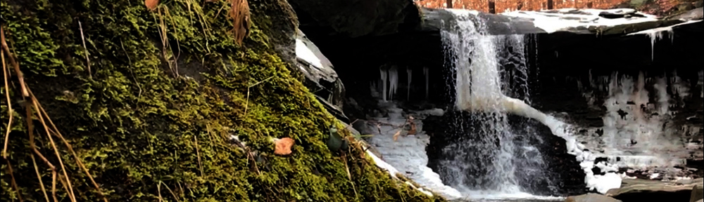
A short two-minute stroll down the trail brought me to the falls, laden with snow and ice, as well as the presumed owner of the truck above, with a new-born in arm and a unleashed dog, who was very eager to meet me. The gentleman asked from afar if I was “okay with the dog” to which I replied “sure, if the dog is okay with me”… The dog approached, eager to meet yet another interesting human and I extended my gloved hand for the greeting and a quick smell to assure the K9 that I was indeed,”cool”…. Dog was cool and thus I was cool with him, I continued toward the falls…
Dogs are quite common in this park and many visitors seem to adhere to a leash free system here while on trails away from roadways, although park regulations indicate that pets should be held to leashes six feet or less in length. I don’t really care, as I’m fine with well-behaved dogs and I’ll kick the shit out of a badly-behaved dog without appology, but hikers should be aware that dogs may be on the loose here despite park regulations to the contrary.
I made haste toward the lower section of the falls in order to examine photo options. After fifteen minutes cursing the panoramic setting on my iPhone and uselessly repeating attempts for the perfect frame while staggering about in flowing water that constantly threatened to overlap my boot-tops, I settled on some slow-motion video footage I accidentally captured and decided to bust a move and get back on the trail. Toes getting cold…
Blue Hen Falls retains a bit of green, even in winter.
My first friend had vanished, replaced by another visitor with an unleashed dog, this one amicable as well. I said a quick hello via a pat on the head and made my way up toward the ridgeline that lay just ahead. Shortly thereafter, I made my way across Columbia Rd. and toward the north. The trail was quiet and desolate.
On most trails in our park system, once you hike about a mile from the paved surface, human interaction often becomes a rarity, and this proved true once again in CVNP. Aside from the two dog-walkers at Blue Hen falls, I encountered one lone passerby, a headset-wearing trail runner, in around 6 miles of hiking on a mid-December day along this section of the Buckeye Trail.
Enjoyable indeed is the terrain between the Blue Hen and the Jaite Mill area as the trail rolls along through heavily wooded groves of hardwoods while meandering along a ridgeline that offers nice views of gorgeous northeast Ohio in the leafless winter. I think summer scenery to be even better, although views are often obscured by those pesky leaves…
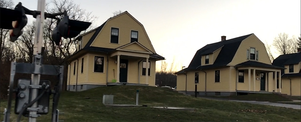
A quick descent from the ridge top toward Snowville Rd. brought me back to pavement and the park headquarters at Jaite. Cool buildings… all yellow and that…
The Jaite railside houses serve as park headquarters
From Jaite, I headed across the Cuyahoga River on a connector trail and then back toward the Boston Mills area via the canal-side Ohio Towpath Trail. This towpath trail runs north-south the length of the park and is a popular way to move about the park in warmer months as bicycles are allowed to ridehard on the trail. Unfortunately for me however, this was December and it had snowed about a week before my visit and the towpath was a sloshy mess despite the well-maintained appearance of the trail. It gets a lot of traffic.
Given the conditions of the towpath trail, I elected to jump off on the less traveled Valley Bridal Trail which sort of runs parallel, but not really, to the towpath trail… Well, let’s just say you can get back to the Boston Mills area from there by either route. The Valley Bridal Trail runs up behind the Brandywine Ski Resort where a brief jaunt up the remote end of the Stanford Rd. can link up with another “connector trail” (connects to Stanford Trail) which runs just above Averill Pond. Just beyond the pond, a link runs to the east toward Brandywine Falls. So, I took that…
It turned out to be fairly close and I arrived shortly at the popular Brandywine Falls, the park’s largest. A couple of people were hanging out at one of the overlooks and a jogger came by, but no one was making the most of the fine day, so I climbed to the top of the falls, stripped my clothes, and took a running leap toward the chilly waters below…
Just playin’… You still reading? Nice work…
Anyway, back in reality, I took a few selfies with the falls and wasted no time in moving back toward the trail, hunger was setting in. I strolled quickly toward the Stanford Trail and headed toward the Stanford House, which is about a fifteen minute stroll from the Boston Mills Visitor’s Center. The field behind the Stanford House is home to the park’s only backcountry campsites. There are five primitive sites available for overnight stays.
Reservations are required. Check the visiting page for more information about camping here.
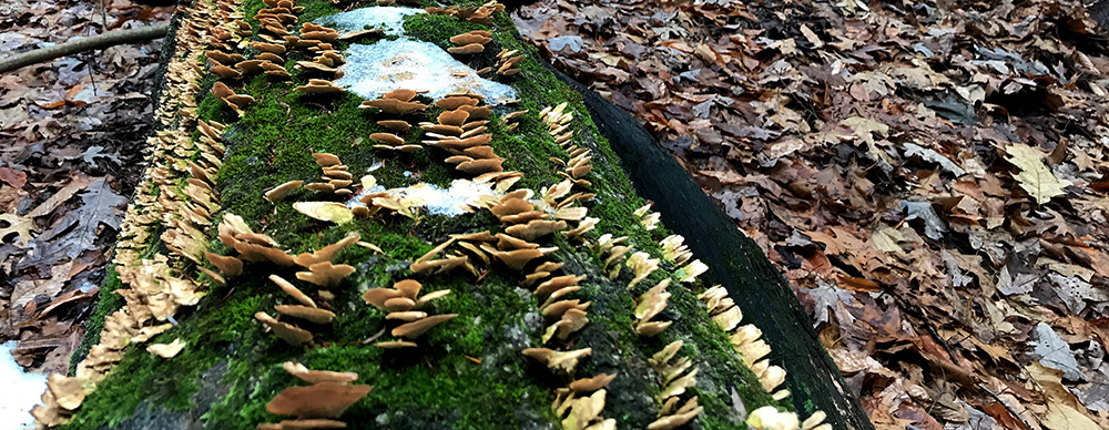
The moist environment allows for a variety of life in Cuyahoga Valley.
Just past the Stanford House, I linked up one more with the Towpath Trail and within a few minutes had returned to the visitor’s center. I went in and spoke with the rangers here for a few minutes where I learned of the Ohio and Erie Canal’s most famous “hoggee”, James Garfield, who drove mules beside the canal that pulled barges on the canal. Mr Garfield later became the nation’s 20th President, but that’s another story.
Once I had soaked in about all of the valuable information I could manage at the visitor’s center, which I assure you is not much given my limber mind, I headed back to park junkie’s mobile headquarters where my hunger further guided me to Peninsula, a charming small town in the south central area of the park.
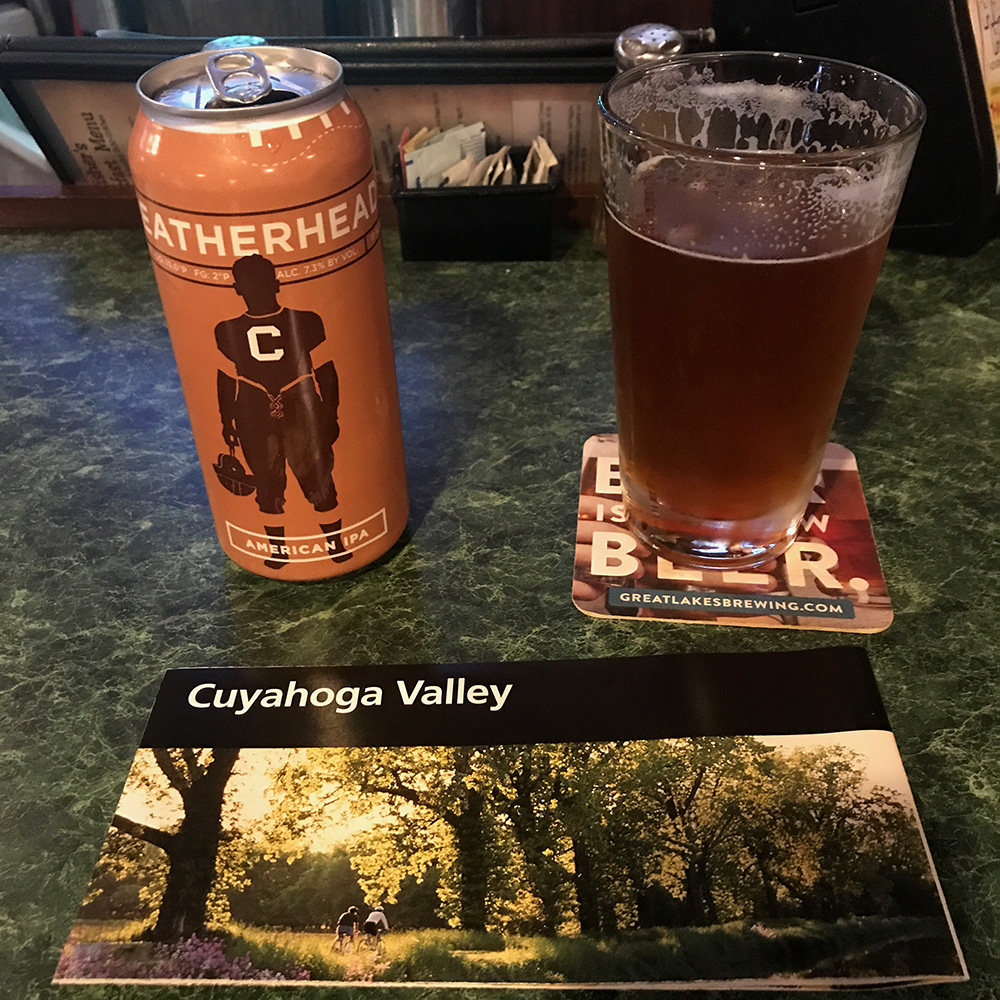
I quickly found my way to Fischer’s Restaurant, right beside the railroad track in what I believe was the center of town. While seated at the bar enjoying a cold local Loggerhead IPA and a reuben sandwich, I reviewed some history of the area as the fact-ridden ranger at the visitor’s center had quite frankly spun my head…
A lunchtime stop seemed appropriate. You gotta take a break to read the map…
As has been detailed in the park descriptions available here at parkjunkie.com, this park is mad unique due to its creation within an existent industrial society, which at the time Cuyahoga National RecreationArea was created in 1974, had played host to more than 150 years of industry, more than 200 in the surrounding areas.
Constructed to facilitate transport between inland Akron, and lakeside Cleveland, whose position on the shore of Lake Erie meant that the region enjoyed significant commerce as the Great Lakes became a central hub of economic activity in the 18th and 19th centuries before the advent of adequate land travel methods.
The Ohio and Erie Canal was built in the early 1820s and the amount of subsequent commercial traffic through the Cuyahoga Valley in the early years of the industrial revolution would rival that of any similar area in the world at the time. The canal’s heyday soon ended with the construction of railroads in the early 1860s which quickly erased demand for the canal’s convenient route to the Great Lakes.
These facts lend Cuyahoga Valley National Park a most-unique position in the National Park System as well as within the national park idea itself. No other such park boasts land that shares history quite as hardcore as this northeastern Ohio park in terms of raw industrial commerce through which titans of industry essentially raped the land for commercial profit while blatantly polluting rivers, air and land alike. Don’t believe me…?
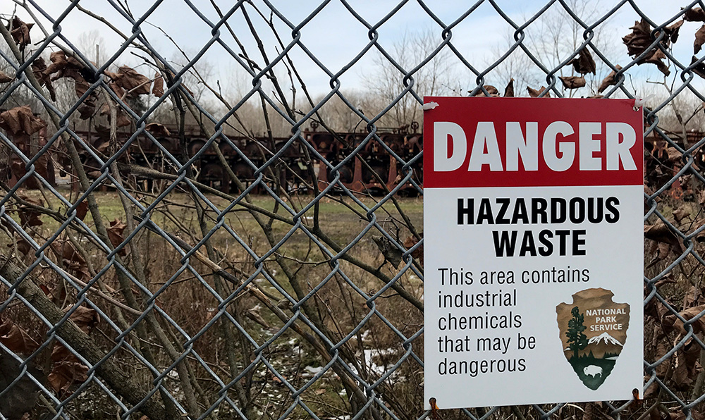
Not your average NPS signage…
The level of unregulated industrial activity in the area lent The Cuyahoga River the reputation of being one of the most polluted rivers in the United States and in 1868, the river caught fire…
Allow me to summarize:
The river caught on fire…!
Unfortunately, this would not be an isolated event. This river is documented to have caught fire a recorded 13 times between 1868 and 1969.
Please allow a second summary:
The river caught fire 13 times in just over 100 years…
The last fire was featured in Time Magazine, directing national attention upon the problem of industrial land and river pollution, leading to the formation of the EPA (1970) and the passage of the Clean Water Act (1972).
The same sentiment that brought federal environmental regulations produced a groundswell for a protected area along the river that could encourage the surrounding community’s dedication to guaranteeing a cleaner, more natural river valley for future generations.
So, after my meal and a beer, I called up some friends who live just up the road, Dan and Camielle. We arranged to have a couple of drinks and they offered me a place to park my van in their driveway. I am always happy to have a couple of drinks and an evening with park peeps and these folks are super cool and literally live inside a national park… so they have that going for them, which is nice…
We agreed that I’d drop by their place around 6:30pm for drinks before dinner. Often one to ensure ample beverage is available, I headed out in search of a couple of nice bottles of vino to contribute to the cause and after a few wild goose chases instigated by my homegirl Siri, I made my way to 750ml, a wine bar and store in the Brecksville area.
I grabbed an Orin Swift red blend and a Mer-Soliel Silver Chardonnay from the rack and headed to the counter where a hostess with a nice smile sent me on my way after I gave her the equivalent of a small fraction of a bitcoin for the wine. See ya next time…
We had a touch of wine at their place and went out for Italian at Oggi’s, somewhere in or near Brecksville. I thoroughly enjoyed two Basil Hadin Manhattan’s and a wonderful house-made lasagna that was fantastic.
Gotta say, it was a treat to have a selection of restaurants that offer quality bar and menu services in such a plethora inside a national park… In most parks, luxuries such as this are a dream. A few parks have such amenities just outside the park, but most don’t have towns that offer such options.
After dinner we retired to their place and had a couple more drinks over conversation about parks and what-have-you… Finally, probably hours after everyone wished I had shut my mouth, I passed out in the Sprinter conveniently parked just outside in the drive and enjoyed a night of splendid slumber…
Awakening the next morning, I had some quick coffee with my gracious hosts, and headed back into the wild. I was ready to attack a couple more trails and check out some new areas of the park.
I headed south first, moving toward the Everret Covered Bridge to an attempt grab a cool sunrise shot of the red bridge and creek, which must look fab in the summer draped by the greenery of summer in the Ohio forests. After 23 mediocre attempts, I stomped off in disgust and drove back across the Cuyahoga River and made my way toward the Ledges as I had heard that this was a pretty cool area and my friends had confirmed this by rapid shakes of the head over the previous night’s meal.
Everette Covered Bridge
I parked at the Happy Days Lodge turnout lot on the north side of Highway 303 and hiked the Boston Run Trail first, as my history-loving ranger from the day before had told me this was one of his favorite trails. Nice trail, kinda rolls along through the forest and covers somewhere around 3 miles with a shortcut available that cuts it by a third. I ran around in the woods out here for a bit, as these Ohio hardwood forests remind me of my childhood home. Many youthful days running about in these Ohio woods… Ah, innocence.
Folks love walking the dogs here too, but most were on a leash, at least when they left the parking lot. I actually did not pass a single person on the trail… December.
(the Happy Days Lodge is on the south side of the highway, but there are not many parking spots for the lodge while there are plenty on the north side)
I came back from this hike and quickly succumbed to a hunger panic as I had skipped my morning can of spinach. Thus I drove the 5 miles or whatever back to Peninsula to check out the place across the street from yesterday’s selection. The Winking Lizard.
Had a seat at the bar once again. I decided upon a burger, the biggest, whichever that was, and a cold beer… I can’t even tell you which beer it was because I forget. Hey, take it easy on me, they have like, 700 beers or so, and I only had one of them. It was an IPA. It was good. How about that?
After lunch, I set back out toward my day’s ultimate destination of the Ledges! I was pretty stoked to check this place out, and had no idea of what lay ahead. I had heard the ledges described in word, but had honestly not even seen images of the this area due to my insistent lack of due process and preparation when examining parks prior to a visit.
So I donned my hat in self-inflicted ignorance and headed out toward the Ledges from the north via the Happy Days Lodge and hit the Haskell Run Trail which connects to the Ledges after a half mile or so. Immediately upon arriving at the Ledges, my soul caught fire! This was what I had been waiting for! Rocky cliffs, green moss and trees combined effortlessly to lift my spirits and I quickened my pace up a small incline in anticipation of cool scenes…
I arrived at the Ledges cliff-base and stopped momentarily to witness tall evergreen and deciduous trees swaying quietly in a light afternoon breeze which sent sunrays dancing in silence upon the leaved forest floor.
I moved toward the sign that directed in one of two ways. The darker, more moss covered landscape appeared to be to the left, so I headed that way (east). Within a thirty second walk, I found an enticing stairway that led, according to the sign, to the Ledges Shelter. I headed up the steps without hesitation, no clue of what this shelter may be, I thought maybe a cave…
Most of the park’s older infrastructure, such as this stone staircase, was built by the Civilian Conservation Corps.
Nope, I ran into a kid at the top of the steps. He was laid back reading “Walden” or something similar and seemed intrigued that I had stumbled upon him. I asked him a question about the Ledges, he asked me about my life…
Turns out, the Ledges Shelter is a man-made structure. Interestingly, this kid informed me that the Ledges Shelter was built by the Civilian Conservation Core in the 1930s and is built from the American Chestnut timbers. This tree was essentially massacred by blight in the early 20th century. Once numbering in the billions and constituting 25% of the trees in the Appalachian Mountains, the trees today number in the 100s if any decent size above 24” in diameter is expected.
While I’m into old CCC stuff and love my American Chestnuts, I was more intrigued by the green, moss-covered rocks that lay below me on the outlying ledges that surrounded the raised plateau that is the upper section of the Ledges.
I made moves back down the steps and to the east, toward the darkening green forests and the large rock cliffs that beckoned me as if I was a helpless child.
What wonderful rocks these were. I moved throughout the mazes, pathways and tunnels that formed between the large separated sections of stone that lay covered with lichen and moss. The silence of the forest was surreal, as I realized that the familiar groan of traffic and industry that had nearly faded from my perception over the past two days, had finally disappeared in this thickly wooded terrain. I smiled and breathed deeply of the fine aroma of reclaimed wilderness.
I made a few photos of the calming scenery and pondered the fate of the bats within Ice-box Cave along the northeastern section of the loop. The cave is closed to human entrance due to the presence of the White Nose Syndrome that has devastated bat habitats here in the east.
I moved southward on the trail, weaving between large, building-size boulders that lay silently covered under blankets of downed leaves and rich rotting trees that turn the most beautiful shade of brown during their slow decay. Moving forward, the late-afternoon forest thick with the darkness evergreens provide, I passed a few wondering souls as I made my way toward what I was told would be an excellent view to the west. Upon arrival at the viewpoint, I was indeed gifted with a nice vista toward the west. The view is nice for northern Ohio, but I enjoy it more in warmer times when leaves adorn the trees…
My stroll back toward the van went well. The sunset cast lovely light on the cliffs while the trees threw stilt-like shadows on the vertical rock. More people seem to enjoy this area in the evening, as I passed more people on this section of the trail at sunset than I had passed in more than 12 miles of hiking during the two days that I enjoyed the park. A couple of people had dogs on an evening walk, and some were obviously out for a workout, but most were enjoying a leisurely walk on what I considered the park’s most scenic trail.
Overall, I must admit, I think a summer visit to Cuyahoga Valley would likely be more fulfilling and provide more opportunity for adventure. That said, my visit was nevertheless enjoyable and left me eager to come back for more. I would like to get out on the water in my kayak with a fishing pole here in warmer weather and I believe that equine activity would be cool here too. Of course, I think the towpath trail on a bike would be more rewarding, as many of the restaurants and bars have outdoor seating areas that accommodate visitors and locals alike in towns that are spread throughout the park. How cool to pull in for a snack and a cold beverage while out on an excursion in the park.
This place definitely provides a unique experience in the national park idea. While many parks offer endless miles on remote trails wondering through rugged terrain far from any semblance of human influence, Cuyahoga Valley gives visitors access to a actively revived landscape in the otherwise industrial powerhouse of northeastern Ohio.
All content found on Park Junkie is meant solely for entertainment purposes and is the copyrighted property of Park Junkie Productions. Unauthorized reproduction is prohibited without the express written consent of Park Junkie Productions.
National Parks and the outdoor recreational activities pursued within their boundaries hold inherent dangers. YOU CAN DIE. I regret to inform you, but you’re going to die anyway… Nevertheless, you are solely responsible for your safety in the outdoors. Park Junkie accepts no responsibility for poor choices made in the wilderness or beyond the controlled area.
Obviously, this site is not affiliated with the National Park Service, or any particular park or park institution. Enjoy your day…