With more than 1,000 miles of trail weaving throughout 2.2 million acres of high wilderness, Yellowstone is a hiker’s paradise. Indeed, with unparalleled landscapes emerging around every curve in the trail, this place is sort of elite as a hiking mecca…
Guide to Yellowstone
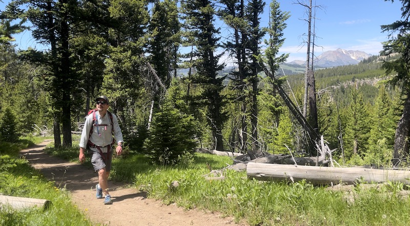
I have included links to YouTube videos from my favorite trails, so you can tag along virtually and see what the trail involves. For trails that I haven’t yet filmed, I link to online resources that I find helpful. Simply click on the underlined Trail Name in the charts below to follow a link to a more complete outline. It is always a wise move to swing through the visitor center prior to journeying into the backcountry, in order to obtain up-to-date trail conditions, closures and wildlife reports.
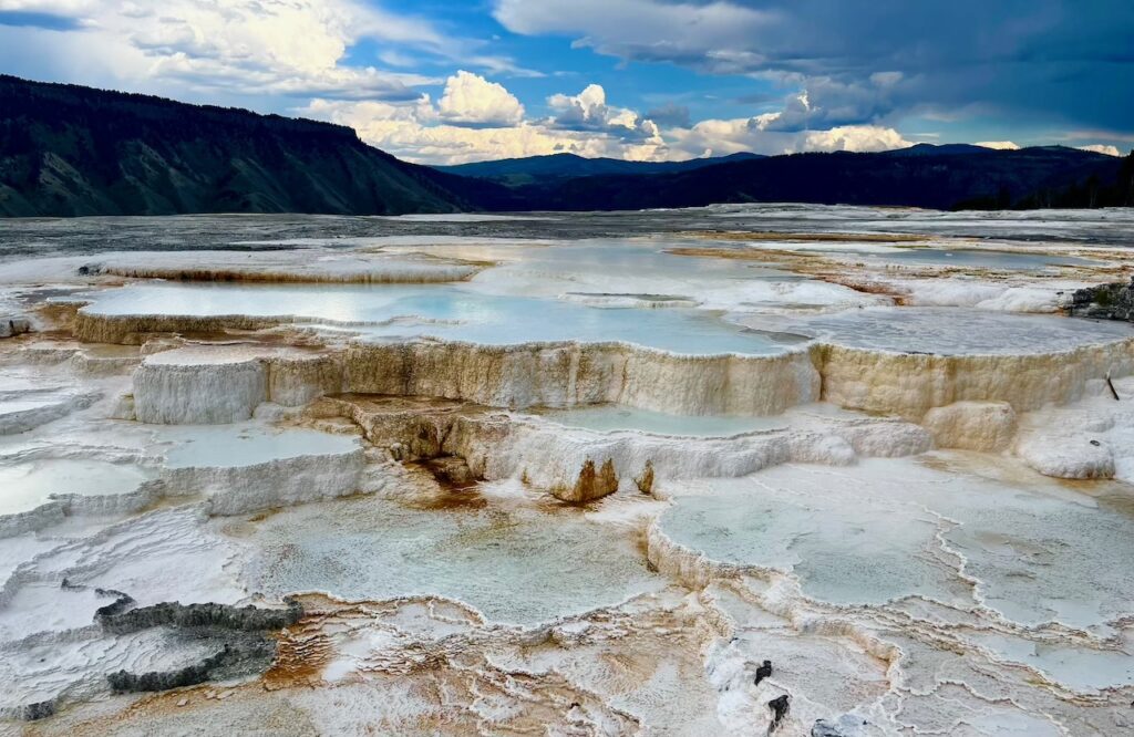
Hiking in Mammoth Hot Springs
A quick boardwalk stroll at Mammoth will provide access to sights unlike any others in the entire park in the form a world-famous travertine terrace. Trails lead past steaming pools of spectacular colorful display while distant snowy alpine peaks decorate the horizon as they rise above the Yellowstone River far below.
The hikes on the travertine terraces are among the most visually simulating in the park, but don’t really offer the classic backcountry experience. For those who want a more rugged terrain, see the list below for a number of hikes that lead into the surrounding mountains and off of the beaten path.
MOREBunsen Peak
Electric Peak
| TRAIL | LOCATION | LENGTH | DIFFICULTY & NOTES |
|---|---|---|---|
| Beaver Ponds | TH – north side of Mammoth Village | 5 miles (RT) | E – M – Mellow trail through meadows and aspen to ponds |
| Bighorn Pass | Trail between Indian Creek Campground and Highway 191 – TH on Mammoth-Norris Road | 20.1 miles (1-way) | S – A march through remote grizzly country passes through Gallatin Mtns |
| Boiling RIver | Park near 45th Parallel Sign, north of Mammoth | 1.3 miles (RT) | E – Out/Back trail to popular soaking hole. |
| Bunsen Peak | TH – Bunsen Peak – near Kingman Pass on Mammoth- Norris Road | 5 miles (RT) | M – Mellow ascent to splendid views of surrounding Mammoth landscape |
| Blacktail Creek | TH – Blacktail – 7 miles east on Mammoth-Tower Roosevelt | 12 miles (1-way) | M – Leads downstream, joins Yellowstone River, ends in Gardiner |
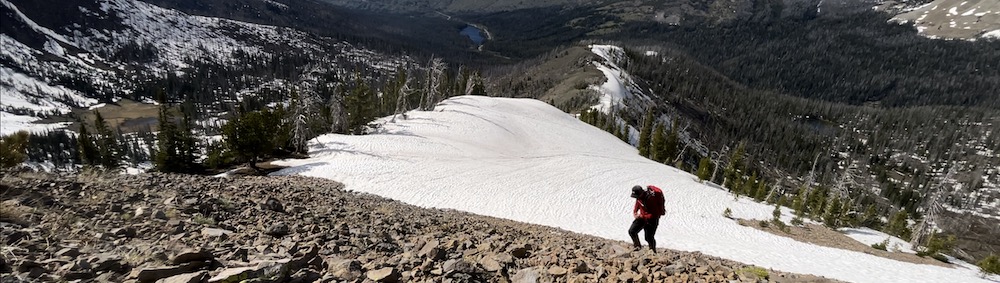
| Electric Peak | TH – 4 miles south of Mammoth on Mammoth- Norris Road | 18 miles (RT) | S – Sportsman Lake Trail leads to spur route which leads up Southeast face of peak |
| Grizzly Lake | TH – 1 mile south of Beaver Lake Picnic Area on Mammoth-Norris Road | 6 miles (RT) | E – Hike through valley to Griz Lake. Trail continues to Mt Holmes Trail. |
| Lava Creek | TH across from Lava Creek Picnic area on Mammoth-Tower Rd | 3.5 miles (1-way) | M – Passes Undine Falls, route leads downstream to Mammoth/Gardiner |
| Mount Holmes | TH is 3 Miles south of Indian Creek Camp on Mammoth-Norris Road | 21.6 miles (RT) | S – Hike leads to 10,336′ summit of Mt Holmes – alt route to Trilobite Lake |
| Osprey Falls | TH is 5 miles south of Mammoth on Mammoth-Norris Road – Park across from Glen Peak TH | 8 miles (O&B) | M – Trail leads through grassland and burnt forest to 150′ Osprey Falls |
| Rescue Creek | TH – Blacktail – is 7 miles east of Mammoth on Mammoth-Tower Road | 8 miles (1-way) | M – One-way route Rescue Creek TH near N Entrance at Gardiner |
| Sepulcher Mtn | TH – Sepulcher/Beaver Ponds trail near stone house in Mammoth | 12 mile loop | S – Follows Beaver Ponds trail to Sepulcher Mtn trail – climbs to 9,652′ summit |
Hiking in Tower-Roosevelt
Named for a towering 132′ waterfall and a former president whose appreciation for wilderness led to the establishment of numerous national parks and monuments, the Tower-Roosevelt region of the park offers quaint rustic charm and some of the least crowded trails in Yellowstone.

This area of the park is quiet, and even the “popular” trails have a remote vibe. From this region, hikers can access the Yellowstone River, as it begins its westward turn toward Montana. See the list below for ideas on where to go while visiting this region of the park.
MOREHellroaring Creek
Mount Washburn
| TRAIL | LOCATION | LENGTH | DIFFICULTY & NOTES |
|---|---|---|---|
| Bliss Pass | TH – Pebble Creek, Slough Creek or Warm Creek | 20+ (depends on route) | S – Trail can lead to Slough Creek or to Warm Creek from Pebble Creek. Bliss Pass connects Slough Creek and Pebble Creek |
| Fossil Forest | TH – 4 miles east of Tower Junction on NE Entrance/Lamar Road | 4 miles (O&B) | M – Largely unmarked and unmaintained trail leads to petrified remains of old trees |
| Garnet Hill | TH – 50 yards north of Tower Junction on NE Entrance/Lamar Road | 7.5 miles | M – Follows old stagecoach road for 1.5 miles then continues along Elk Creek to Yellowstone River & Hellroaring Trail |
| Hellroaring | TH – 3.5 west of Tower Junction on Tower-Mammoth Road | 4.5 miles | S – Steep in & out with exciting suspension bridge in Yellowstone’s Black Canyon |
| Lost Lake | TH – Roosevelt Lodge | 4 miles (loop) | M – Loop skirts Lost Lake and provides access to Petrified Tree before returning to Roosevelt Lodge |
| Mount Washburn | TH – Chittenden or Dunraven Pass – Tower-Canyon Road | 7 miles | S – Optional routes lead to panoramic views atop popular peak |
| Pebble Creek/Warm Creek | TH – West of NE entrance on Lamar Valley Road – Warm Creek TH | 4.1 – 12 miles depending on route | M – Short, steep hike into meadows & forest. Options for longer hike with shuttle |
| Petrified Trees | TH – 5.3 miles east of Roosevelt Junction | 3 miles | S – Climb 1,200′ to forest of petrified trees |
| Specimen Ridge | TH – 2.5 mile east of Tower Junction on NE entrance road | 4.1 – 17.5 miles depending on route | S – Route runs along ridgeline above Yellowstone River. Option for longer hike with shuttle |
| Slough Creek | TH – On dirt road to Slough Creek Camp | 3.4 – 9.6 miles depending on route | M – Follows old wagon trail to meadows. Option for longer hike, can connect to Bliss Pass or Buffalo Fork. |
| Yellowstone River Picnic Area | TH – 1.25 miles northeast of Tower Junction on NE entrance road | 3.8 miles | M – Follows rim of Yellowstone River with canyon views |
Hiking in Canyon Village
Canyon Village is located near the center of Yellowstone and is the base for adventures and sightseeing journeys in the Grand Canyon of the Yellowstone. Only one hike in this location descends into the canyon itself, but many lead to quiet lakes which lie removed from the hustle and bustle of Canyon Village.

Most visitors to the park want to see the Grand Canyon of the Yellowstone, so it shouldn’t be surprising that trails in this area, are some of the busiest in the park. That said, the less-traveled trails that lead to surrounding lakes are quiet and offer a good degree of solitude.
MORESeven Mile Hole
| TRAIL | LOCATION | LENGTH | DIFFICULTY & NOTES |
|---|---|---|---|
| Cascade Lake | TH – 0.3 mile south of Cascade Lake Picnic Area / or / Cascade Creek TH | 5 miles | E – Trails lead to quiet lake at the base of Observation Peak |
| Grebe Lake | TH – 3.5 miles west of Canyon Junction on Canyon – Norris Road | 6.2 miles (O&B | M – Follows old fire road to remote lake below Observation Peak |
| Mary Mountain | TH – 4 miles south of Canyon Junction on Canyon – Lake Road | 21 miles (one way) | S – Trail leads from Hayden Valley, across Central Plateau to Nez Perce Trail between Madison & Old Faithful |
| Observation Peak | TH – 0.3 mile south of Cascade Lake Picnic Area | 9.6 miles | S – Climbs 1,400′ in 3 miles to old fire lookout on top of peak |
| Point Sublime | TH – Artist Point Overlook | 2.5 miles (O&B) | E – South Rim Trail leads to overlook of Grand Canyon of Yellowstone |
| Ribbon Lake – Clear Lake | TH – 2.3 miles south of Canyon Junction on South Rim Drive – Upper Falls Viewpoint | 6 miles (O&B) | M – Trail leads to quiet lake |
| Seven Mile Hole | TH – Glacial Boulder near Inspiration Point on North Rim Drvie | 10 miles (O&B) | S – Only trail in Grand Canyon to Yellowstone River |
| Wapiti Lake | TH – South Rim Drive | 30 mile (O&B) with options | S – Long trail leads to remote lakes – options to continue to Yellowstone Lake thru Pelican Valley |
Hiking at Lake Village
Hiking trails in the area of Yellowstone Lake are numerous and cover a wide area. The trails in this section lie in the northern area of the Lake, including those along the East Entrance Road. Those in the southern region will be listed in the Grant Village section.
Trail goers will find a variety of hikes in the Lake region. Short strolls near the Fishing Bridge area skirt the lake shore, while steep mountainous slopes make up the bulk of the popular Avalanche Peak Trail. Those who lust for true adventure can embark on a long jaunt along the Lake’s eastern shore, which leads toward the Thorofare, in the park’s remote southeastern corner.
MOREAvalanche Peak
| TRAIL | LOCATION | LENGTH | DIFFICULTY & NOTES |
|---|---|---|---|
| Avalanche Peak | TH – Avalanche Peak at Eleanor Lake, along the East Entrance Road | 6.2 miles | S – Steep trail leads through wooded area to rocky summit with stunning view of eastern side of Yellowstone |
| Elephant Back | TH – Along Grand Loop Road, just outside Lake Village | 3.6 miles | M – trail leads to ridge with views of Yellowstone Lake and Lake Village |
| Pelican Valley | TH – East of Fishing Bridge on East Entrance Road | 6.5 miles | M – Trail runs through vast marshy valley with numerous stream crossings. Frequent Grizzly sightings – Bear Habitat restrictions |
| Pelican Creek Nature Trail | Just east of Fishing Bridge before Pelican Creek Bridge | 1 mile | E – Short trail through wooded area to lakefront. |
| Natural Bridge | TH – Bridge Bay Marina | 3 miles (O&B) | E – Follows old road to natural bridge. Bicycles allowed |
| Storm Point | TH – Storm Point – East of Pelican Creek on East Entrance Road | 2.5 miles (loop) | E – Short trail through wooded area to bluff overlooking Yellowstone Lake |
| Nine Mile – Thorofare | TH – Nine Mile near Steamboat Geyser along Lake on East Entrance Road | 70 miles minimum with options for longer route | M – Long winding trail follows east shore of Yellowstone Lake into remote area of southeastern Yellowstone – link with South Boundary for full adventure |
Hiking at Grant Village
The trails in the Grant Village area offer access to the park’s southern Lake region, including Lewis and Shoshone Lakes, and to the Thorofare region in the park’s most remote corner. This area of the park is vast and wild, and holds a high number of miles ripe for more footprints.
This area has quiet trails for the most part, although the Heart Lake region is one of the park’s most active backcountry camping areas. Trails along the southern entrance road are included in this section. Cruise through the list below to find a suitable adventure for your next Yellowstone visit.
MOREHeart Lake
Lewis Lake – Shoshone Lake
| TRAIL | LOCATION | LENGTH | DIFFICULTY & NOTES |
|---|---|---|---|
| Duck Lake | TH – West Thumb Geyser Basin | 1 mile | E – Views of Duck Lake, and Yellowstone Lake |
| Heart Lake | TH – 5.4 miles south of Grant Village on South Entrance Road | 16 miles | S – Trail leads into pristine wilderness at along northern base of Mount Sheridan. Camping allows summit attempt of 10,305′ peak |
| Heart Lake to Throrfare Trail | TH – 5.4 miles south of Grant Village on South Entrance Road | 28 miles minimum – options link to other trails | S – Follow to Trail Creek Trail & connect to Thorofare in park’s most remote & least traveled area |
| Riddle Lake | TH – 3 miles south of Grant Village on South Entrance Road | 4.8 miles | E – Trail crosses Continental Divide providing access to small lake with many waterfowl |
| Lewis River / Dogshead Loop | TH – 5 miles south of Grant Village on South Entrance Road | 11 mile loop | S – Lollipop trail leads to Shoshone Lake through lodgepole forests of various ages |
| Shoshone Lake | TH – 8.8 miles west of Grant Village on the West Thumb – Old Faithful Road | 6 miles | E – Hike leads through woods & along DeLacy Creek to park’s largest backcountry lake |
| South Boundary to Thorofare | TH – Just inside Southern Entrance Station | 36 miles minimum with connection to numerous trails | S – Runs along park’s southern boundary, linking to the remote Thorofare ranger station in southeastern Yellowstone |
| West Thumb Geyser Basin | TH – At junction of Lake-Old Faithful Road | 0.5 mile boardwalk | E – provides access to a scenic thermal geyser basin, on the southwest shore of Yellowstone Lake |
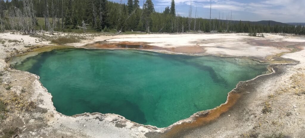
Hiking at Old Faithful
This is perhaps the most popular hiking area in the park, with numerous boardwalks leading through a wonderland of active geysers. Hikes listed in this section include those around Old Faithful and along the road north to Madison Junction.
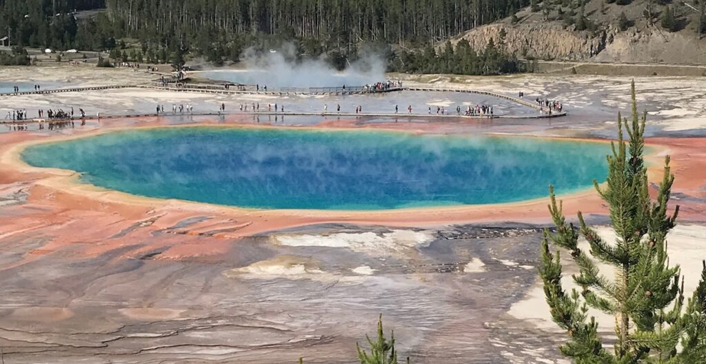
The more popular boardwalks of the Old Faithful area overshadow the few backcountry routes that exist here, but such underrated hikes should not be omitted from an eager hiker’s itinerary, as there are a few spectacular scenes that lie off the beaten path.
MOREUpper Geyser Basin
Biscuit Basin & Mystic Falls
| TRAIL | LOCATION | LENGTH | DIFFICULTY & NOTES |
|---|---|---|---|
| Divide | TH – 6.8 miles south of Old Faithful on the Old Faithful – West Thumb Road | 3.5 miles | M – Wooded trail leads to partial view of Shoshone Lake along Continental Divide |
| DeLacy Creek | TH – Signed TH about 1/2 way on Old Faithful – West Thumb Road | 9.6 miles | E – This mostly flat trail provides the shortest route to Shoshone Lake. |
| Fairy Falls | TH – Fairy Falls – Midway Basin, north of Old Faithful on Old Faithful – Madison Road | 6.5 miles | E – Leads along Firehole River to nice waterfall, with stop above Grand Prismatic Spring for spectacular scenery |
| Lone Star Geyser | TH – Near Kepler Cascades on Old Faithful – West Thumb Road | 4.8 miles | M – Old road leads through mature trees to sick geyser |
| Mallard Creek | TH – Mallard Creek on Old Faithful – Madison Road | 9.1 miles | M – Climbs along creek to Mallard Lake |
Mallard Lake | TH – South of Old Faithful Lodge Cabins in Old Faithful Village | 7.1 miles | M – Rises above Old Faithful Village to forest and on to Mallard Lake |
| Mystic Falls | TH – Biscuit Basin on Old Faithful – Madison Road | 2 miles | M – Leads past springs & along Firehole River to 70′ falls |
| Observation Point | TH – Old Faithful Boardwalk | 1.9 miles | M – Trail leads across Firehole River and upward to view of Old Faithful |
| Sentinel Meadows | TH – End of Fountain Flats Drive on Old Faithful – Madison Road | 5 miles | M – Runs through open meadows & along Firehole River |
Hiking in Norris
Hikes around the Norris Geyser Basin lead through the park’s oldest and hottest thermal features. Trails here include boardwalks that provide access to the Echinus Geyser and Steamboat Geyser, which is the world’s tallest, at nearly 400′ in height.
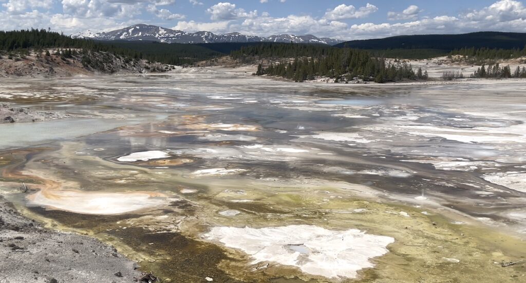
Other trails in this region usher hikers toward the high country lakes and mountains of the southern Gallatin Mountains, with Mount Holmes beckoning the bold toward a 10,300′ summit that rises just to the northwest of the Norris Geyser Basin.
MORE| TRAIL | LOCATION | LENGTH | DIFFICULTY & NOTES |
|---|---|---|---|
| Artist Paintpots | TH – 4.5 miles south of Norris Junction on Norris – Madison Road | 1 mile | E – Stroll with small loop on hillside provides views of peculiar geothermal features |
| Mary Mountain | TH – Nez Perce on Madison – Old Faithful Road | 20 miles | S – Trail leads eastward across Mary Mountain to Hayden Valley |
| Monument Geyser Basin | TH – 5 miles south of Norris Junction on Madison – Norris Road | 2.5 miles | M – Winds through thick forests with views of Gibbon RIver |
| Mount Holmes | TH – Mount Holmes – 3 miles south of Indian Creek on Mammoth – Norris Road | 20 miles | S – Rugged hike to 10,330′ summit with fab views |
| Purple Mountain | TH – 0.25 mile north of Madison Junction | 6.5 miles | S – Climb through lodgepole forests to view of Gibbon River and Old Faithful area |
| Solfatara Creek | TH – Loop C in Norris Campground | 6.5 miles (one way) | M – Winds along creek through pines to small thermal areas |
Hiking in Bechler Meadows
This little-known area in southwestern Yellowstone is definitely “out-of-the-way”. This region is difficult to access, as it requires some navigation & travel on gravel roads that lead out into the wild. That said, some of the best kept secrets of the park can be yours for the finding in this area.

There are a number of trails that wind through this area, many of which provide access to waterfalls and riverbanks. There are also a number of hot springs out here, which attract the most hardcore of hot springs fanatics who are willing to put in some miles. There are a number of small loops and trails that lead further out into the backcountry in this area, but online information is scant, so this is largely uncharted territory! Enjoy!
MORE| TRAIL | LOCATION | LENGTH | DIFFICULTY & NOTES |
|---|---|---|---|
| Bechler Canyon | TH – Lone Star Geyser or Bechler Ranger Station – SW corner of park | varies by route | S – Remote area of park, usually requires multi day backpacking from Old Faithful or Bechler |
| Bechler Falls | TH – Cave Falls Road, from Ashton, Idaho. Remote SW Yellowstone | 2.6 miles | E – Hike crosses level terrain through forest along river to falls |
| Cave Falls / Bechler | TH – Cave Falls Road, from Ashton, Idaho. Remote SW Yellowstone | varies by route | E – Trails provide access to a number of remote river cascades |
Guide to Yellowstone
Relevant Links
All content found on Park Junkie is meant solely for entertainment purposes and is the copyrighted property of Park Junkie Productions. Unauthorized reproduction is prohibited without the express written consent of Park Junkie Productions.
YOU CAN DIE. Activities pursued within National Park boundaries hold inherent dangers. You are solely responsible for your safety in the outdoors. Park Junkie accepts no responsibility for actions that result in inconveniences, injury or death.
This site is not affiliated with the National Park Service, or any particular park.