It is no secret, most Park Junkies are well aware that Yellowstone is a giant volcano… However, its magnitude may be of some amazement, especially to those who understand just how big this thing really is.
Guide to Yellowstone
Geology of Yellowstone
Yellowstone is at its core, a collection of at least three giant elevated calderas (large craters that are formed by the ground collapse of a once explosive volcano) that sit on a high plateau along the continental divide in the Rocky Mountains. Encircled by peaks that range from 10,000 to nearly 14,000 feet, it is the headwaters of both the Yellowstone River to the north and the Snake River to the south.
Greater Yellowstone Ecosystem
The park is the heart of the larger Greater Yellowstone Ecosystem (GYE) which comprises some 18-20 million acres of land in Wyoming, Montana and Idaho. Home to five national forests, three national wildlife refuges and three national park units, and comprising eleven separate mountain ranges, this area is one of the largest nearly intact contiguous temperate ecosystems in the world. The GYE today still contains at least traces of most of the living organisms that would have been found here 1,000 years ago.
Much of the rock found in the GYE dates to the Precambrian period (4.6 billion to 550 million years ago). As time rolled forward into the Paleozoic and Mesozoic eras, (541-66 million years ago) the area of North America that is home to Yellowstone experienced numerous profound topographic changes that placed its terrain below seas, under sand dunes, and beneath coastal tidal flats.
Laramie Orogeny
During the Cenozoic era, beginning 66 million years ago, much of the area became subject to the Laramide orogeny, a period of mountain-building due to increased tectonic plate movement along what was then the western coast of North America, when the Farallon Plate began to move beneath the North American plate in a process known to scientists as “subduction”.
These plate movements facilitated major faulting and volcanism in the western United States and Canada, and led to the formation of the entire Rocky Mountain Range, which contains the GYE.
The Absaroka Range, which runs along the park’s north and eastern border was birthed by numerous such volcanic eruptions that took place some 50 million years ago. These eruptions were not connected to today’s volcanic activity at Yellowstone.
Basin and Range
Approximately 30 million years ago, the mountainous area began to experience changes brought on by the lithographic expansion (east/west separation of the Earth’s upper mantle and crust) of the Basin and Range province.
This expansion created the classic north/south mountain ranges separated by long, often flat north/south valleys, found in much of the western United States, including Yellowstone. Numerous periods of glaciation also acted upon the area’s mountains over the course of this period.
While periods of glaciation and tectonic activity have played active roles in the formation of the landscape we observe today, it is the massive power of volcanism that bears ultimate responsibility for the curious wonder that is Yellowstone.
These volcanic forces began to affect its topography some 16 million years ago, when an intense period of volcanism rose from the Earth in the area near the present-day borders of Nevada, Oregon and Idaho.
Stationary Hotspots
Geologists tell us that large pools of molten rock lie just below the Earth’s surface in the Yellowstone area. In fact, scientists believe the park is located above a prominent “hotspot”.
This term was coined in the early 1960s to describe the theories of Canadian geophysicist J. Tuzo Wilson, an important contributor to plate tectonics and fault zone theory. A hotspot is an area where intense high heat energy in the form of magma from the Earth’s molten core is released outward in “thermal plumes” which rise through the mantle, melting rocks along the way to the Earth’s crust, where the molten material forms a pool, or sort of reservoir of liquid rock.
Hotspots leave trails of volcanos as clues to their existence as tectonic plates slowly move above them. Such outlets are often found in oceans and are thought responsible for island chains such as Hawaii, but also are believed to be the conduit through which such forces affect the Yellowstone area. Both the Hawaii islands and the GYE display a geographic swath of volcanic deposits, that likely formed as plates drifted across an underlying hotspot.
A series of more 100 calderas create a nearly 500-mile trail of volcanic activity across southern Idaho that leads directly to Yellowstone. This is a result of the southwestern movement of the North American plate, while the hotspot below remains somewhat stationary.
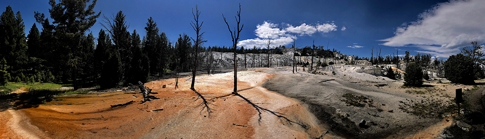
Geologists believe that two separate hotspots exist below Yellowstone and their presence is readily available for view, as hydrothermal features attest to the presence of some under-worldly connection to the depths of the Earth.
However this area’s unique terrain is not solely the result of these continual displays. Yellowstone is the product of a series of giant explosions, the likes of which have never been observed by humans in recorded history.
Stress Creates Faults
The volcanic activity that created the Yellowstone we know today resulted from these hotspots and occurred relatively recently, geologically speaking. Intense heat from these hotspots caused the above areas of the Earth’s crust to expand and rise, stressing the above lying rocks, which resulted in earthquake activity and newly formed faults.
As these faults separated over millions of years, they deepened, eventually reaching the underlying magma chamber (hotspot). The arrival of these cracks provided the release of massive amounts of pressure. The subsequent rapid expansion of volcanic gasses resulted in a a massive volcanic eruption, that remains one of the largest volcanic eruptions for which man has found evidence.
3 Massive Eruptions
In the past 2 million years, there have been a series of three massive eruptions, in addition to more than 80 much smaller events that have created what became the world’s first national park.
About 2.1 million years ago, the first of these giant volcanoes released its fury. The skies above what would one day be known as North America darkened as an explosion some 2,500 times the size of 1980’s Mount St. Helens sent ashes as far as current day Missouri. Locations within 200 miles of Yellowstone received more than a foot of ash, and skies filled with ash that would have prevented sunlight from reaching the Earth, likely resulting in a “notable” temperature decrease.
Huckleberry Ridge Eruption
This first Yellowstone eruption is referred to as the Huckleberry Ridge eruption. It released more than 600 cubic miles of rock and ash, about 17 times more than the 36 cubic miles of debris released in 1815 by Mount Tambora in Indonesia, which killed more than 10,000 people and remains the largest eruption in written human history. By comparison Mount St. Helens released a mere 0.24 cubic miles of debris, and it was devastating to the surrounding landscape, removing more than 1,300 feet off the top of the mountain.
Island Park Eruption
The second Yellowstone eruption came about 1.3 million years ago, and formed the Island Park Caldera. It is the smallest of the park’s three eruptions, but was still a monster, releasing some 67 cubic miles of debris, twice the amount of Tambora.
Lava Creek Eruption
The Lava Creek eruption was the most recent of the large events and took place about 630,000 years ago. Although only one third the size of the Huckleberry blast it was a behemoth, releasing 240 cubic miles of debris. Due to its relatively youthful age, its flows can easily be observed. The debris field extends eastward of the Huckleberry Caldera and part of its basin holds Lake Yellowstone.
Several more recent, but smaller flows are partly responsible for the scenery we enjoy today in Yellowstone. The West Thumb of Yellowstone Lake was created by an explosion about 174,000 years ago and Pitchstone rhyolite flows are found in the southwest corner of the park that date to 70,000 years ago, making them the park’s youngest lava flows.
Volcanic Activity Today
Volcanic activity below the park continues today and scientists believe that active hotspots lie a short distance from the Earth’s surface in at least two places in Yellowstone. Active magma chambers may be as little as 3-8 miles beneath Sour Creek Dome and 8-12 miles beneath Mallard Lake Dome.
Both of these domes change, rising and falling as the volume of hydrothermal flows change below. In fact, the entire floor of the 3rd caldera is in motion today, rising and falling depending upon the forces underneath. Over the past 100 years, the caldera has inflated to the north, effectively tilting Yellowstone Lake to the south, which is evidenced by the sandy beaches at Fishing Bridge, while large trees stand submerged at the lake’s southern shore.
Glaciers
Other forces have also contributed to the scenery of Yellowstone. The park shows evidence of several periods of heavy glaciation that saw nearly every square mile of the park covered by sheets of ice that were thousands of feet thick.
Glaciers form when an area receives more snowfall during the winter than melts during subsequent summers. Over the course of a few decades, this can lead to massive fields of snow, which slowly become large blocks of ice. When the thickness of these ice fields exceeds 100 feet or so, the weight of the ice above begins to crush the bottom layers, causing an outward and downward expansion, which begins to affect the underlying layer of earth.
Materials that lie upon the ice-covered surface are easily moved by the massive sheets of ice. Giant boulders are often moved along at a snail’s pace, eroding the Earth’s surface inch by inch. Glaciers leave behind clues to their once-powerful presence. Large U-shaped valleys (cirques), ridges of debris left behind by retreating ice (moraines), and strangely placed boulders that do not match the surrounding landscape (erratics), are often signs that indicate past glacial presence.
Often, subsequently occurring glaciers will eliminate evidence of past glaciers, greatly complicating any attempt to determine exactly how many glaciers have affected a given area.
Analysis shows that Yellowstone’s mountains have underwent glacial erosion numerous times during the past couple of million years. In fact, scientists have discovered glacial deposits near Tower Fall that date back more than a 1.3 million years, a rare find for those who study glacial activity.
While there is no way to determine with any degree of certainty exactly how many different periods of glaciation have occurred here, there does exist ample evidence of the Bull Lake glaciers about 150,000 to 160,000 years ago. This period’s glaciers covered much of the park, but many of the signs for this period have been erased by more recent glacial activity.
The most recent episode of major glaciation in this park occurred somewhat recently in geologic-speak. Beginning around 20,000 years ago and lasting until approximately 14,000 years ago, the Pinedale period is the most studied period of glacial activity in Yellowstone. During this time, most of the park was covered with massive ice caps that were up to 4,000 feet thick.
When Will it Blow Again?
A common question here at Yellowstone is: When will this thing blow next? Will it be in the next few hundred years? In the next thousand or million…?
Geologists think that a major eruption any time soon is certainly not likely, but conclude that one day, this volcanic giant will probably reemerge from its current resting state.
To study the likelihood of such an occurrence, the Yellowstone Volcano Observatory was established in 2001. This is a collaborative effort between the Park Service, the USGS and numerous universities throughout the area. Efforts to measure the seismic activity, changing GPS coordinates and stream flow stations are underway and monthly reports are available at their website.
Guide to Yellowstone
Relevant Links
National Park Guides
All content found on Park Junkie is meant solely for entertainment purposes and is the copyrighted property of Park Junkie Productions. Unauthorized reproduction is prohibited without the express written consent of Park Junkie Productions.
YOU CAN DIE. Activities pursued within National Park boundaries hold inherent dangers. You are solely responsible for your safety in the outdoors. Park Junkie accepts no responsibility for actions that result in inconveniences, injury or death.
This site is not affiliated with the National Park Service, or any particular park.