At 14,411 feet, nearly 3 miles high, Mount Rainier towers above the surrounding area, proudly showcasing its strength to any mere mortal within a 100 mile range.

Guide to Mount Rainier
Mount Rainier National Park
Known historically by native tribes as “Tohoma” (the great mountain) and known today throughout the Pacific Northwest simply as “The Mountain”, Mount Rainier is without doubt, the defining landmark of the Washington State’s Cascade Range and the Seattle area. No one can ignore its command of attention from any angle…
On cloudy days, of which there are many, the mountain can appear deceptively tranquil from afar, as if christening itself to shine once more on a sunny day. In reality, relentless storms often pound the mountain without mercy during such times.
Where is Mount Rainier?
Mount Rainier is located in western Washington state and is the tallest mountain in the larger Cascade Range, which runs from northern California to Canada. The park is located about 60 miles to the southeast of Seattle, from where the mountain appears to sit right in the city’s backyard.
Exploring Mount Rainier
At 236,000 acres, Mount Rainier is a fairly small park by western standards, but it will take some time to move from one location to another due to the complex topography of the mountain environment.
Most visitors enter through the gateway community of Ashford, which sits about 6 miles west of the southwestern entrance to the park, which is known as the Nisqually entrance. The small roadside hamlet holds a few lodging options, as well as a couple of eateries.
The park offers three visitor centers, at Paradise, Sunrise and Ohanapecosh. There is also the historic Longmire Museum, as well as the Wilderness Information Center at Longmire, where guests can gather beta on the backcountry options in the park.
Longmire
Longmire is located seven miles from the park’s southwest Nisqually entrance and is the first stop upon entering the park. This historic location was first developed by James Longmire, and served as the first visitor service area inside the park. Mr. Longmire hosted John Muir when he came here to climb Mount Rainier in 1888.
Today, visitors can gain information and backcountry permits at the Wilderness Information Center, check out the Longmire Museum or just chill with a drink on the porch of the historic National Park Inn, which offers accommodations and a small restaurant where the Park Junkie once worked.
A few nice trails can be accessed here, such as the Eagle Peak Trail, the Trail of Shadows, and the 93-mile Wonderland Trail, which is the holy grail of Mount Rainier hiking and circles the entire mountain.
Longmire is the park’s only location that offers a full array of services year-round, including lodging, food and a general store. Camping is available at the Cougar Rock Campground, just a couple of miles up the road from Longmire.
See the visiting page for more information on what is available at Longmire.
Paradise
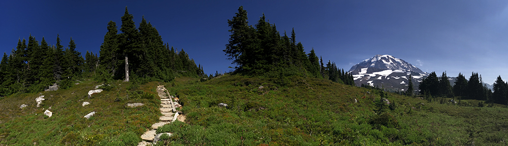
For most visitors, a trip to Mount Rainier means a trip to Paradise, which is 12 miles past Longmire and 2,700′ further up the mountain. Nearly 70% of the park’s guests make their way to this mountain retreat in order to enjoy the flowery meadows, the jagged glacial terrain, and the dramatic mountain vistas that are of constant display. This place is paradise, in Paradise.
A full array of services are available here in the summer, although these are somewhat curtailed during the winter months. The historic Paradise Inn, built in 1916, has provided mountainside lodging for more than a century and the Henry M. Jackson Visitor Center is a good place to scoop up some information before you jump on the Skyline Loop, which departs the upper parking lot and leads to the most stellar views you’ll probably see during your visit.
This is the jumping-off-point for the most popular climbing route on the mountain. Most summit-bound adventurers head up to Camp Muir, spend a few restless hours trying to sleep, and wake at 2 am in order to head up the Ingraham Glacier and then up the Disappointment Cleaver before reaching the Columbia Crest and the 14,411′ mountain summit.
Motivated day-hikers can also make the trek to Camp Muir in an effort to earn an extra evening drink or two. Use caution on this journey, many such hikers have become lost on this trek due to whiteout conditions, which can strike the mountain quickly even on clear summer days.
See the activities page for more information on hiking or climbing at Mount Rainier.
Ohanapecosh
The southeastern region of the park is home to Ohanapecosh, which holds a thick collection of Douglas firs, western red cedars and hemlocks that form an incredible old-growth forest which sits on an island in the middle of the Ohanapecosh River.
This area is 42 miles from the Nisqually entrance and offers a visitor center, and the Ohanapecosh Campground is the park’s largest option for campers. These services are limited to the months of April – September, as Ohanapecosh is close during the winter season. Check the links for exact dates, as these will vary according to weather.
The Grove of the Patriarchs is a nice flat 1-mile trail that leads through an old-growth forest, and showcases some massive trees, while the rugged 15-mile march to Indian Bar takes more motivated hikers to the crest of the Cowlitz Divide and some rare views of Mount Rainier.
Other options exist here as well, see the activities page to see what interests you.
Sunrise
If you want to take your car to the highest possible point in the park, you’ll be headed to Sunrise. Situated at 6,400 feet on the northeast side of the park, this location is 60 miles from the Nisqually entrance, pretty much on the direct opposite side of the mountain. The Sunrise area can also be easily accessed from Washington Highway 410, which enters the northeastern corner of the park.
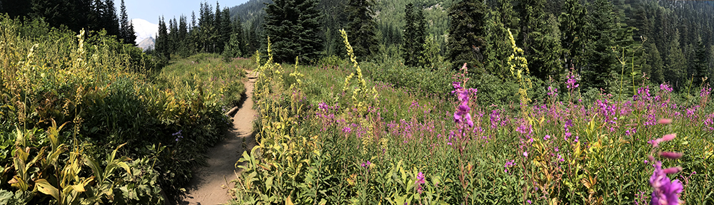
Sunrise is the second most popular destination in the park, and features a splendid view of the mountain and the Emmons Glacier, especially during the hour of… you guessed it: sunrise. The area’s mountain meadows lie flanked in abundant numbers of wildflowers and Sunrise Point offers a stunning 360 panorama of this area of the Cascade Range.
Visitors can stop by the Sunrise Visitor Center to ask questions and inquire about trail conditions, as late snows often leave a number of the areas trails snowbound until mid summer. Trails such as the Mount Fremont Lookout Trail and the Shadow Lake Loop allow hikers to gain views that perhaps outshine those at Sunrise, if that can be possible.
There are no lodging options at Sunrise, but there is quite a scene. The Sunrise Day Lodge has a gift shop and a cafeteria style restaurant that serves decent food and cold beer, an especially enjoyable option for those in the middle of a Wonderland trek. The White River Campground is about 12 miles from Sunrise. It is a first-come-first-serve campground and enjoys a nice wooded setting, right on the banks of a rushing river.
Carbon River & Mowich Lake
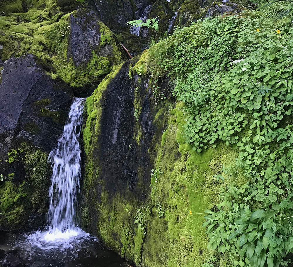
This is the park’s quiet side, located in the remote northwest corner of the park. This is a cool area, as the climate is essentially that of a rainforest, and the forests here are as enchanting as any you’ll find in the national parks.
These two areas are both accessed by Washington Highway 165 and lie completely removed from all other park locations. Neither Carbon River or Mowich Lake offer services, aside from an intermittently staffed ranger station at Carbon, and a primitive, tent-only campground at Mowich.
The Carbon River Road experienced significant damage during a floods in 2006, and is closed to vehicular travel inside the park. Visitors may hike, or ride bicycles into the park on the road, which is now converted to a trail.
Mowich Lake is located south of the Carbon entrance, on a continuation of the Hwy. 165. This area offers access to the Wonderland Trail, and has a few other hiking options as well, such as Spray Park, which is a fabulous option and when combined with a section of the Wonderland, is one of the park’s best unknown loops.
The Mountain
Mt Rainier is an active (although dormant) stratovolcano that last erupted about 150 years ago. Born of volcanic activity somewhere between 500,000 and one million years ago, this relatively young volcano is today dormant, but scientists warn that it will awaken one day, perhaps in the not-distant future. It’s neighbors have done such. Recall Mt St Helens in 1980 and Lassen Peak in 1916. It is only a matter of time kids… Boom!
If they predict this thing to blow, it may not be a bad time to book that Everglades canoe trip of which you’ve always dreamt… you won’t mind those damned mosquitoes when the entire northwest is under three feet of ash…
Mt. Rainier is the most glaciated mountain in the continental US with 25 active glaciers. It is the 5th tallest mountain in the lower 48 and is the headwater for six of the northwest’s major rivers.
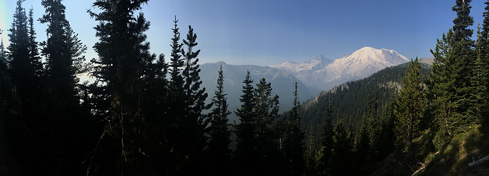
The mountain is so massive compared to its surroundings that it actually creates its own weather, blocking storm fronts coming in from the Pacific Ocean, which are thus forced to release their contained moisture on the mountain.
The Paradise area of the park, at around 5,000’ is the “snowiest place on earth” with a recorded average of 59’ of the white stuff each winter. Paradise previously held the world-record total snowfall of 93.5’ in 1971-1972, although this was broken by nearby Mt. Baker, which received 95’ in 1998-1999, and Paradise recorded a record thickness on the ground of 30ft of snow in 1955.
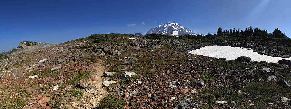
More than 260 miles of well-maintained trails lead through colorfully flowered meadows and the magically silent evergreen forests of the parks lower-lying regions beckon hikers to explore a few of the more than 260 miles of trail that exist within the park. Many paths in this unique national park lead to sick views of incredible scale and magnitude, looking out on what may seem to simply be a brilliantly layered painting crafted by a master…
Playtime
This park is a wonderful playground, offering a multitude of outdoor activities that will thrill even the most prude of adventurers.
The most revered of all trails here would likely be the famed Wonderland Trail, a 93-mile cirque of the mountain that meanders through a mix of mountain, meadow, river and forest terrain one is unlikely to witness elsewhere. This trail is no joke, as it is a constant chorus of up, down, river crossing, up, down, river crossing, up, down, river…. yeah, you get the point.
The Wonderland Trail involves more than 23,000 feet of elevation change. It would probably get old if it wasn’t for the stunning scenery at every turn.
The hiking options in Mount Rainier National Park are out-of-this-world and provide access to the most incredible flowered meadows and mountain vistas that one can image. Summer days spent on the park’s trails are days that cannot be better spent.
More than 260 miles of well-maintained trails lead through colorfully flowered meadows and the magically silent evergreen forests of the parks lower-lying regions beckon hikers to explore a few of the more than 260 miles of trail that exist within the park.
Climbing Mount Rainier
Obviously, some will be tempted to climb the mountain, because it is there…
For these restless souls, there are limitless options, depending on skill, time and desire of difficulty. For the novice, there are guide services that can arrange a trip to the summit, and back… which is the important leg of the journey.
Each year, numbers indicate that more than 10,000 maniacs attempt to scale the heights of Rainier, and reportedly, only 25% can claim the journey a success. This mountain serves as a training ground for more serious worldly climbs, as it contains the most complex glacial systems in the world, outside the Himalaya. All routes here will be of at least 9,000’ vertical gain to the summit over steep crevasse laden terrain. Oh, and then back down… let’s not forget that part.
Horseback Riding
Opportunities for equestrian pursuits exist on many of the park’s trails and bicycling on the park roads is an option as well, including the Westside Road and the Carbon River Road, both older roads that have been closed due to flood activity.
Fishing
Fishing is allowed in the park, as there are numerous streams and lakes, however, this can be a trying exercise here as stocking practices were abandoned in 1973 to return the lakes to the native aquatic conditions found prior to the early 1900s when fish were not found in the park’s waters.
Winter Activities
In winter months, snowshoeing and cross-country skiing are popular here, and some find the vertical terrain of the Tatoosh Range inviting for backcountry skiing and snowboarding. Sledding is allowed in the Paradise area and snowmobiles are permitted in a few designated areas. Check with the NPS to find regulations on motorized travel by such means.

Park Junkie Verdict
Mt. Rainier is a parkjunkie fave, for sure! As a midwest boy, this park introduced the thrill of the mountains to me during a summer stint working in the park in 1999, as a server at the Longmire location for the park’s 100th anniversary. I lived in a quaint lil cabin that no longer exists along the banks of the Nisqually River and had one of the best summers of my life.
The maddening glow of gorgeous summer days spent wandering about in the enchanting forests of the mountain’s lowlands… Morning runs up Eagle Peak to stare back down at my little cabin… The peaceful breezes that blew across my face on sunny afternoons as I lay in flowery meadow near Mildred Point and Indian Henry’s Hunting Ground…
A frigid and exhausting, yet exhilarating 7 am arrival at the Columbia Crest, the summit of Mount Rainier after a 5-hour climb on the ice in the dark of night… The rush of adrenaline produced by climbing beyond my comfort level on the jagged peaks of the Tatoosh Range with trusty snowboard strapped to my back, learning the moves necessary to make one’s way into the mountains… & back out safely…
What a summer at Mount Rainier…
I think it’s time for a return trip.
See ya there…
Guide to Mount Rainier
Relevant Links
National Park Guides
All content found on Park Junkie is meant solely for entertainment purposes and is the copyrighted property of Park Junkie Productions. Unauthorized reproduction is prohibited without the express written consent of Park Junkie Productions.
YOU CAN DIE. Activities pursued within National Park boundaries hold inherent dangers. You are solely responsible for your safety in the outdoors. Park Junkie accepts no responsibility for actions that result in inconveniences, injury or death.
This site is not affiliated with the National Park Service, or any particular park.