Some of you Park Junkies may be unaware that Kings Canyon National Park was actually one of our first national parks. A portion of the park was set aside back in 1890 as General Grant National Park, in order to protect an impressive grove of ancient sequoia trees.
Guide to Kings Canyon
Kings Canyon National Park
Kings Canyon holds some the largest trees on Earth, as well as some of the highest and most remote mountain terrain in the lower 48, which provides the perfect testing ground for some of the most rugged adventures in all of our national parks.
This is a land of mountains, and the Kings Canyon section of the Sierra Nevada is strewn with a line of some of the highest peaks this range has to offer, with more than 15 summits above 13,000 feet. These jagged summits lie flanked with year-round snowfields, flower-speckled meadows and high altitude lakes so clear you can see the depths of your own soul in their waters.
Where is Kings Canyon
Kings Canyon National Park is located just to the north of its sister park, Sequoia National Park, in the southern realm of the Sierra Nevada Mountains. These mountains form the longest mountain chain in the lower 48, stretching more than 400 miles north to south in eastern California.
Kings Canyon has few access points. Ca Hwy. 180 is the only road into the park and departs General’s Highway at Grant’s Grove before heading north to access the Kings River, where the road heads east and into the actual Kings Canyon, which is the main section of the much larger Kings Canyon National Park.
Exploring Kings Canyon
Kings Canyon is co-managed with Sequoia, and the two are generally lumped together in most guidebooks and reviews. This tends to give Kings the short end of the stick, because Sequoia has the bigger tree, the bigger mountain and the bigger reputation. Thus, most tourists simply visit Sequoia and figure they’ve seen the best these parks have to offer.
Anyone who skips out on Kings Canyon because it seems to lack the sizable treats offered by its sister park to the south is the one who gets the short end of the stick…
Kings Canyon is divided into two separate sections. The Grants Grove area lies just outside the northwestern boundary of Sequoia National Park, while the mass of the park lies due north of Sequoia, and holds nearly 500,000 acres of absolute wilderness.
Grant’s Grove
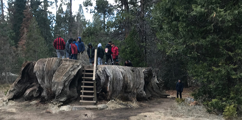
This small area holds a grove of giant sequoia that is home to the world’s second largest tree, the General Grant Tree, the size of which is only eclipsed by Sequoia’s General Sherman Tree. Most of the visitors to Kings can be found in Grants Grove, as its position just outside of Sequoia along the Generals Highway assures its popularity.
Several short trails provide avenues into the massive trees that led to the park’s protection in 1890. Numerous trees along the paved General Grant Trail command attention, such as the Robert E. Lee Tree – the world’s 11th largest, the Fallen Monarch, the Centennial Tree, the California Tree, and naturally, the General Grant Tree, named for Ulysses Grant, the victorious Civil War General whose Presidential signature christened the world’s first national park in 1872.
Situated at about 6,500′, Grant’s Grove offers nearly every amenity a park traveler should expect, except a gas station. A number of lodging and dining options make guests feel right at home and a small market can provide the little things you may have forgotten. The newly remodeled Kings Canyon National Park Visitor Center is a logical first stop, and can set you up with all the info you’ll need on current conditions in the park.
Cedar Grove & Zumwalt Meadow
Once the experience of Grant’s Grove is under the belt, it is time to head into the actual Kings Canyon, home to the rushing waters of the Kings River.
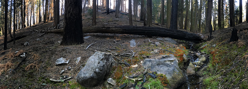
The Kings Canyon section of this park is similar to Yosemite, with massive granite walls and towering peaks that rise far above the ant-sized cars that travel on Ca. Hwy. 180, far below. This is one of the deepest canyons in North America, with an 8,000′ drop from Spanish Peak to the confluence of the South and Middle forks of the Kings River, just outside the park.
The small village of Cedar Grove is located 35 miles east of Grant’s Grove, and has a small market, snack bar and a lodge, as well as the Cedar Grove Visitor Center, which is the perfect place to find an answer to the questions that arise about the fantastic scenery unfolding before the eye. The area has a few campgrounds that can offer a scenic place to lay your head, and the sleeping to the sound of the Kings River will have you resting like a king… Yeah, I just did that…
Just east of Cedar Grove is Road’s End, and Zumwalt Meadow, named for Daniel K. Zumwalt, who was a California lawyer who regularly represented railroad interests in the late 19th century. Zumwalt is believed to have had an instrumental hand in the crafting of the legislation that created the park in 1890.
Zumwalt Meadow is flanked by two prominent rock formations that rise more than 3,000 feet above the 5,025′ meadow. North Dome rises to 8,717′ and the Grand Sentinel stands at 8,518′. The scenic 1.5 mile Zumwalt Meadow Loop provides a great introduction to the scenic wonderland of Kings Canyon.
Trails from here lead deep into the rugged backcountry of Kings Canyon and give hikers access to an endless wilderness.
Park History
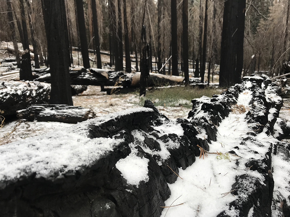
Originally set aside in 1890 as General Grant National Park in order to protect a large sequoia grove from logging interests, the park remained relatively unknown for the next 40 years due to its rugged landscape which made it inaccessible to much of the public.
Although most were unaware of the treasures hidden within this area of California’s Sierra Mountains, industrial forces were indeed aware of the area. Valuable water flowed from the King’s River and industrialists made moves in the 1930s to construct damns in the canyon to provide water for thirsty developments to the west.
This led then-Secretary of the Interior Harold Ickes, who had fallen in love with King’s Canyon on an earlier trip to the area, to become involved on a personal level. He hired photographer Ansel Adams to make images of the majestic landscape in order to publicize the area. His efforts worked, and President Franklin Roosevelt signed the bill to create King’s Canyon National Park in 1940.
The protection of the area was still not complete however, as the new park’s Cedar Grove and Tehipite Valley were left unprotected as part of the deal. These areas would not be fully protected by park boundaries until 1965 as battles with industrial interests continued.
The park was now some 700 times larger than it was originally and the administrators struggled to manage the newly acquired land. Being wartime, resources at the federal level were already significantly strained, so the administrations of Sequoia and King’s Canyon were combined in 1943 and remain so as of 2017.
Today, King’s Canyon is larger than Sequoia by some 50,000 acres, yet it receives less than half the visitors of its adjacent sister park. It is remote, and requires a bit more travel time to access. However, for those who make the drive up California Highway 180 past Cedar Grove toward Road’s End, unparalleled views that once charmed the likes of John Muir unfold before eyes glued wide-open.
King’s Canyon is a largely undeveloped park, as was Ickes vision, with numerous backcountry trails tempting travelers to leave their automobiles behind and to stroll forth into nature’s kingdom, high in the Sierra Mountains. Most treks here are of significant distance and require overnight stays in order to complete loops. The Pacific Crest Trail joins with the John Muir Trail in this region and covers more than 75 miles in King’s Canyon.
Playtime in Kings Canyon
Kings Canyon is a hiking paradise and when combined with Sequoia, an avid hiker has more than 800 miles of trail to explore. My favorite miles in Kings Canyon would probably be the 46-mile Rae Lakes Loop, which provides some of the best scenery in the Sierra.
The park offers incredible rock climbing and canyoneering, although there are many more easily accessible areas that provide similar terrain outside the park. However, the novelty of ascending the more remote peaks and classic lines of this area bring motivated adventure-seekers to its lair, as most never make the effort… losers. The bums will always lose.
Fly fishing is quite good here, and kayakers will find insane challenges as well. Several of the park’s remote creeks offer maddening runs for the able-bodied boater, with the Middle Fork of the King’s River standing as the true test of courage. This 29-mile Class V run is for experts only, duh, descends over 10,000 feet, involves countless portages and takes most parties 5 days. Have fun…
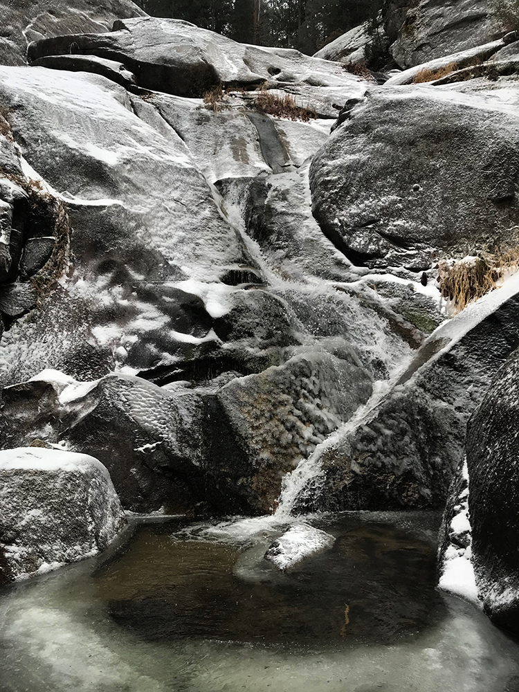
The high country of this park is littered with countless gorgeous alpine lakes and grand granite monoliths that appear surreal under clear summer skies. Here, crisp evenings and starry nights beckon thrill-seekers searching for solitude and beauty in area just short of heaven’s gate…
Park Junkie Verdict
Kings Canyon holds some of the most remote terrain in the lower 48, so as you can imagine, it is a Park Junkie favorite. The Rae Lakes region may be one of the most beautiful areas a backcountry hiker could ask for, and the forests of the lower western slopes are as enchanting as any in the parks, with trees that rival the world’s largest.
It is easy to escape the crowds in Kings Canyon. Most seem to stick to Sequoia’s main road, and a few stragglers make their way up to Road’s End and Zumwalt Meadows. Far less actually hit the trails up there.
I finally decided to spend a few days backpacking in the park a couple of years ago, and took advantage of the opportunity to hike into the park’s high country from the eastern side of the Sierra.
I found a wonderland of high mountain lakes and incredible mountain passes, with few people and even fewer cares. The only care I actually did have in those mountains was making sure I didn’t piss off a momma bear with two cubs who I found feeding on the trail one morning.
Now that’s my kind of care, and my kind of crowd…
See ya there…
Guide to Kings Canyon
Relevant Links
National Park Guides
All content found on Park Junkie is meant solely for entertainment purposes and is the copyrighted property of Park Junkie Productions. Unauthorized reproduction is prohibited without the express written consent of Park Junkie Productions.
YOU CAN DIE. Activities pursued within National Park boundaries hold inherent dangers. You are solely responsible for your safety in the outdoors. Park Junkie accepts no responsibility for actions that result in inconveniences, injury or death.
This site is not affiliated with the National Park Service, or any particular park.