Visions of cowboys and oil rigs may come to mind when the average person thinks of Texas. There are no active oil rigs inside the park, but when researching the available activities in Guadalupe Mountains National Park, one will find that they can ride a horse right to the very top of Texas.
That’s right, the trail to Guadalupe Peak at 8,751 feet allows horse access. And why the hell wouldn’t it? This is Texas after all…
Here are some of Park Junkie’s favorite activities in Guadalupe Mountains.
Guide to Guadalupe Mountains
Hiking in Guadalupe Mountains
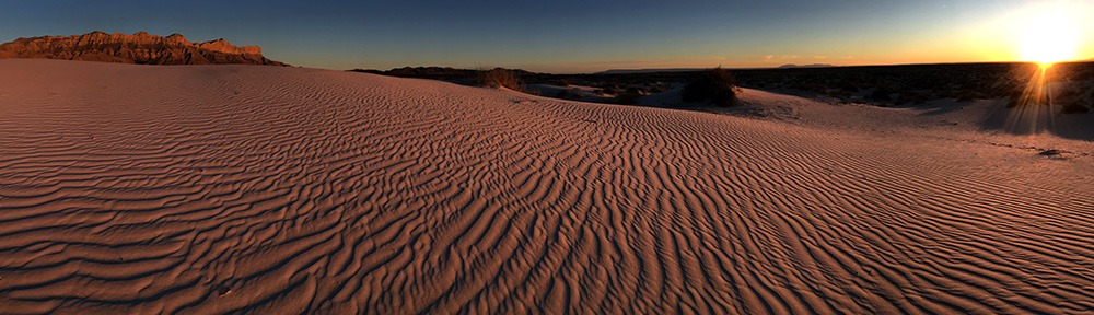
My first visit to Guadalupe Mountains did not include a single hike, which led me to vastly underestimate the stunning scenery of the park’s high country. Luckily, I eventually got the opportunity to hit the trail here, and now I make sure to get up into these mountains every chance I get.
MoreThis is a relatively small park, and hiking the Guadalupes is not as intense an undertaking as hiking in many other mountain ranges. The distances on trail from point to point are usually manageable in a single day. Nevertheless, windy conditions can provide challenging conditions, and the lack of water in the backcountry requires that all water be carried from the trailhead.
Pine Springs Trails
Most of the park’s popular hikes will depart from Pine Springs. Several of these trails offer easy access to attractions in the park’s lower region, while a few provide routes into the high country.
| TRAIL | LOCATION | LENGTH | Difficulty & Notes |
|---|---|---|---|
| Frijole/Foothills Trail | Pine Springs/Frijole Ranch | 3.7 miles RT | E – Loop trail between Pine Springs Campground & Frijole Ranch |
| Smith Spring | Frijole Ranch | 2.3 miles RT | M – Casual trail leads to watery oasis. |
| Devil’s Hall | Pine Springs | 4.2 miles RT | M – Hike leads up Pine Springs Canyon to staircase & Devil’s Hall |
| Guadalupe Peak | Pine Springs | 8.5 miles RT | S – 3,000 foot elevation gain from visitor center to top of Texas |
| El Capitan | Pine Springs/Williams Ranch | 9.4 miles 1-way | S – Trail runs along base of El Capitan, connecting Pine Springs to Williams Ranch |
| Salt Basin Overlook | El Capitan Trail | 3.6 miles 1-way | S – Trail departs El Capitan Trail 3.4 miles from Pine Springs. Total loop distance from VC is 11.4 miles |
| The Bowl | Pine Springs | 9.5 miles – varies | S – Follow Tejas Trail into the park’s high country. The Bowl Trail & Juniper Trail connect to Bear Canyon Trail. |
| Bear Canyon | The Bowl | 1.2 miles | S – Steep trail connects The Bowl with Frijole Trail. Can be used to make loop from Pine Springs to Bowl & Tejas Trail. |
| Tejas Trail | Pine Springs/Dog Canyon | 11.7 miles 1-way | S – Cross park trail connects Pine Springs with Dog Canyon. Used to access many trails in park’s high country. |
McKittrick Canyon Trails
Many of the park’s fall visitors will flock to McKittrick Canyon to view the spectacular fall colors that explode from bit tooth maple and oak trees along the only year-round water source in the park.
| TRAIL | LOCATION | LENGTH | Difficulty & NOTES |
|---|---|---|---|
| McKittrick Canyon Nature Trail | McKittrick Canyon | 1 mile RT | M – Self-guiding loop trail with information on geology & park ecology. |
| McKittrick Canyon | McKittrick Canyon | 5 miles RT – varies | M – Trail leads along stream to Pratt Cabin, where many turn around. / S – Trail extends to Grotto and McKittrick Ridge – connects to Tejas Trail. |
| Permian Reef Trail | McKittrick Canyon | 8.4 miles RT | S – Leads through geologic wonderland. Trail guide available at Pine Springs Visitor Center. |
The Bowl
This is the park’s mountainous backcountry. All trails in this area are accessed by foot or horseback via trails that lead in from the lowlands. No water is available.
| TRAIL | LOCATION | LENGTH | NOTES |
|---|---|---|---|
| Bowl Trail | The Bowl | 1.5 – 2.5 miles / varies | M – Trail connects Tejas Trail to Bear Canyon Trail. Spur trail leads to Hunter Peak |
| Juniper Trail | The Bowl | 2.8 miles 1-way | M – Connects Tejas Camp with Bear Canyon Trail. |
| Blue Ridge | The Bowl | 1.7 miles 1-way | M – Connects Marcus Trail with Bush Mtn Trail |
| Marcus Trail | The Bowl | 4.1 miles 1-way | M – Connects Tejas & Blue Ridge Trail with Marcus Overlook & Bush Mtn Trail |
| Bush Mtn Trail | Dog Canyon / The Bowl | 12 miles | S – Trail runs the western line of the Guadalupes from Dog Canyon to Bush Mtn. Continues to Pine Top & Tejas Trail. |
Dog Canyon
Dog Canyon is located in the far north of the park, just south of the New Mexico state line. This remote region is a perfect place to get away from the world, and offers quick access into the park’s high country from an elevation of 6,300 feet.
| TRAIL | LOCATION | LENGTH | Difficulty & NOTES |
|---|---|---|---|
| Indian Meadow Nature Trail | Dog Canyon | .7 miles | E – Level Trail around canyon meadow. See Dog Canyon VC for trail guide. |
| Lost Peak | Dog Canyon | 6.4 miles RT | S – Section of Tejas Trail leads up 3.2 miles to Lost Peak & turn around point. |
| Marcus Overlook | Dog Canyon | 4.7 miles RT | S – Follow Bush Mtn Trail to Marcus Overlook & return via same route. |
| Bush Mtn | Dog Canyon | 12 miles 1-way | S – Trail leads from Dog Canyon to Bush Mtn, continues to Pine Top & junction with Tejas Trail |
| Tejas Trail | Dog Canyon / Pine Springs | 11.7 miles 1-way | S Cross-park trail leads from Dog Canyon to Pine Springs with multiple trail junctions in The Bowl. |
Backpacking in Guadalupe Mountains
This is a great park for backpacking, both for the experienced and inexperienced participant. Trails are generally in great condition and the network of trails in the park’s backcountry is relatively straightforward. Distances are not too intimidating, offering a quick exit if it becomes necessary.
MoreBackpackers must be aware that there are no water sources in the backcountry, so that good ol’ pack will weigh a bit more than usual if you’re heading out for a few days. There are only 10 backcountry campsites, and each one assures a level of isolation not found in many other parks. Make sure to be aware of the wilderness regulations before camping in the park.
There are a number of alternatives when it comes to trips into the backcountry, and many can be connected to give a long-distance hiker a variety of routes from which to choose.
Pine Springs to McKittrick Canyon
Horseback Riding in Guadalupe Mountains
Hiking is cool and all, but if you’d rather watch the miles pass beneath your feet as they rest in a set of comfy stirrups, you can. This is Texas, and riding stock through the rugged Guadalupe wilderness seems somewhat appropriate, don’t ya think?
MoreSixty percent of the park’s backcountry trails allow stock use, and these provide access to most of the more popular scenes. For a full list of available routes, and a run-down of the park’s stock regulations, check the NPS Guadalupe Mountains Horseback Riding page.
4×4 Trails
Let’s be clear, this ain’t Moab… But if you are fortunate enough to have a high-clearance 4×4, there is a remote ranch in Guadalupe Mountains National Park that begs your attention.
MoreThe Williams Ranch Road is a rocky trail that leads northward along the vertical cliffs of the Guadalupes. It runs for about 8 miles before arriving at the Williams Ranch. This historic ranch provides a glimpse of pioneer and ranching life back around the turn of the 20th century.
The road is single lane, rocky and slow going, but is not a difficult drive for the average 4×4. The views are stellar and the isolation is superb. Access to the road is given by the NPS at the Pine Springs Visitor Center. Just stop by, tell them of your desire and they will give you a key to the gate. This is a day-use only area, so the key must be returned by closing time at the visitor center.
So, take a lunch and enjoy a day at Williams Ranch…
NPS – Guadalupe Mountains – Williams Ranch Access
NPS – Guadalupe Mountains – Williams Ranch History
Bird Watching in Guadalupe Mountains
The skies above Guadalupe Mountains are the roadways for more than 300 species of our feathered friends. Many birds stop by this area during migration periods, while many others call the park home.
MoreCheck out the park’s webpage to get a description of which birds you may encounter in the park’s various locations.
Stargazing
It will become abundantly clear as you drive to Guadalupe Mountains, that there are no major cities anywhere near the park. In fact, there are really no small cities. The nearest population center is Carlsbad, New Mexico, and while it has a population of nearly 30,000, the 55 miles that separate it from Guadalupe Mountains seems to erase all but a faint glow of light.
MoreThis means that the park is a fabulous place to observe the night skies of West Texas. An evening spent staring upward from a backcountry camp provides an opportunity to reach out and touch the Milky Way… at least it seems that way!
If you’re spending a night in the park, you just gotta make sure to stay up for a while and enjoy those stunning night skies. Head on over to the McDonald Observatory Website to find what stars and constellations will be overhead during your visit to Guadalupe Mountains.
Ranger-Led Activities
While you’re in the park, you may come across a few fossils, plants or scenes that peak your interest. If you have questions, you should ask a ranger. One of the best places to find a ranger who may have an answer to your questions, is at one of the ranger-led activities that are scheduled in Guadalupe Mountains.
MoreNumerous programs are held that offer an educated description of the park’s more interesting scenes. Be sure to check the calendar to see what events may be happening during your visit.
Guide to Guadalupe Mountains
Relevant Links
National Park Guides
All content found on Park Junkie is meant solely for entertainment purposes and is the copyrighted property of Park Junkie Productions. Unauthorized reproduction is prohibited without the express written consent of Park Junkie Productions.
YOU CAN DIE. Activities pursued within National Park boundaries hold inherent dangers. You are solely responsible for your safety in the outdoors. Park Junkie accepts no responsibility for actions that result in inconveniences, injury or death.
This site is not affiliated with the National Park Service, or any particular park.