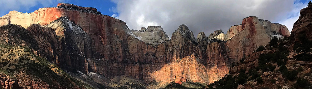
Following an adventurous 150th anniversary season in Yellowstone, Park Junkie finds his way to the red rock canyons of southern Utah, and Zion National Park. Upon arrival however, our wandering explorer finds that fall has not yet made it to this area, and triple digit temperatures send him on a Top Down Hike through the Zion Narrows in search of cool water seldom found shade!
I woke slowly that Monday, which would prove to be my last such day in Yellowstone for this season…
For some strange reason I found it easy to just roll over and close my eyes again, hugging my pillow and contemplating how I might one day design a system by which I could telepathically tell my french press to just make the coffee itself. It’s hard to get up without the smell of coffee… & it turns out my french press is worthless with my physical direction.
After a few minutes of self-directed deprecating humor about what a lazy loser I was, I found my way to my feet, stood tall and stretched my back toward the sky before slowly lumbering toward the heavenly destination that is my coffee station. I grabbed the water kettle, filled it with water from my gravity filter and placed it on its stand before pushing the button that would magically ignite the electric element and heat the water for my morning fix…
I emptied a precise amount of beans into the grinder, pushed down and listened as the blades of the electronic device effortlessly shredded the beans into a coarsely ground mixture that quickly made its way into the dark depths of my french press… Ten minutes later, I poured a cup of coffee and sat back to observe the morning light from the Park Junkie Maproom’s back patio… content to enjoy a few moments of serenity before deciding upon the day’s adventure.
One day prior, adventure had rewarded with me, as it had all summer long in Yellowstone. My old friend Eva & I had attempted a hike to the Pelican Cone, at the northern end of Pelican Valley. The journey to the cone proved a bit too much for the time restraints that day, as the Park Service regulates the time during which one can hike in Pelican Valley, due to the fact it is a bear management area. Hikers can only access the area between the hours of 9am and 7pm.
Yellowstone’s Pelican Valley provides an easy entrance into the one of the park’s wildest areas. Entry is restricted due to the number of grizzly bear encounters in this area.
The hike to the Pelican Cone is a minimum of 22 miles, and with only a few hours during which my hiking partner & I had to cover those miles, we just cruised at a comfortable pace, content with whatever route the day presented. If the summit of the Cone proved unattainable, there was always a stellar consolation prize: The Pelican Spring Cabin, which required a mere additional mile or two, rather than the added 8 miles needed to summit the Cone.
As we strolled along with this comforting fact in the back of our heads, we gazed about the vast green valley and chatted about the stunning scenery. We wondered to one another if the numerous bison grazing on the never-ending grasses in the valley were “out to pasture”, content to just graze in peace in the final years of their lives.
It was rutting season, after all. During this time, most of the young virulent bulls were out in Hayden and Lamar Valleys, testing their testosterone in heated battles with others of prime physical condition. Such battles reward the strongest with the ability to mate with fertile females, ensuring the stability of the herd through the ancient process of natural selection.
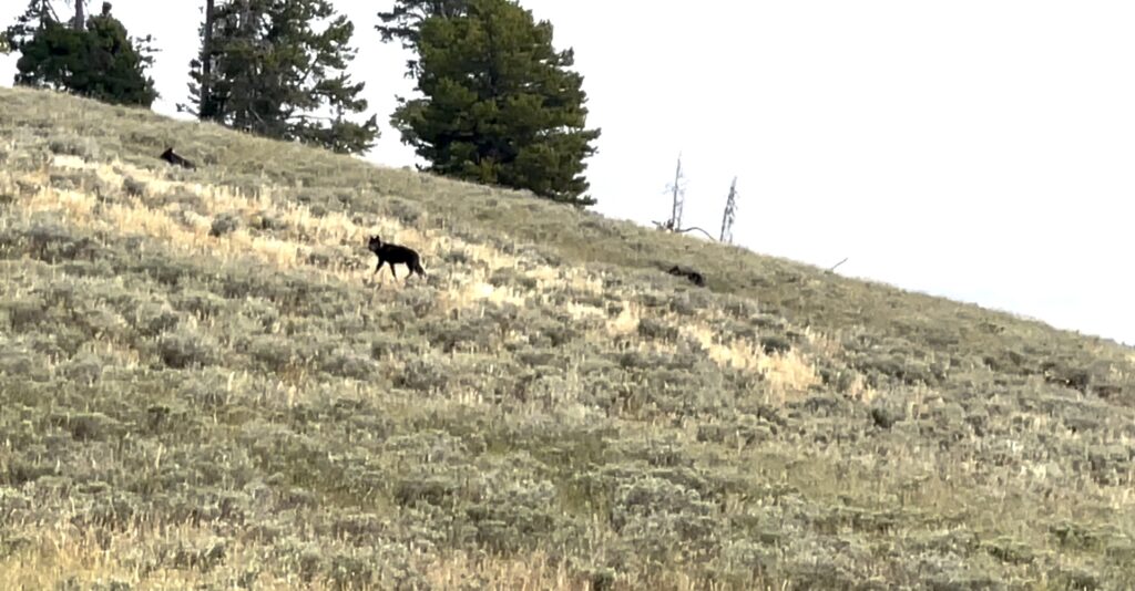
I hiked in the lead as we made our way along the western edge of the vast valley. As we crested a small knoll, I stopped suddenly, staring out into the sage brush before me, startled by an out-of-place character whom I had no expectation of encountering in this setting. A doglike beast stood about thirty yards out, staring intently at me, as I stared intently at it.
Upon first notice, I thought it a dog… a German Shepard or some mix thereof, as it stood with head raised, noble in stature, solid black, with a collar… I literally thought to myself in an instant “whose dog is lost out here”… Then, I honed in on its piercing blue eyes, which locked in unison with my own for a few seconds. I instantly revised my original interpretation of this creature’s identity, and quietly spoke the word “wolf”…
A lucky encounter in Pelican Valley. Rather than running across an angry grizzly bear, we came across a pack of wolves, which we believe to be the Mollie’s Pack.
Both the wolf and I visually recorded and mentally processed the necessary information about the being before us. After a few long seconds, we each seemed satisfied that we were probably safe from attack, and we slowly backed away from one another. At this point, we noticed that there were others, in fact, there were six wolves in the pack, that we later found was known as Mollie’s Pack. This pack is known to inhabit the wooded areas in the northern region of Pelican Valley.
The wolves followed the lead of the wolf closest to us, and as it trotted up the hill, toward the wooded area above, it turned to look back at us several times, curious, but content to continue its retreat into the safety of the trees. We stood silent, aside from a few utterances about how “cool” this was or how “unreal” the whole episode seemed.
Once the wolves were gone, we gloated about for a few minutes, unable to contain the emotion of the experience. It was both Eva & I’s first time seeing a wolf. I had always assumed that my first sighting would come through binoculars, or a spotting scope, as close wolf sightings in the wild are not commonly reported.
After some time spent in such fashion, we continued our mission, not quite ready to exclude Pelican Cone from the possibilities for the day. Another hour of hiking brought us to the Pelican Cone Trail, at which point we reluctantly decided that we’d rather enjoy the remainder of the day than relentlessly pound out miles in order to record a successful summit.
So we made our way across the Raven Creek Trail to the Pelican Spring Cabin, where we just chilled in the shade for an hour or so, before making our way back to the trailhead. An early exit to the trail led us to the Lake Hotel Sunroom for a cocktail, before we parted ways. Eva was staying at the Hotel, while I was making my way back to Wapiti, on the eastern side of the park, just a short drive from the cowboy town of Cody, Wyoming.
I drove back to my humble abode, had a nice lil dinner and called it a great day!
That Monday, as I enjoyed my first cup of coffee, I thought back on the summer’s adventures in our first national park. The sighting of the wolves seemed to complete something for me and I couldn’t help but feel that somehow they signaled a completion to my Yellowstone adventure for this year. I also felt the cool breeze that had recently became common in the Yellowstone area, reminding me that summer was over. Fall was on the way…
It took little time to decide upon a mission for the day, as I had already been considering a departure from Yellowstone. However, this mission was not quite what I had considered just a few days before, when I debated my next destination. My birthday was coming, and what hike should I do for that increasingly remorseful event…? I had been kicking a few ideas around my head. Climb the Grand Teton, hike to Delta Lake, head to Glacier & try a jaunt to Goat Haunt… or just stay in the area and retry a summit hike of Yellowstone’s Electric Peak…?
Or, should I just break south & get back to Zion?…
Just like that, I sipped the final lukewarm dregs of my first cup of coffee, and decided upon the Zion option… I packed up in a jiffy, poured the remains of the french press into two Yeti travel mugs, tossed them in the console and hooked the MapRoom onto my truck, and headed out!
The drive took all day and went into the night. I arrived at my little Zion retreat about 2am on August 30. Upon waking the next day, I took care of some overdue chores at my camp and enjoyed the morning from my little piece of paradise. As the day wore on however, the heat index surpassed any numbers that I had experienced during that summer. My body began to feel the exhausting effects of the triple digit heat, and I began to wonder if I had perhaps made my southern trip a few weeks too soon.
No big deal, I’ve spent a few hot seasons in this Land of Zion… So it wasn’t that hard to come up with a relief from the maddening heat. Without delay, I headed to the Zion Visitor Center, where the backcountry desk provided me with a permit for a Top Down Hike through the Zion Narrows.
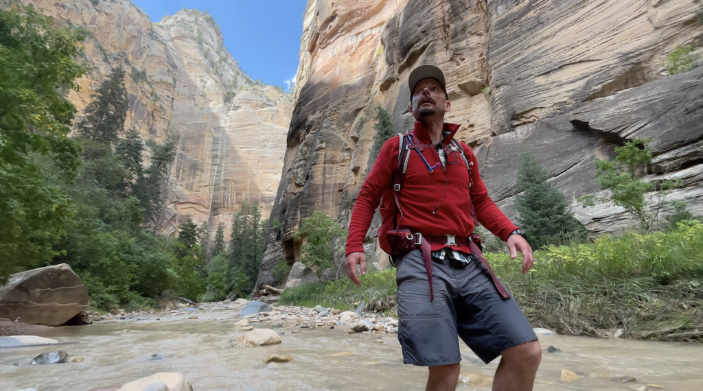
A quick visit with my boy @jonnyzion secured a shuttle ride to a trailhead at Chamberlain’s Ranch, where I would begin a 16-mile hike through on of my favorite slices of the Earth… The Zion Narrows!
All content found on Park Junkie is meant solely for entertainment purposes and is the copyrighted property of Park Junkie Productions. Unauthorized reproduction is prohibited without the express written consent of Park Junkie Productions.
YOU CAN DIE. Activities pursued within National Park boundaries hold inherent dangers. You are solely responsible for your safety in the outdoors. Park Junkie accepts no responsibility for actions that result in inconveniences, injury or death.
This site is not affiliated with the National Park Service, or any particular park.
A brief December visit to Cuyahoga Valley National Park proved memorable as Park Junkie was gifted with a window of clear weather and an introduction to what is now, a new favorite area of the park!
I know… I know… This park is commonly viewed as one of those “better to visit in summer” parks, and I certainly do not wish to dispute that. But hey, this is December, and I’m already in Ohio to visit the folks, so I’m going to CVNP! After my winter visit, I can assure you, winter in Cuyahoga Valley is fun!
Pulling into the southern section of the park around 9pm, I first motored into the Boston Mills Ski Resort’s parking lot and considered sleeping there in my van. However, as the parking lot quickly emptied upon night-skiing’s end, it became apparent that I would be the only remaining vehicle in the lot. Past experience has taught me that this usually leads some underpaid employee to my doorstep in an attempt to kindly (or rudely) usher me along, shortly after I have fallen into peaceful slumber in my cozy mobile abode…
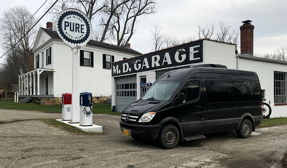
Thus I decided to roll on down the road to the Walmart parking lot in nearby Cuyahoga Falls. This worked out well and I snoozed there for eight hours before rising to return to the Boston Mills Visitor’s Center in the early morning hours. There I found that the visitor center does not open until 09:30… So, I changed into my winter activity clothing and boots, and headed out unadvised to see just what all the rage is about in Cuyahoga Valley.
A quick stop at the Boston Mills area. This white house behind the gas station was the location of the old visitor center. A new visitor center is located near this point.
A quick gander at the park unigrid map, available in outside map-boxes everywhere throughout the park (no other national park offers easier access to the unigrid map, there are map-boxes literally, everywhere in CVNP) led me to conclude that the best bet from my location was to head out onto the nearby Buckeye Trail and use it to access Blue Hen falls and just see what happened from there as I hiked northward toward the Jaite Mill historic district.
So out I went… From Boston Mills Station, I crossed Riverview Rd and shortly accessed the Buckeye Trail where I entered the woods with the idea to simply put in some miles, as the prior week had witnessed a total of zero miles of hiking and very little activity while at my parent’s place. I needed to play…
The pace was quick and the air a brisk 35 degrees as I moved through a deciduous forest absent of canopy cover, as 2017’s leaves now covered the cold forest floor. The land lay quiet aside from the constant groan of freeway traffic from nearby urban corridors. Multiple interstate and state highway systems crisscross this park, as well as the 137 year-old B&O railroad that runs north-south through the park. These stand as constant reminders that this park is not made up of the typical unspoiled landscape and untamed wilderness found in most national parks.
While the sounds of urban sprawl may deter some from enjoyment of such lands, I quickly grew to enjoy the perpetual hum emitting from the surrounding landscape, as I realized that I was completely removed from its grasp. Those folk had responsibilities and deadlines and deliveries and meetings and greetings and bullshit to deal with… and I had a national park to explore!
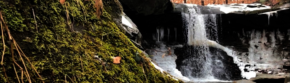
A short two-minute stroll down the trail brought me to the falls, laden with snow and ice, as well as the presumed owner of the truck above, with a new-born in arm and a unleashed dog, who was very eager to meet me. The gentleman asked from afar if I was “okay with the dog” to which I replied “sure, if the dog is okay with me”… The dog approached, eager to meet yet another interesting human and I extended my gloved hand for the greeting and a quick smell to assure the K9 that I was indeed,”cool”…. Dog was cool and thus I was cool with him, I continued toward the falls…
Dogs are quite common in this park and many visitors seem to adhere to a leash free system here while on trails away from roadways, although park regulations indicate that pets should be held to leashes six feet or less in length. I don’t really care, as I’m fine with well-behaved dogs and I’ll kick the shit out of a badly-behaved dog without appology, but hikers should be aware that dogs may be on the loose here despite park regulations to the contrary.
I made haste toward the lower section of the falls in order to examine photo options. After fifteen minutes cursing the panoramic setting on my iPhone and uselessly repeating attempts for the perfect frame while staggering about in flowing water that constantly threatened to overlap my boot-tops, I settled on some slow-motion video footage I accidentally captured and decided to bust a move and get back on the trail. Toes getting cold…
Blue Hen Falls retains a bit of green, even in winter.
My first friend had vanished, replaced by another visitor with an unleashed dog, this one amicable as well. I said a quick hello via a pat on the head and made my way up toward the ridgeline that lay just ahead. Shortly thereafter, I made my way across Columbia Rd. and toward the north. The trail was quiet and desolate.
On most trails in our park system, once you hike about a mile from the paved surface, human interaction often becomes a rarity, and this proved true once again in CVNP. Aside from the two dog-walkers at Blue Hen falls, I encountered one lone passerby, a headset-wearing trail runner, in around 6 miles of hiking on a mid-December day along this section of the Buckeye Trail.
Enjoyable indeed is the terrain between the Blue Hen and the Jaite Mill area as the trail rolls along through heavily wooded groves of hardwoods while meandering along a ridgeline that offers nice views of gorgeous northeast Ohio in the leafless winter. I think summer scenery to be even better, although views are often obscured by those pesky leaves…
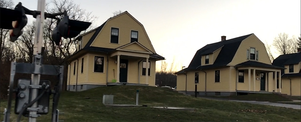
A quick descent from the ridge top toward Snowville Rd. brought me back to pavement and the park headquarters at Jaite. Cool buildings… all yellow and that…
The Jaite railside houses serve as park headquarters
From Jaite, I headed across the Cuyahoga River on a connector trail and then back toward the Boston Mills area via the canal-side Ohio Towpath Trail. This towpath trail runs north-south the length of the park and is a popular way to move about the park in warmer months as bicycles are allowed to ridehard on the trail. Unfortunately for me however, this was December and it had snowed about a week before my visit and the towpath was a sloshy mess despite the well-maintained appearance of the trail. It gets a lot of traffic.
Given the conditions of the towpath trail, I elected to jump off on the less traveled Valley Bridal Trail which sort of runs parallel, but not really, to the towpath trail… Well, let’s just say you can get back to the Boston Mills area from there by either route. The Valley Bridal Trail runs up behind the Brandywine Ski Resort where a brief jaunt up the remote end of the Stanford Rd. can link up with another “connector trail” (connects to Stanford Trail) which runs just above Averill Pond. Just beyond the pond, a link runs to the east toward Brandywine Falls. So, I took that…
It turned out to be fairly close and I arrived shortly at the popular Brandywine Falls, the park’s largest. A couple of people were hanging out at one of the overlooks and a jogger came by, but no one was making the most of the fine day, so I climbed to the top of the falls, stripped my clothes, and took a running leap toward the chilly waters below…
Just playin’… You still reading? Nice work…
Anyway, back in reality, I took a few selfies with the falls and wasted no time in moving back toward the trail, hunger was setting in. I strolled quickly toward the Stanford Trail and headed toward the Stanford House, which is about a fifteen minute stroll from the Boston Mills Visitor’s Center. The field behind the Stanford House is home to the park’s only backcountry campsites. There are five primitive sites available for overnight stays.
Reservations are required. Check the visiting page for more information about camping here.
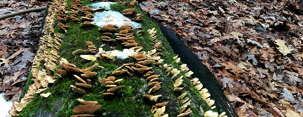
The moist environment allows for a variety of life in Cuyahoga Valley.
Just past the Stanford House, I linked up one more with the Towpath Trail and within a few minutes had returned to the visitor’s center. I went in and spoke with the rangers here for a few minutes where I learned of the Ohio and Erie Canal’s most famous “hoggee”, James Garfield, who drove mules beside the canal that pulled barges on the canal. Mr Garfield later became the nation’s 20th President, but that’s another story.
Once I had soaked in about all of the valuable information I could manage at the visitor’s center, which I assure you is not much given my limber mind, I headed back to park junkie’s mobile headquarters where my hunger further guided me to Peninsula, a charming small town in the south central area of the park.
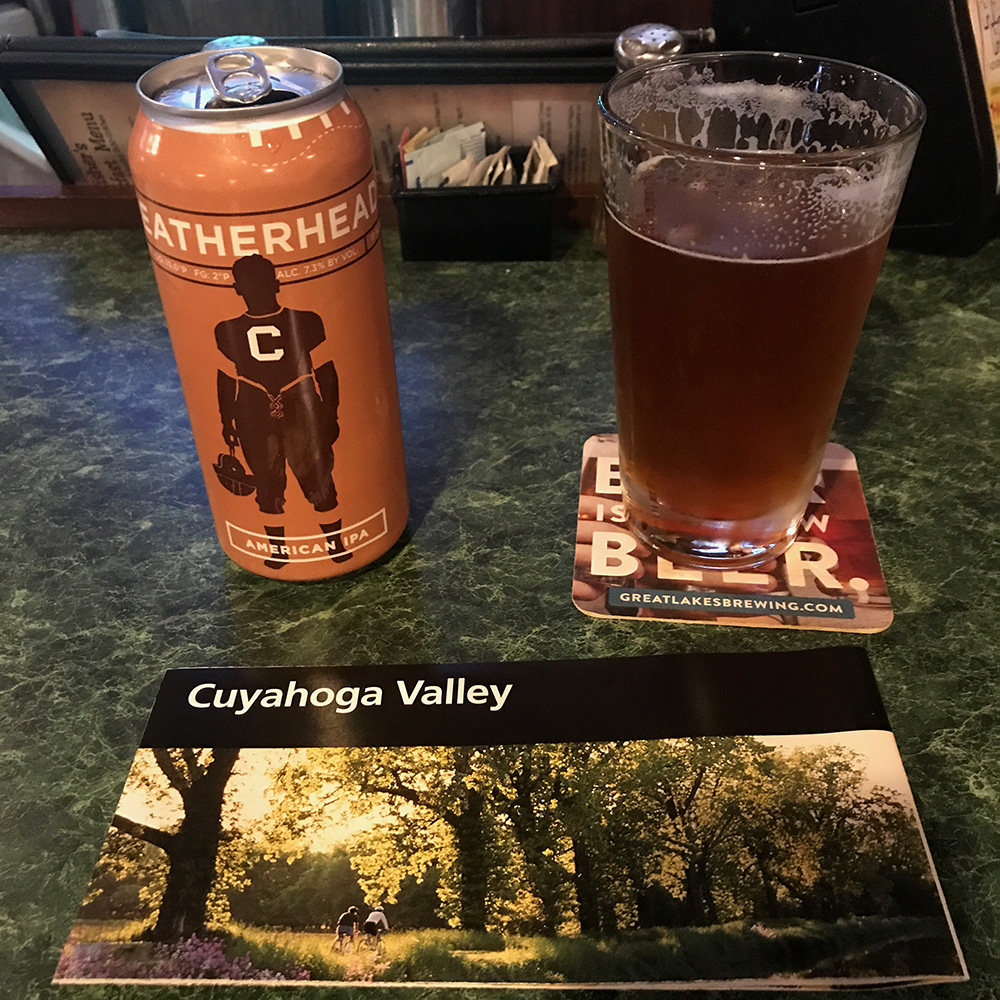
I quickly found my way to Fischer’s Restaurant, right beside the railroad track in what I believe was the center of town. While seated at the bar enjoying a cold local Loggerhead IPA and a reuben sandwich, I reviewed some history of the area as the fact-ridden ranger at the visitor’s center had quite frankly spun my head…
A lunchtime stop seemed appropriate. You gotta take a break to read the map…
As has been detailed in the park descriptions available here at parkjunkie.com, this park is mad unique due to its creation within an existent industrial society, which at the time Cuyahoga National RecreationArea was created in 1974, had played host to more than 150 years of industry, more than 200 in the surrounding areas.
Constructed to facilitate transport between inland Akron, and lakeside Cleveland, whose position on the shore of Lake Erie meant that the region enjoyed significant commerce as the Great Lakes became a central hub of economic activity in the 18th and 19th centuries before the advent of adequate land travel methods.
The Ohio and Erie Canal was built in the early 1820s and the amount of subsequent commercial traffic through the Cuyahoga Valley in the early years of the industrial revolution would rival that of any similar area in the world at the time. The canal’s heyday soon ended with the construction of railroads in the early 1860s which quickly erased demand for the canal’s convenient route to the Great Lakes.
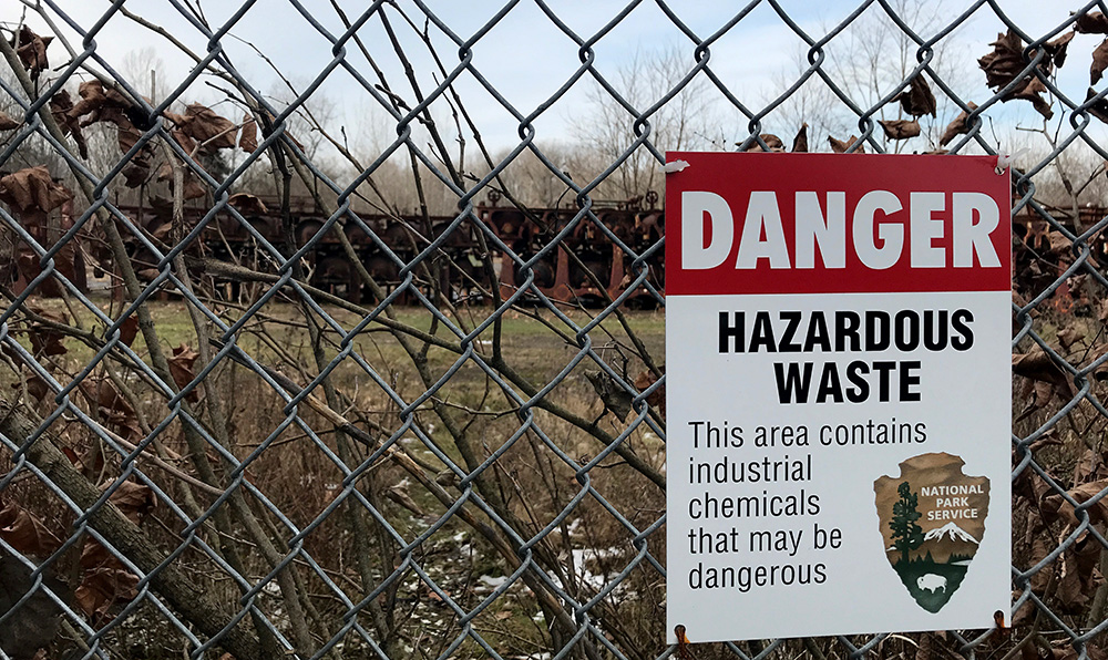
These facts lend Cuyahoga Valley National Park a most-unique position in the National Park System as well as within the national park idea itself. No other such park boasts land that shares history quite as hardcore as this northeastern Ohio park in terms of raw industrial commerce through which titans of industry essentially raped the land for commercial profit while blatantly polluting rivers, air and land alike. Don’t believe me…?
Not your average NPS signage…
The level of unregulated industrial activity in the area lent The Cuyahoga River the reputation of being one of the most polluted rivers in the United States and in 1868, the river caught fire…
Allow me to summarize:
The river caught on fire…!
Unfortunately, this would not be an isolated event. This river is documented to have caught fire a recorded 13 times between 1868 and 1969.
Please allow a second summary:
The river caught fire 13 times in just over 100 years…
The last fire was featured in Time Magazine, directing national attention upon the problem of industrial land and river pollution, leading to the formation of the EPA (1970) and the passage of the Clean Water Act (1972).
The same sentiment that brought federal environmental regulations produced a groundswell for a protected area along the river that could encourage the surrounding community’s dedication to guaranteeing a cleaner, more natural river valley for future generations.
So, after my meal and a beer, I called up some friends who live just up the road, Dan and Camielle. We arranged to have a couple of drinks and they offered me a place to park my van in their driveway. I am always happy to have a couple of drinks and an evening with park peeps and these folks are super cool and literally live inside a national park… so they have that going for them, which is nice…
We agreed that I’d drop by their place around 6:30pm for drinks before dinner. Often one to ensure ample beverage is available, I headed out in search of a couple of nice bottles of vino to contribute to the cause and after a few wild goose chases instigated by my homegirl Siri, I made my way to 750ml, a wine bar and store in the Brecksville area.
I grabbed an Orin Swift red blend and a Mer-Soliel Silver Chardonnay from the rack and headed to the counter where a hostess with a nice smile sent me on my way after I gave her the equivalent of a small fraction of a bitcoin for the wine. See ya next time…
We had a touch of wine at their place and went out for Italian at Oggi’s, somewhere in or near Brecksville. I thoroughly enjoyed two Basil Hadin Manhattan’s and a wonderful house-made lasagna that was fantastic.
Gotta say, it was a treat to have a selection of restaurants that offer quality bar and menu services in such a plethora inside a national park… In most parks, luxuries such as this are a dream. A few parks have such amenities just outside the park, but most don’t have towns that offer such options.
After dinner we retired to their place and had a couple more drinks over conversation about parks and what-have-you… Finally, probably hours after everyone wished I had shut my mouth, I passed out in the Sprinter conveniently parked just outside in the drive and enjoyed a night of splendid slumber…
Awakening the next morning, I had some quick coffee with my gracious hosts, and headed back into the wild. I was ready to attack a couple more trails and check out some new areas of the park.
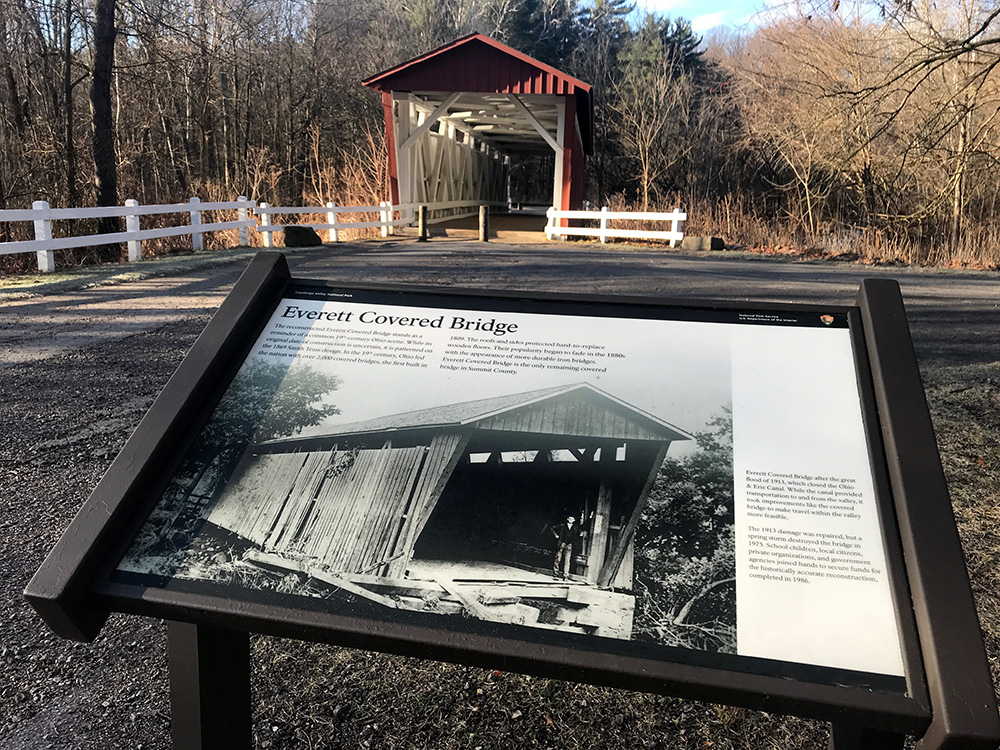
I headed south first, moving toward the Everret Covered Bridge to an attempt grab a cool sunrise shot of the red bridge and creek, which must look fab in the summer draped by the greenery of summer in the Ohio forests. After 23 mediocre attempts, I stomped off in disgust and drove back across the Cuyahoga River and made my way toward the Ledges as I had heard that this was a pretty cool area and my friends had confirmed this by rapid shakes of the head over the previous night’s meal.
Everette Covered Bridge
I parked at the Happy Days Lodge turnout lot on the north side of Highway 303 and hiked the Boston Run Trail first, as my history-loving ranger from the day before had told me this was one of his favorite trails. Nice trail, kinda rolls along through the forest and covers somewhere around 3 miles with a shortcut available that cuts it by a third. I ran around in the woods out here for a bit, as these Ohio hardwood forests remind me of my childhood home. Many youthful days running about in these Ohio woods… Ah, innocence.
Folks love walking the dogs here too, but most were on a leash, at least when they left the parking lot. I actually did not pass a single person on the trail… December.
(the Happy Days Lodge is on the south side of the highway, but there are not many parking spots for the lodge while there are plenty on the north side)
I came back from this hike and quickly succumbed to a hunger panic as I had skipped my morning can of spinach. Thus I drove the 5 miles or whatever back to Peninsula to check out the place across the street from yesterday’s selection. The Winking Lizard.
Had a seat at the bar once again. I decided upon a burger, the biggest, whichever that was, and a cold beer… I can’t even tell you which beer it was because I forget. Hey, take it easy on me, they have like, 700 beers or so, and I only had one of them. It was an IPA. It was good. How about that?
After lunch, I set back out toward my day’s ultimate destination of the Ledges! I was pretty stoked to check this place out, and had no idea of what lay ahead. I had heard the ledges described in word, but had honestly not even seen images of the this area due to my insistent lack of due process and preparation when examining parks prior to a visit.
So I donned my hat in self-inflicted ignorance and headed out toward the Ledges from the north via the Happy Days Lodge and hit the Haskell Run Trail which connects to the Ledges after a half mile or so. Immediately upon arriving at the Ledges, my soul caught fire! This was what I had been waiting for! Rocky cliffs, green moss and trees combined effortlessly to lift my spirits and I quickened my pace up a small incline in anticipation of cool scenes…
I arrived at the Ledges cliff-base and stopped momentarily to witness tall evergreen and deciduous trees swaying quietly in a light afternoon breeze which sent sunrays dancing in silence upon the leaved forest floor.
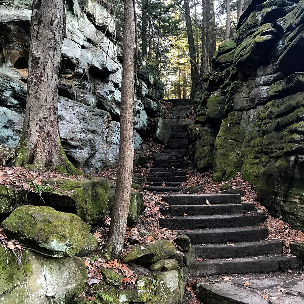
I moved toward the sign that directed in one of two ways. The darker, more moss covered landscape appeared to be to the left, so I headed that way (east). Within a thirty second walk, I found an enticing stairway that led, according to the sign, to the Ledges Shelter. I headed up the steps without hesitation, no clue of what this shelter may be, I thought maybe a cave…
Most of the park’s older infrastructure, such as this stone staircase, was built by the Civilian Conservation Corps.
Nope, I ran into a kid at the top of the steps. He was laid back reading “Walden” or something similar and seemed intrigued that I had stumbled upon him. I asked him a question about the Ledges, he asked me about my life…
Turns out, the Ledges Shelter is a man-made structure. Interestingly, this kid informed me that the Ledges Shelter was built by the Civilian Conservation Core in the 1930s and is built from the American Chestnut timbers. This tree was essentially massacred by blight in the early 20th century. Once numbering in the billions and constituting 25% of the trees in the Appalachian Mountains, the trees today number in the 100s if any decent size above 24” in diameter is expected.
While I’m into old CCC stuff and love my American Chestnuts, I was more intrigued by the green, moss-covered rocks that lay below me on the outlying ledges that surrounded the raised plateau that is the upper section of the Ledges.
I made moves back down the steps and to the east, toward the darkening green forests and the large rock cliffs that beckoned me as if I was a helpless child.
What wonderful rocks these were. I moved throughout the mazes, pathways and tunnels that formed between the large separated sections of stone that lay covered with lichen and moss. The silence of the forest was surreal, as I realized that the familiar groan of traffic and industry that had nearly faded from my perception over the past two days, had finally disappeared in this thickly wooded terrain. I smiled and breathed deeply of the fine aroma of reclaimed wilderness.
I made a few photos of the calming scenery and pondered the fate of the bats within Ice-box Cave along the northeastern section of the loop. The cave is closed to human entrance due to the presence of the White Nose Syndrome that has devastated bat habitats here in the east.
I moved southward on the trail, weaving between large, building-size boulders that lay silently covered under blankets of downed leaves and rich rotting trees that turn the most beautiful shade of brown during their slow decay. Moving forward, the late-afternoon forest thick with the darkness evergreens provide, I passed a few wondering souls as I made my way toward what I was told would be an excellent view to the west. Upon arrival at the viewpoint, I was indeed gifted with a nice vista toward the west. The view is nice for northern Ohio, but I enjoy it more in warmer times when leaves adorn the trees…
My stroll back toward the van went well. The sunset cast lovely light on the cliffs while the trees threw stilt-like shadows on the vertical rock. More people seem to enjoy this area in the evening, as I passed more people on this section of the trail at sunset than I had passed in more than 12 miles of hiking during the two days that I enjoyed the park. A couple of people had dogs on an evening walk, and some were obviously out for a workout, but most were enjoying a leisurely walk on what I considered the park’s most scenic trail.
Overall, I must admit, I think a summer visit to Cuyahoga Valley would likely be more fulfilling and provide more opportunity for adventure. That said, my visit was nevertheless enjoyable and left me eager to come back for more. I would like to get out on the water in my kayak with a fishing pole here in warmer weather and I believe that equine activity would be cool here too. Of course, I think the towpath trail on a bike would be more rewarding, as many of the restaurants and bars have outdoor seating areas that accommodate visitors and locals alike in towns that are spread throughout the park. How cool to pull in for a snack and a cold beverage while out on an excursion in the park.
This place definitely provides a unique experience in the national park idea. While many parks offer endless miles on remote trails wondering through rugged terrain far from any semblance of human influence, Cuyahoga Valley gives visitors access to a actively revived landscape in the otherwise industrial powerhouse of northeastern Ohio.
All content found on Park Junkie is meant solely for entertainment purposes and is the copyrighted property of Park Junkie Productions. Unauthorized reproduction is prohibited without the express written consent of Park Junkie Productions.
National Parks and the outdoor recreational activities pursued within their boundaries hold inherent dangers. YOU CAN DIE. I regret to inform you, but you’re going to die anyway… Nevertheless, you are solely responsible for your safety in the outdoors. Park Junkie accepts no responsibility for poor choices made in the wilderness or beyond the controlled area.
Obviously, this site is not affiliated with the National Park Service, or any particular park or park institution. Enjoy your day…