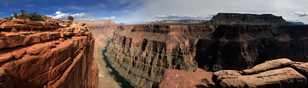
This park is massive, with more than 1.2 million acres of rugged desert landscape available for exploration. For those who wish to access some of the park’s more remote areas, backpacking in Grand Canyon National Park offers the only option.
explore grand canyon
backpacking – grand canyon
There are an unlimited number of backcountry trails in the Grand Canyon, and many of these are simply too far removed to be considered feasible for day hikes. That said, there is likely no better place to spend an evening or two than some of the remote sites accessible to backpackers in this park. So lace up those shoes and toss on your pack… Let’s go!
rim-to-rim
21.6 – 23.9 miles one-way / 2-5 days / 5,800 ft / strenuous
This is the Grand Canyon classic. The trail can be done as a big day hike of course, but for those who want to have a more relaxing experience, a multi-day backpacking trip is a better option. There are two ways to tackle the route, from north-to-south or from south to north. The N to S route can be done with only 4,400 feet of elevation gain required to reach the south rim from the river, while the S to N route will be 5,781 feet.
moreThe south side of the canyon has two trails that lead to the rim, so hikers need to make a choice between the South Kaibab and the Bright Angel Trail. Both trails lead from the Colorado River to the South Rim, but arrive on the Rim at different points. At 7.3 miles, the South Kaibab is shorter, but steeper, gaining 4,800 feet. By contrast, the Bright Angel is 9.6 miles and gains only 4,400 feet above the river.
For those who choose the South Kaibab Trail, this will be non-stop slog. Camping is restricted to designated campgrounds and none exist on the South Kaibab trail. Hikers who wish to spend a night on the southern ascent or descent will be taking the Bright Angel Trail, which offers the beautiful Indian Garden Campground.
Camping options along this route include the Cottonwood Campground, on the North Kiabab Trail, the Bright Angel Campground at the bottom of the canyon near Phantom Ranch and the Indian Garden Campground on the Bright Angel Trail.
distances between campsites:
North Kaibab Trailhead to Cottonwood Camp – 6.8 miles
Cottonwood Camp to Bright Angel Camp – 7.2 miles
Bright Angel Camp to Indian Garden – 4.7 miles
Indian Garden to South Rim Trailhead – 4.8 miles
south kiabab to bright angel loop
18 miles / 4,800 feet / strenuous
This is an excellent way to get into the canyon and is many a Grand Canyon hiker’s first trip into the canyon. The trail is steep, but doable, especially if you take your time and put in mellow miles. The South Kaibab Trail is especially rough on some folk’s knees, but it is all downhill on this route. The South Kaibab is also one of the rare routes into the canyon that follows ridgelines instead of canyons, providing stellar views of the inner canyon.
moreIf you have a couple of nights, you can descend the 7.4 miles of the South Kaibab Trail and spend the night at the Bright Angel Campground, or book at cabin at Phantom Ranch. The next day, hike the 4.7 miles up to Indian Garden, where you’ll camp a second night. The third day is up and out the 4.8 miles to the South Rim, where you can catch a shuttle back to your vehicle and grab a cheeseburger.
Of course, this route can be done quicker, or slower. Your choice. Hikers also have the option to descend and ascend the Bright Angel Trail. If a three night trip with super low miles is desired, a stay at Indian Garden on the descent and ascent is possible. Another option to shorten the route exists by using the Tonto Trail, which connect the trails, but this will subtract the river portion of the trip.
hermit to bright angel loop
24.8 miles / 3,430 feet / strenuous
This classic Grand Canyon journey utilizes the Tonto Trail to connect the Hermit Trail to the Bright Angel Trail. Most of the trails in the Grand Canyon require a steep and constant up or down. Thanks to a number of miles rolling along on the Tonto Trail, this option allows a little break from the grueling vertical rise of these hikes.
moreHikers can descend the Hermit Trail, which departs from just west of the Hermit’s Rest shuttle stop, at the west end of the South Rim. A drop of 3,430 feet brings the junction with the Tonto Trail. This trail runs for 95 miles east to west along the Tonto Platform, which is a relatively level topographic region of the Grand Canyon that separates the inner canyon from the upper canyon. Arriving at the Tonto Trail, backcountry campers can head east toward one of the designated campsites along this section of trail.
Follow the Tonto Trail to the east where the trail meets the Bright Angel Trail, near Indian Garde. From here, climb the 4.8 miles back to the South Rim.
distances:
Hermit’s Rest to Tonto Trail – 7 miles / 3,430 ft.
Tonto Trail from Hermit Trail to Bright Angel Trail – 13 miles
Bright Angel Trail from Tonto to South Rim – 4.8 miles / 3,060 ft.
hermit trail – route to river
18.6 miles / 4,250 feet / strenuous
Most modern visitors to the Grand Canyon have never heard of the Hermit Trail. Undoubtedly, this trail lacks the fame and recognition of trails such as the Bright Angel and the South Kaibab. There once was a time however, when this was “the trail to hike” in the park, and provided a pathway to the only below-rim accommodations in the Grand Canyon. This classic trail led to a small tent cabin village on the Colorado River that the Harvey Company advertised as “camping out de luxe“.
moreBack in the day, those who made the journey to the river on this route were greeted with a luxury camp on the river, complete with private chefs and an on-location automobile to transport guests around the camp. A cable-car from the rim was used to provide supplies to the camp. Construction on the Hermit Trail was began in 1911 and Hermit Camp’s setting predates that of Phantom Ranch by more than a decade. Commercial operation of the camp was abandoned in the 1930s.
The original trail was reputed to be something to behold. The route was essentially “paved” with large stones and masonry techniques that, despite more than a century of age, are still intact today in many sections of the trail. Despite the fact that the trail is currently unmaintained by park service staff, it remains in generally good condition. Although a few areas of the trail have suffered washouts and small slides over the decades, the trail is easily manageable by competent backpackers.
Camping is restricted to the designated sites at Hermit Creek and Hermit Rapids. There is also a group site. At-large camping is not permitted in this section of the park.
grandview trail to bright angel
35 miles / strenuous
This beautiful backcountry route uses the Tonto Trail to connect the Grandview Trail and the Bright Angel Trail. It is possible to regain access to the South Rim via the South Kiabab Trail as well. This shortens the route to 28.7 miles, but the South Kaibab is a considerably steeper climb, and this leads many to choose the longer, but gentler incline of the Bright Angel.
moreThe route departs from Grandview Point and drops nearly 4,000 feet to meet the Tonto Trail, just west of Horseshoe Mesa. From here, the Tonto Trail leads west, meandering along the Tonto Platform, providing stellar views of the inner canyon as it weaves in and out of drainages. After about 25 miles of strolling on the relatively flat Tonto Platform, the Tonto meets the South Kaibab, allowing a quick upward 4.4 miles exit here. For those who wish a more gentle exit, continue on another 4.5 miles and climb the roughly 5 miles on the Bright Angel Trail.
Camping is permitted in sites only on Horseshoe mesa and is at-large camping along the Tonto Trail between the Cottonwood drainage and the Cremation drainage, prior to the junction with the South Kiabab Trail.
horseshoe mesa loop
17 miles / 3,700 feet / strenuous
This is a quick and easy backcountry option for those with a couple of days on their hands and want to get away from those lovely South Rim crowds. The scenery on Horseshoe Mesa is stunning and the area is a magnet for any mining history buffs, due to the abundance of mining regalia scattered about the mesa.
moreThis trail begins at Grandview Point and descends the Grandview Trail before meeting the East Horseshoe Mesa and Cottonwood Creek Trails just before an introduction to the Last Chance Mine. This is the area to choose a counter or clockwise direction. Lets go clockwise…
Continuing straight for just more than a mile, the views really start to kick in, providing post-card quality photos in all directions. After a quick drop down to the Tonto Trail, hikers continue to the east in search of the East Horseshoe Mesa Trail, near Hance Creek, which is a dependable year-round water source.
The option exists here to follow the Tonto Trail east toward the Hance Rapids and the New Hance Trail that leads back to the canyon’s southern rim and highway 64. See the New Hance Trail description.
A right turn on the East Horseshoe Mesa Trail brings a quick 2 mile ascent to Page Spring, aka Miner’s Spring, another dependable year-round water source. Just past this point, hikers regain the intersection with the Grandview Trail and an upward march of just over 3 miles and 2,500 feet leads back to Grandview Point.
Camping is only permitted in established campsites on Horseshoe Mesa and toilet facilities are on site. Animal proof for containers are required.
more possibilities
There are many other options for backpacking in this massive national park. This is only a brief introduction into the rabbit hole of possibilities in the Grand Canyon. Check out a more complete list of trails on the NPS site linked below.
NPS – Grand Canyon – Backcountry Trails