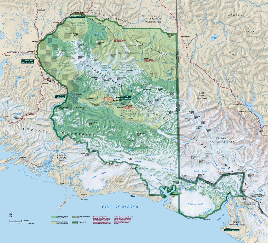
You’ll want to examine a map of Wrangell-St Elias National Park before you arrive. Play around with the Park Junkie Map below and discover what areas of the park you’ll want to explore during your visit.
These are not hiking maps, and are not intended for backcountry navigation. Use a more detailed topographic trail map, such as this one, from Trails Illustrated.
Guide to Wrangell-St Elias
Park Junkie Wrangell-St Elias Map
Wrangell-St Elias Satellite Map
Official Map
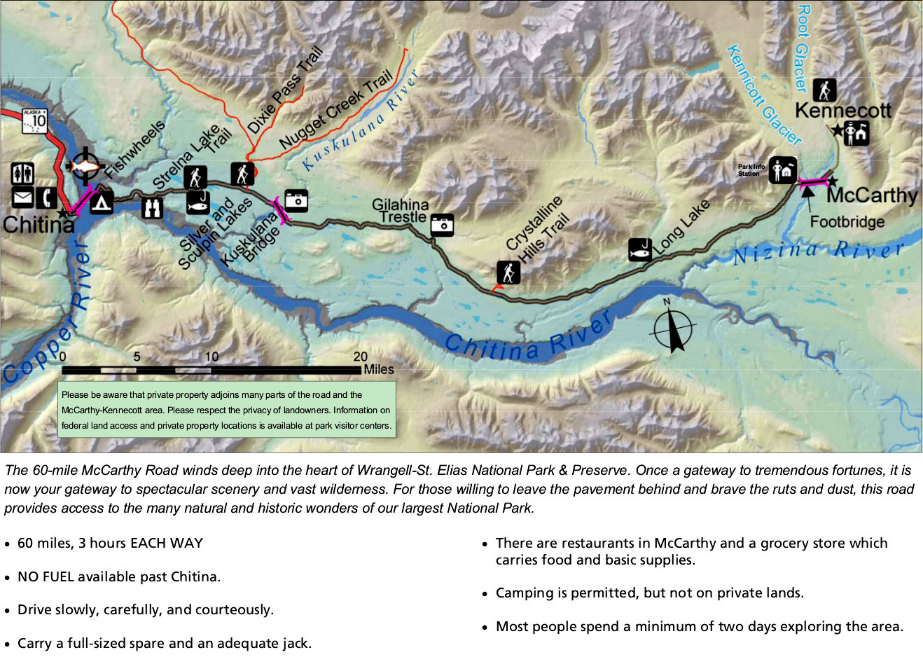
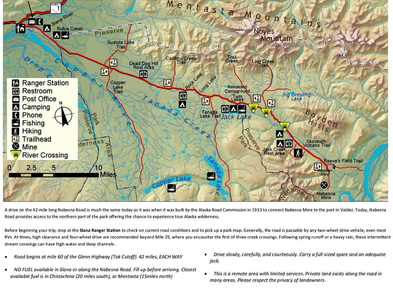
These are cool maps… You probably collect them… These are the park service unigrid maps that are provided at the visitor center. High resolution PDF links are included under the images, so you can also download these public domain maps.

McCarthy Road Map

Nabesna Road Map

Guide to Wrangell-St Elias
Relevant Links

All content found on Park Junkie is meant solely for entertainment purposes and is the copyrighted property of Park Junkie Productions. Unauthorized reproduction is prohibited without the express written consent of Park Junkie Productions.
YOU CAN DIE. Activities pursued within National Park boundaries hold inherent dangers. You are solely responsible for your safety in the outdoors. Park Junkie accepts no responsibility for actions that result in inconveniences, injury or death.
This site is not affiliated with the National Park Service, or any particular park.
